Cape Fear Regional Jetport (ICAO: KSUT, FAA LID: SUT), also known as Howie Franklin Field, is a public use airport in Brunswick County, North Carolina...
6 KB (434 words) - 23:27, 2 March 2025
North Carolina portal North Carolina statistical areas Cape Fear Museum Cape Fear Regional Jetport (Howie Franklin Field) formerly known as Brunswick County...
14 KB (888 words) - 07:12, 28 March 2025
KJNX Johnston Regional Airport GA 3 Southern Pines SOP SOP KSOP Moore County Airport GA 110 Southport SUT KSUT Cape Fear Regional Jetport (Howie Franklin...
32 KB (625 words) - 17:34, 11 April 2025
Oak Island, North Carolina (category Cape Fear (region))
•Property on both sides of Long Beach Rd. (NC 133) to include the Cape Fear Regional Jetport, and South Harbour Village with its nine-hole golf course and...
21 KB (1,768 words) - 01:50, 15 March 2025
KSUS – Spirit of St. Louis Airport – St. Louis, Missouri KSUT – Cape Fear Regional Jetport (Howie Franklin Field) – Oak Island, North Carolina KSUU – Travis...
176 KB (15,597 words) - 05:27, 3 March 2025
Brunswick County, North Carolina (category Cape Fear (region))
Head Island Ferry, private ferry that serves Bald Head Island Cape Fear Regional Jetport, near Oak Island Military Ocean Terminal Sunny Point, military...
38 KB (2,985 words) - 00:35, 1 February 2025
fairly sharp rise just after the NC133 roadway passes by the Cape Fear Regional Jetport, going over the ICW at it highest point (65’ above Mean High Water)...
4 KB (355 words) - 05:56, 16 April 2025
NC 42 NC 55 NC 82 NC 87 NC 210 NC 217 Fort Bragg (Linden Oaks) Harnett Regional Jetport As of the 2020 census, 133,568 people resided in the county, making...
24 KB (1,478 words) - 15:08, 14 March 2025
Bridge. The road name changes to Long Beach Road SE and passes the Cape Fear Regional Jetport to the east. 2.1 miles (3.4 km) north of the G. V. Barbee Bridge...
26 KB (2,416 words) - 20:45, 17 February 2025
NC 217, ends at US 421 in the northern part of the city. By air Harnett Regional Jetport is the only airport in the city, which is 10 miles near Buies Creek...
13 KB (1,177 words) - 02:08, 15 March 2025
of Historic Places listings in Wayne County, North Carolina Kinston Regional Jetport, closest airport to Wayne County 1961 Goldsboro B-52 crash, plane crash...
24 KB (1,980 words) - 01:50, 25 March 2025
US 421 US 421 Bus. US 501 NC 42 NC 78 NC 87 NC 87 Byp. Raleigh Executive Jetport As of the 2020 census, there were 63,285 people, 21,894 households, and...
21 KB (1,669 words) - 15:07, 14 March 2025
Everglades (section Jetport proposition)
Interior study of the environmental impact of the jetport read, "Development of the proposed jetport and its attendant facilities ... will inexorably destroy...
123 KB (14,714 words) - 06:22, 25 April 2025
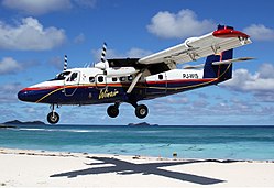
scheduled Twin Otter flights between the Disney resort and nearby Orlando Jetport, now Orlando International Airport, as well as to Tampa International Airport...
62 KB (4,903 words) - 09:35, 25 April 2025
but does not connect with the Interstate. Access to the North Campus of Cape Fear Community College is provided by utilizing Blue Clay Road, which intersects...
76 KB (7,290 words) - 20:31, 17 February 2025
ISSN 0882-7729. ProQuest 510781727. "Fair Will Exhibit Operating Model Of Busy Jetport". The New York Times. December 23, 1963. ISSN 0362-4331. Retrieved September...
221 KB (19,667 words) - 13:50, 16 April 2025


