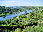
Cigüela from the left near the Ojos del Guadiana, Villarrubia de los Ojos municipal term. There are authors though that claim that it is the Cigüela that...
2 KB (148 words) - 13:37, 13 November 2020
within the system. Another of the origin theories, postulated that the Cigüela and Záncara rivers were the sources of the Guadiana. Today, they are considered...
15 KB (1,483 words) - 22:58, 6 December 2024
Ciudad Real. The region is watered by the Guadiana, Jabalón, Záncara, Cigüela, and Júcar rivers. The climate is cold semi-arid (Köppen BSk), with strong...
10 KB (795 words) - 00:41, 16 October 2024
from east to west, is the Guadiana, and its right bank tributary, the Cigüela. Most of the province is an arid plain, cool in summer and very cold in...
12 KB (1,059 words) - 23:30, 12 August 2024
here treated as a primary river. The 167 km Záncara joins the 155 km Cigüela (or Gigüela) and the 76 km Guadiana Alto in a trifurcation some 755 km...
262 KB (9,219 words) - 18:21, 27 November 2024
de Santa María, señor de las villas de Cogolludo, Deza, Enciso, Luzón y Cigüela y de la Tierra de los Alabastros), (1485 – 20 January 1544) was a Spanish...
3 KB (400 words) - 12:20, 10 December 2024
Villa de don Fadrique is in the southeast of the Toledo province between Cigüela and Riánsares rivers. Buildings of interest are Nuestra Señora de la Asunción...
5 KB (319 words) - 18:41, 3 November 2024
121 km; 75 mi) Piedras [es] (ms) Guadiana (ms · int · 818 km; 508 mi) Cigüela (r) Záncara (l) Rus [es] (l) Saona [es] (r) Córcoles (l) Ojuelo (l) Jabalón [es]...
41 KB (2,775 words) - 19:16, 5 November 2024
of Castilla–La Mancha. Housing lies on the left (southern) bank of the Cigüela. It stands on the A-4 route. Villarta was seemingly settled by the Hospitallers...
4 KB (169 words) - 10:44, 30 December 2023
Záncara (category Tributaries of the Cigüela)
Cigüela from the left near the Ojos del Guadiana, Villarrubia de los Ojos municipal term. There are authors though that claim that it is the Cigüela that...
2 KB (139 words) - 13:40, 13 November 2020
03819; -2.49171 • elevation 883m Length 9 km (5.6 mi) Basin features Progression Córcoles→Acequia de Socuéllamos→Záncara→Cigüela→ Guadiana→ Gulf of Cádiz...
3 KB (64 words) - 17:48, 25 July 2024
sea level. The area is drained by two tributaries of the Guadiana: the Cigüela and the Záncara, located to the west and south of the urban centre, respectively...
14 KB (1,182 words) - 03:26, 2 November 2024
the basin located north of the city, with the defensive advantage of the Cigüela river which served as a moat. Remains of the fortress have not appeared...
15 KB (1,747 words) - 20:54, 4 January 2024
39.81722°N 6.98167°W / 39.81722; -6.98167 Puente Romano Sobre el Río Cigüela de Villarta de San Juan Puente sobre el rio Bañuelos Puente sobre el Rio...
30 KB (6,805 words) - 04:51, 14 November 2024
this route, there are several aqueducts, the most outstanding being the Cigüela aqueduct, which is 6190 m long and 44 m high, several tunnels, 12 in the...
81 KB (8,194 words) - 04:21, 1 May 2024


