
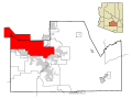
Gila Crossing (O'odham: Kuiwa) is a census-designated place (CDP) in Maricopa County, Arizona, United States, within the Gila River Indian Community south...
6 KB (264 words) - 02:00, 17 August 2024
The Gila River Indian Community (GRIC) (O'odham language: Keli Akimel Oʼotham, meaning "Gila River People", Maricopa language: Pee-Posh) is an Indian reservation...
14 KB (1,333 words) - 02:20, 29 September 2024

the Buckeye Hills Regional Park. SR 85 continues northward to a crossing of the Gila River as it nears Buckeye. The highway intersects Buckeye Road which...
20 KB (1,704 words) - 07:40, 19 August 2024

Gila Wilderness was designated the world's first wilderness area on June 3, 1924. Along with Aldo Leopold Wilderness and Blue Range Wilderness, the 558...
14 KB (1,565 words) - 03:29, 2 August 2024

explored this area in Arizona's White Mountains. From source to mouth, the river flows through Apache, Greenlee, Graham, Navajo and Gila counties. It forms...
9 KB (688 words) - 05:07, 6 July 2022
Big Chief Russell Moore (category Musicians from Arizona)
as a member of Louis Armstrong's band. Moore was born in Gila Crossing, Arizona inside the Gila River Indian Community reservation in 1912 and belonged...
11 KB (1,155 words) - 10:00, 1 April 2024

87 is known as Arizona Boulevard. The highway leaves Coolidge heading northwest and travels as a two-lane rural road through the Gila River Indian Community...
12 KB (736 words) - 02:06, 2 August 2024

the Gila. Levi Ruggles, a veteran of the American Civil War, founded the town of Florence on the south bank of the Gila River. He came to Arizona Territory...
26 KB (2,398 words) - 17:04, 2 September 2024
begins in Yavapai County before entering Coconino County and then entering Gila County before reentering Coconino County and then entering Navajo and Apache...
8 KB (455 words) - 00:55, 19 March 2024
an inventory of all vascular plants growing along the Salt River (Arizona), Gila River, New River and Agua Fria River and their tributaries in the Phoenix...
58 KB (4,075 words) - 04:11, 7 September 2024

utilizes a stop at 2931 East Gila Ridge Road. Camel Express to Quartzsite, Arizona Interstate 8 Business Loop 8 U.S. Route 95 Arizona State Route 195 Alex Barrett...
49 KB (4,926 words) - 11:47, 14 October 2024

of the population were Hispanic of any race. The K-8 tribal school Gila Crossing Community School, affiliated with the Bureau of Indian Education, is...
9 KB (444 words) - 03:19, 18 August 2024

city of Tucson. Other cities and large towns in Southern Arizona include Ajo, Casa Grande, Gila Bend, Oro Valley, Sierra Vista, Yuma, and the border cities...
7 KB (870 words) - 01:42, 2 July 2024
Desert Diamond Arena (redirect from Gila River Arena)
and formerly Jobing.com Arena and Gila River Arena) is an indoor entertainment arena located in Glendale, Arizona, which anchors the 223-acre, $1 billion...
15 KB (1,529 words) - 19:31, 14 October 2024
League's Arizona Sting and the lease to Gila River Arena to trucking magnate Jerry Moyes, who was also a part-owner of Major League Baseball's Arizona Diamondbacks...
98 KB (10,720 words) - 15:34, 20 October 2024

Painted Rock Dam (redirect from Painted Rock Reservoir, Arizona)
The Painted Rock Dam is an earthfill embankment dam located west of Gila Bend, Arizona. It is primarily used for flood control purposes. The Painted Rock...
8 KB (764 words) - 22:34, 11 February 2023

Akimel O'odham (category Native American history of Arizona)
ceded the territory of what is now Arizona to the United States, with the exception of the land south of the Gila River. Soon thereafter the California...
24 KB (3,212 words) - 02:56, 17 October 2024

Gillespie Dam Bridge (category Bridges over the Gila River)
Bridge) is a through truss bridge spanning the Gila River in Maricopa County, in the U.S. state of Arizona. The bridge was constructed to bypass a concrete...
19 KB (1,888 words) - 00:49, 5 August 2024

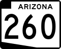
through the Gila River Indian Reservation towards the City of Chandler and Chandler Municipal Airport. The route is maintained by the Arizona Department...
17 KB (1,690 words) - 17:31, 23 August 2024

Gillespie Dam, Gila Bend Gillespie Dam Bridge, Gila Bend, 1927 bridge across the Gila River next to the Gillespie Dam Agua Caliente, Arizona Arizona State Capitol...
112 KB (12,565 words) - 05:02, 28 August 2024

Laveen, Phoenix (redirect from Laveen, Phoenix, Arizona)
County, Arizona, United States, situated eight miles (13 km) southwest of Downtown Phoenix, between South Mountain and the confluence of the Gila and Salt...
42 KB (4,120 words) - 02:26, 15 September 2024

Graham County, and Pinal County to its confluence with the Gila River, at Winkelman, Arizona. It is the last major, undammed desert river in the American...
27 KB (2,672 words) - 03:32, 22 July 2024

Interstate 8 (redirect from Interstate 8 (Arizona))
the Gila Trail continued east to Gila Bend. These were later replaced by U.S. Route 80 (US 80) across California and part of Arizona, and Arizona State...
113 KB (12,102 words) - 03:54, 14 October 2024

of the Gila River Valley. It was probably considered – and rejected – for its sentimental value before Congress settled on the name "Arizona".) [citation...
164 KB (13,824 words) - 06:40, 19 October 2024

territory was defined as being east of longitude 113° 20' and north of the Gila River. Soon thereafter, the counties of Apache, Coconino, Maricopa, and Navajo...
32 KB (2,499 words) - 10:32, 30 June 2024

Coolidge Dam (redirect from Coolidge Dam, Arizona)
multiple dome and buttress dam 31 miles (50 km) southeast of Globe, Arizona on the Gila River. Built between 1924 and 1928, the Coolidge Dam was part of...
15 KB (1,566 words) - 16:41, 10 June 2024

"Paloma Solar Hybrid | Solar Farm in Gila Bend, AZ". www.gridinfo.com. Retrieved 2024-07-11. "SRP, AES Launch Arizona's First Standalone Energy Storage Project...
47 KB (1,822 words) - 22:19, 15 August 2024

Gillespie Dam (redirect from Gillespie, Arizona)
Dam is a concrete gravity dam located on the Gila River between the towns of Buckeye and Gila Bend, Arizona. The dam was constructed during the 1920s for...
8 KB (771 words) - 18:14, 29 December 2023

The Gila River Bridge near Clifton, Arizona, also known as the Clifton Bridge, is a Luten Arch bridge which was built in 1918. It was listed on the National...
3 KB (343 words) - 00:02, 2 August 2023

a census-designated place (CDP) in Maricopa County, Arizona, United States, located in the Gila River Indian Community. The population was 690 at the...
4 KB (200 words) - 00:54, 17 August 2024