
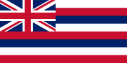
Route 63 is a state highway on the island of Oʻahu in Honolulu County, Hawaiʻi, United States, that is one of three main highways passing through the Koʻolau...
3 KB (198 words) - 01:25, 17 May 2022

established in 1955. Route numbers are organized so that the initial digit corresponds to the island: Numbers beginning with 1 or 2: Hawaiʻi Numbers beginning...
130 KB (597 words) - 16:08, 4 September 2024

Hana Highway (redirect from Hawaii Route 36)
referred to as The Road to Hana) is a 64.4-mile-long (103.6 km) stretch of Hawaii Routes 36 and 360 which connects Kahului to the town of Hana in east Maui....
15 KB (1,178 words) - 16:01, 25 July 2024
Kamehameha Highway (redirect from Hawaii Route 99)
at Route 61. Hawaii Route 830 is a 5.5-mile-long (8.9 km) north–south route on the island of O‘ahu, Hawai‘i. Its northern terminus is with Route 83,...
13 KB (710 words) - 17:19, 25 July 2024
Georgia State Route 63 (1921–1967) (former) Hawaii Route 63 Illinois Route 63 (former) Indiana State Road 63 K-63 (Kansas highway) Kentucky Route 63 Louisiana...
6 KB (419 words) - 16:11, 27 August 2024

Interstate H-3 (redirect from Hawaii Route 3)
Harbor. Its eastern end is at the main gate of Marine Corps Base Hawaii (MCBH). This route satisfies the national defense purpose of connecting MCBH with...
17 KB (1,643 words) - 22:48, 5 September 2024

Koʻolau Range (category Mountains of Hawaii)
windward: Hawaii Route 61 (Pali Highway) Hawaii Route 63 (Likelike Highway) Interstate H-3 View of Koʻolau Range with Koko Crater and Maunalua (Hawaii Kai)...
7 KB (624 words) - 06:25, 24 April 2024

Hawaii Route 61, often called the Pali Highway, is in Honolulu County, Hawaii, United States, that is the main highway connecting downtown Honolulu with...
8 KB (623 words) - 21:19, 13 July 2024
Route 50 Hawaii Route 51 Hawaii Route 56 Hawaii Route 58 Hawaii Route 61 Hawaii Route 63 Hawaii Route 64 Hawaii Route 72 Hawaii Route 76 Hawaii Route 92 Hawaii...
66 KB (6,751 words) - 02:24, 7 October 2024

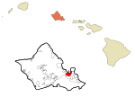
Hawaii County (Hawaiian: Kalana o Hawaiʻi; officially known as the County of Hawaiʻi) is a county in the U.S. state of Hawaii in the Hawaiian Islands...
20 KB (1,516 words) - 20:55, 3 October 2024

Kailua-Kona via a route close to the shore. Hawaii Route 190 leads south from Waimea and provides a shorter inland route to Kailua-Kona of 39 miles (63 km). According...
16 KB (1,411 words) - 16:04, 20 July 2024
Hawaii (/həˈwaɪ.i/ hə-WY-ee; Hawaiian: Hawaiʻi [həˈvɐjʔi, həˈwɐjʔi]) is an island state of the United States, in the Pacific Ocean about 2,000 miles (3...
242 KB (22,933 words) - 00:12, 16 October 2024

media related to Hawaii Route 92. KML file (edit • help) Template:Attached KML/Hawaii Route 92 KML is from Wikidata Hawaii Highways – Oahu Route List...
5 KB (280 words) - 17:11, 25 July 2024

it has 63% of the Hawaiian archipelago's combined landmass. However, it has only 13% of the archipelago's population. The island of Hawaiʻi is the third...
45 KB (3,843 words) - 18:14, 1 September 2024

Honolulu (redirect from Pauoa, Hawaii)
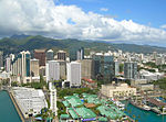
(/ˌhɒnəˈluːluː/ HON-ə-LOO-loo; Hawaiian: [honoˈlulu]) is the capital and most populous city of the U.S. state of Hawaii, which is in the Pacific Ocean...
90 KB (7,879 words) - 13:40, 7 October 2024
Interstate H-1 (redirect from Hawaii Route 1)
US, early Interstate shields also included the writing of 'Hawaii' above the Interstate route number and below the 'Interstate' writing. While the "Queen...
21 KB (1,395 words) - 10:59, 11 September 2024
Hawaiʻi Belt Road is a modern name for the Māmalahoa Highway and consists of Hawaiʻi state Routes 11, 19, and 190 that encircle the Island of Hawaiʻi...
30 KB (2,563 words) - 17:11, 25 July 2024

Kauai (redirect from Kauai, Hawaii)
Waimea Canyon. Hawaii Route 550 spans 15 mi (24 km) from Route 50 in Waimea to Kōkeʻe State Park. Hawaii Route 540 goes 4 mi (6.4 km) from Route 50 in Kalaheo...
42 KB (4,364 words) - 06:14, 28 September 2024

miles (68 km) to Hilo and west 14 miles (23 km) to Waimea. Hawaiʻi Route 240 branches off Route 19 and runs through the center of Honokaʻa, then continues...
14 KB (1,141 words) - 06:13, 22 August 2024

to the north by Hawaiian Paradise Park, to the south by Pahoa and Nanawale Estates, and to the east by the Pacific Ocean. Hawaii Route 130 forms the western...
9 KB (578 words) - 12:15, 11 February 2024

Lahaina had a resident population of 12,702. The CDP spans the coast along Hawaii Route 30 from a tunnel at the south end, through Olowalu, and to the CDPs of...
48 KB (4,132 words) - 23:22, 8 October 2024

Hawaii Route 11 is the main road through the CDP, leading north 16 miles (26 km) to Kailua-Kona and south 43 miles (69 km) to Nāʻālehu. Hawaii Route 160...
11 KB (685 words) - 03:43, 15 February 2024
Hawaiian Airlines (Hawaiian: Hui Mokulele o Hawaiʻi [huwi mokulele o həˈʋɐjʔi]) is a commercial U.S. airline, headquartered in Honolulu, Hawaii and a...
106 KB (8,493 words) - 13:23, 16 October 2024
Hawaii and to major destinations across the Pacific. H-1 H-2 H-3 H-201 Route 61 Route 63 Route 65 Route 72 Route 80 Route 83 Route 93 Route 95 Route 99...
48 KB (4,150 words) - 15:55, 9 October 2024

Pacific Ocean to the west. Hawaii Route 11 is the main highway through the community, running north–south, and Hawaii Route 180 runs parallel to it farther...
10 KB (672 words) - 20:09, 8 March 2024

Kahuku (Hawaiian pronunciation: [kəˈhuku]) is a census-designated place (CDP) in Honolulu, Hawaii, United States. In the Hawaiian language, ka huku means...
15 KB (1,078 words) - 03:44, 21 August 2024
Haleʻiwa (Hawaiian pronunciation: [həleˈʔivə]) is a North Shore community and census-designated place (CDP) in the Waialua District of the island of Oʻahu...
17 KB (1,445 words) - 03:44, 21 August 2024
Kāneʻohe (Hawaiian pronunciation: [kaːneˈʔohe]) is a census-designated place (CDP) included in the City and County of Honolulu and in Hawaiʻi state District...
22 KB (1,607 words) - 20:58, 6 September 2024

the south. Hawaii Route 50 leads west from Lihue 12 miles (19 km) to Kalaheo and beyond to the western side of the island, while Hawaii Route 56 leads north...
21 KB (1,583 words) - 03:45, 21 August 2024

are land and 0.4 square miles (1.0 km2), or 9.63%, is water. The community is located on Hawaii Route 56 on the northeast coast of the island of Kauai...
10 KB (721 words) - 22:29, 25 July 2024