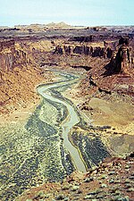
Horse Canyon is a small canyon near the towns of Boulder and Escalante in the Grand Staircase–Escalante National Monument in central Garfield County, Utah...
1 KB (148 words) - 05:11, 21 August 2022
feet (2,400 to 2,700 m). The area is in portions of Garfield County and Kane County. The Bryce Canyon area was settled by Mormon pioneers in the 1850s and...
38 KB (3,400 words) - 14:00, 4 October 2024
2024-09-29. Glen Canyon National Recreation Area is located [...] in Garfield, Kane, San Juan, and Wayne Counties, Utah, and Coconino County, Arizona. "Listing...
8 KB (635 words) - 21:12, 11 November 2024
I-70 US-191 Utah State Highway UT-128 Utah State Highway UT-313 Uintah County - north Garfield County, Colorado - northeast Mesa County, Colorado - east...
24 KB (2,154 words) - 01:02, 14 December 2024
the fifth-smallest county in Utah by total area. Sevier County (north) Wayne County (east) Garfield County (south) Beaver County (west) Dixie National...
17 KB (1,412 words) - 21:19, 26 November 2024
Lake Powell (category Lakes of Garfield County, Utah)
lies primarily in parts of Garfield, Kane, and San Juan counties in southern Utah, with a small portion in Coconino County in northern Arizona. The northern...
32 KB (3,364 words) - 19:51, 10 July 2024
Paria River (redirect from Paria Canyon)
canyons along part of its course. It is formed in southern Utah, in southwestern Garfield County from several creeks that descend from the edge of the Paunsaugunt...
9 KB (737 words) - 14:13, 25 April 2024
Glen Canyon is a natural canyon carved by a 169.6-mile (272.9 km) length of the Colorado River, mostly in southeastern and south-central Utah, in the United...
17 KB (2,129 words) - 15:19, 28 December 2024
list of canyons in the U.S. state of Utah along with any rivers, roads, and other features (such as rail lines) that pass through them. Utah portal Media...
14 KB (41 words) - 22:49, 9 September 2024
County, Idaho Horse Barn (Bryce Canyon, Utah), listed on the National Register of Historic Places in Garfield County, Utah This disambiguation page lists...
415 bytes (70 words) - 03:02, 21 March 2013
the central part of Bryce Canyon National Park in southwestern Garfield County, Utah, United States, that is listed on the National Register of Historic...
5 KB (555 words) - 03:33, 6 August 2023
Goosenecks State Park Snow Canyon State Park Utah portal "Utah Division of State Parks ("Utah State Parks")". State of Utah. Retrieved September 27, 2023...
21 KB (544 words) - 21:06, 16 October 2023
Roaring Fork. Most of the canyon is in Garfield County, with the upper portion near Dotsero lying in Eagle County. The canyon was formed relatively recently...
5 KB (520 words) - 00:50, 5 August 2024
Wayne County is a county in the U.S. state of Utah. As of the 2020 census, the population was 2,486, making it the fourth-least populous county in Utah. Its...
20 KB (1,583 words) - 21:30, 26 November 2024
Dirty Devil River (category Rivers of Garfield County, Utah)
000-foot-deep (610 m) canyon in Wayne and Garfield counties. Its lower 20 miles (32 km) flows through Glen Canyon National Recreation Area, where it finally...
7 KB (495 words) - 03:58, 10 December 2024
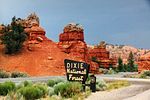
Dixie National Forest (redirect from Red Canyon visitor center)
in parts of Garfield, Washington, Iron, Kane, Wayne, and Piute counties. The majority (over 55%) of forest acreage lies in Garfield County. Elevations...
9 KB (708 words) - 03:11, 29 September 2024
Wolverine Canyon is a canyon near the town of Boulder, Utah. It is small, only 3 miles in length until it meets with Horse Canyon and Little Death Hollow...
684 bytes (68 words) - 15:17, 28 December 2024
Canyonlands National Park (redirect from Canyon Rims Recreation Area)
States located in southeastern Utah near the town of Moab. The park preserves a colorful landscape eroded into numerous canyons, mesas, and buttes by the Colorado...
55 KB (4,674 words) - 20:47, 31 December 2024
Sevier River (category Rivers of Garfield County, Utah)
into Garfield County passing Hatch and Panguitch. It then flows through the narrow, 5-mile (8.0 km) Circleville Canyon and enters Piute County at the...
58 KB (6,257 words) - 06:18, 21 December 2024
Roan Cliffs (category Mountains of Garfield County, Colorado)
Uintah County, they reach the Utah‑Colorado state line. East of the state line, the Roan Cliffs continue a northeastern course in Garfield County until...
10 KB (1,073 words) - 10:32, 5 January 2025
Area. Utah is the only state where every county contains some national forest. Arches National Park Pariette Wetlands Little Cottonwood Canyon Deer Creek...
206 KB (18,045 words) - 08:25, 3 January 2025
The Horse Barn at Bryce Canyon National Park, Utah, is a rustic structure built in 1929, shortly after the National Park Service assumed control of the...
3 KB (336 words) - 06:59, 23 August 2024
Death Hollow (category Canyons and gorges of Garfield County, Utah)
Hollow, Death Canyon or Little Death Hollow is a slot canyon in the Grand Staircase–Escalante National Monument in central Garfield County, Utah, United States...
2 KB (176 words) - 16:56, 31 July 2023
Capitol Reef National Park (redirect from Capitol Reef National Park, Utah)
through September being the highest visitation months. Partially in Wayne County, Utah, the area was originally named "Wayne Wonderland" in the 1920s by local...
41 KB (4,316 words) - 20:12, 7 December 2024
Markagunt Plateau (category Landforms of Garfield County, Utah)
eruptions. The Markagunt Plateau is in southern Utah in the counties Iron County, Garfield County and Kane County. Cedar City lies west and Kanab south of the...
24 KB (2,108 words) - 18:17, 17 November 2023
Fishlake National Forest (redirect from Fishlake National Forest, Utah)
nine counties. In descending order of forestland area, they are Sevier, Millard, Piute, Beaver, Wayne, Juab, Garfield, Iron, and Sanpete counties. Forest...
8 KB (539 words) - 08:30, 29 September 2024
Grand Staircase–Escalante National Monument (category Landforms of Garfield County, Utah)
Staircase, the Kaiparowits Plateau, and the Canyons of the Escalante (Escalante River) in southern Utah. It was established in 1996 by President Bill...
29 KB (2,896 words) - 23:05, 7 November 2024
White River (Green River tributary) (redirect from White River (Colorado-Utah))
river rises in two forks in northwestern Colorado in northeastern Garfield County in the Flat Tops Wilderness Area in the White River National Forest...
7 KB (452 words) - 10:50, 13 February 2024
Garfield County, Utah. This is intended to be a complete list of the properties and districts on the National Register of Historic Places in Garfield...
12 KB (318 words) - 20:33, 5 March 2022
Cataract Canyon is a 46-mile-long (74 km) canyon of the Colorado River located within Canyonlands National Park and Glen Canyon National Recreation Area...
10 KB (1,238 words) - 01:40, 28 November 2022


