
Jayuya Abajo is a barrio in the municipality of Jayuya, Puerto Rico. Its population in 2010 was 3,367. Jayuya Abajo was in Spain's gazetteers until Puerto...
7 KB (430 words) - 01:03, 31 December 2023

municipality, in a barrio referred to as "el pueblo". Coabey Collores Jauca Jayuya Abajo Jayuya barrio-pueblo Mameyes Arriba Pica Río Grande Saliente Veguitas Zamas...
33 KB (2,631 words) - 22:12, 3 October 2024
Cayey Jauca 1, Santa Isabel Jauca 2, Santa Isabel Jauca, Jayuya Jayuya Abajo, Jayuya Jayuya barrio-pueblo Jiménez, Río Grande Jobos, Guayama Jobos, Isabela...
76 KB (3,116 words) - 10:42, 8 April 2024

travels from Jayuya, Puerto Rico to northeastern Utuado. This highway begins at PR-144 in downtown Jayuya and ends at PR-140 in Mameyes Abajo. Puerto Rico...
5 KB (194 words) - 01:59, 6 February 2024

Cerro Morales (Utuado, Puerto Rico) (category Jayuya, Puerto Rico)
municipalities of Utuado, in the barrio of Tetuán, and Jayuya, in the barrio of Jayuya Abajo. The mountain is considered a geographical landmark as it...
1 KB (70 words) - 22:56, 1 February 2022

Hato Abajo is a barrio in the municipality of Arecibo, Puerto Rico. Its population in 2010 was 19,699. Hato Abajo was in Spain's gazetteers until Puerto...
11 KB (904 words) - 03:44, 16 July 2024

Aibonito. At 1,338 meters (4,390 ft) on the town line between Ponce and Jayuya, Cerro de Punta is the summit of the Cordillera Central and the highest...
49 KB (3,375 words) - 06:44, 6 October 2024
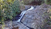
neighbouring Jayuya at a higher elevation, but was once part of Utuado as well. The Río La Venta is a river in Mameyes Abajo. Mameyes Abajo was in Spain's...
7 KB (447 words) - 19:43, 31 December 2023

Puerto Rico Highway 144 (PR-144) is a rural road that travels from Jayuya, Puerto Rico to Ciales. This road extends from PR-140 in Collores and ends at...
6 KB (198 words) - 02:31, 6 February 2024

revolts was the Jayuya uprising, where a group of Puerto Rican Nationalists, under the leadership of Blanca Canales, held the town of Jayuya for three days;...
56 KB (6,487 words) - 00:15, 16 October 2024

Monte Jayuya is the second highest peak of Puerto Rico measuring 1,296 meters (4,252 ft) above sea level. The mountain is located in the Cordillera Central...
3 KB (163 words) - 19:42, 19 April 2023

Machuelo Abajo is one of the 31 barrios of the municipality of Ponce, Puerto Rico. Along with Canas Urbano, Magueyes Urbano, Portugués Urbano, and San...
12 KB (956 words) - 13:16, 27 December 2023

Ponce; south of Hatillo and Arecibo; east of Lares; and west of Ciales and Jayuya. It is the third-largest municipality in land area in Puerto Rico (after...
52 KB (4,801 words) - 17:26, 30 September 2024

Sector El Tamarindo Sector El Tanque Sector El Tres Sector Iglesia Sector Jayuya Sector Juncos Sector Korea Sector La Ceiba Sector Las Canelas Sector Los...
17 KB (1,519 words) - 23:06, 11 July 2024

Cerro de Punta (category Jayuya, Puerto Rico)
is located on the town boundary between the municipalities of Ponce and Jayuya in the central region of the main island of Puerto Rico. The mountain is...
14 KB (1,197 words) - 21:43, 11 September 2024
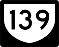
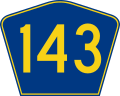
between barrios Machuelo Abajo and Machuelo Arriba to the intersection of PR-143 with PR-140 (former Road No. 15) on the Ponce–Jayuya–Utuado municipal tripoint...
12 KB (852 words) - 01:54, 6 February 2024

and Adjuntas), San Patricio (borders Adjuntas, Utuado, and Jayuya), Anón (borders Jayuya and Juana Diaz), Real (borders Juana Diaz), Coto Laurel (borders...
39 KB (2,316 words) - 00:19, 18 September 2024

of the Ana G. Mendez University. It has five campuses: Aguadilla Bayamón Jayuya San Juan - the main campus and usually referred to as the Metropolitan University...
20 KB (1,705 words) - 07:27, 5 October 2024

Villalba and Coamo; south of Morovis and Corozal; southeast of Ciales; east of Jayuya; and west of Barranquitas Since before the Spanish colonization in the 16th...
31 KB (2,540 words) - 20:33, 30 September 2024
Mountains, Vermont, US – Highest in Vermont Cerro de Punta 1,338 4,390 Jayuya, Puerto Rico – Highest in Puerto Rico Seward Mountain (New York) 1,329.2...
139 KB (176 words) - 08:35, 3 October 2024
Rodríguez) – Ciales, Jayuya Northern terminus of PR-149 concurrency Bauta Abajo 34.0 21.1 PR-564 – Bauta Abajo 39.3 24.4 PR-590 – Bauta Abajo Villalba Caonillas...
11 KB (295 words) - 18:25, 1 August 2024

National Register of Historic Places listings in central Puerto Rico (redirect from National Register of Historic Places listings in Jayuya, Puerto Rico)
retrieved December 21, 2015. "Discover Petroglyphs on Piedra Escrita in Jayuya", Puerto Rico Day Trips, March 1, 2015, archived from the original on September...
47 KB (810 words) - 21:25, 6 September 2024

Ponce, north to barrio San Patricio, and to barrio Consejo in southern Jayuya. This interchange also connects to PR-504, which leads to downtown Ponce...
38 KB (3,432 words) - 01:31, 5 August 2024
Campos's residence used to be in the community of Tenerias, Barrio Machuelo Abajo. The statue is in bronze. Pedro Albizu Campos (1891 – 1965) was a Puerto...
4 KB (371 words) - 02:35, 15 August 2024

and merging shortly with PR-123. It ends at PR-140 east of Utuado, near Jayuya. It is one of two long highways going west–east through the center of Puerto...
22 KB (756 words) - 01:56, 6 February 2024

municipality of Puerto Rico located on the southern coast of the island, south of Jayuya, Ciales, Orocovis and Villalba; east of Ponce; and west of Coamo and Santa...
35 KB (2,842 words) - 02:19, 12 October 2024

southern coastal plain region of the island, south of Adjuntas, Utuado, and Jayuya; east of Peñuelas; west of Juana Díaz; and bordered on the south by the...
220 KB (21,933 words) - 14:39, 9 October 2024
its own. Its tower is now located at Cerro Jayuya in the border between the municipality of Ponce with Jayuya. Las Noticias Teleonce is the flagship news...
63 KB (5,660 words) - 21:52, 6 October 2024
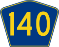
Puerto Rico Highway 140 (PR-140) is a road that travels from Jayuya, Puerto Rico to Barceloneta, passing through Utuado, Ciales and Florida. This highway...
8 KB (206 words) - 02:29, 6 February 2024

separate municipalities. These include Manati, Barceloneta, Florida, Utuado, Jayuya, Hatillo, Camuy, Quebradillas and Isabela. In 1982, it was promoted to city...
59 KB (4,640 words) - 21:19, 27 September 2024