Josephinian Land Survey (redirect from Josephinische Landesaufnahme)
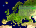
The Josephinian Land Survey (German: Josephinische Landesaufnahme) was the first comprehensive land survey and mapping of the Habsburg Empire. The survey...
1 KB (147 words) - 19:07, 24 September 2023

Sighișoara in the Grand Duchy of Transylvania, 1769–1773. Josephinische Landesaufnahme...
20 KB (1,631 words) - 02:26, 4 September 2024

The Kingdom of Hungary on the Josephinische Landesaufnahme Original Map, 1782–1785...
43 KB (4,640 words) - 17:29, 14 September 2024

dell'Allio. Other important sources are the Josephinische Landesaufnahme and the Franziszeische Landesaufnahme, which were large-scale maps prepared for...
177 KB (22,261 words) - 21:01, 5 January 2024
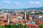
Clausenburg in the Grand Duchy of Transylvania maps, 1769–1773. Josephinische Landesaufnahme...
217 KB (19,310 words) - 16:20, 16 September 2024

(Fényes), Plopu, Sat Bătrân (Ófalu) and Sub Margine. Armeniș in the Josephinische Landesaufnahme cadastral maps, 1769–72 "Populaţia rezidentă după grupa de vârstă...
2 KB (91 words) - 10:15, 8 July 2022

Sânnicolau Mare (Gros St. Miklosch) on the Josephinische Landesaufnahme of 1769–1772...
47 KB (5,890 words) - 02:28, 4 September 2024

in fact stony, devoid of trees and shrubby vegetation. On the Josephinische Landesaufnahme maps the area of Mount Cocusso has marked toponyms: Berg Monte...
18 KB (1,873 words) - 20:22, 4 April 2024

Josephinische Landesaufnahme. Senzitive map of the Arad county, 1782-1785. (Click on the desired quadrant)...
25 KB (1,462 words) - 19:04, 7 April 2024

ownership structure also remains unknown. On the maps of the Josephinische Landesaufnahme from 1787, the castle is referred to as altes Gschloss. One of...
49 KB (6,445 words) - 04:38, 19 August 2024

Făget (Facshet) on the Josephinische Landesaufnahme of 1769–1772...
12 KB (1,008 words) - 02:37, 4 September 2024

of Slovenia. Statistical Office of the Republic of Slovenia "Josephinische Landesaufnahme (1763-1787)". Mapire. Retrieved April 22, 2018. Rajšp, Vincenc...
5 KB (86 words) - 20:28, 21 August 2024
Cluj-Napoca in the Grand Duchy of Transylvania maps, 1769–1773. Josephinische Landesaufnahme...
23 KB (2,678 words) - 10:02, 14 August 2024

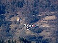
Stănija Interior of the wooden church from Stănija Buceș in the Josephinische Landesaufnahme cadastral maps, 1769-72 Vulcan Mountain seen from Buceș Road...
2 KB (114 words) - 22:11, 30 May 2020

Sânandrei (St. Andrasch) on the Josephinische Landesaufnahme of 1769–1772...
10 KB (763 words) - 18:27, 30 September 2023

The district of Csanád with Beba in the lower left in the Josephinische Landesaufnahme of 1769–1772...
13 KB (1,190 words) - 06:47, 31 July 2024
Slovenia Archived November 18, 2008, at the Wayback Machine "Josephinische Landesaufnahme (1763-1787)". Mapire. Retrieved April 22, 2018. Rajšp, Vincenc...
5 KB (128 words) - 20:30, 21 August 2024

Șag (Schag) on the Josephinische Landesaufnahme of 1769–1772...
11 KB (919 words) - 23:52, 2 October 2023

Pădureni (Liget) in the Josephinische Landesaufnahme of 1769–1772...
7 KB (460 words) - 19:10, 2 October 2023

Deta on the Josephinische Landesaufnahme of 1769–1772...
14 KB (1,368 words) - 07:55, 1 February 2024

name is derived (in Hungarian kastély means "castle"). On the Josephinische Landesaufnahme of 1717, it was listed under the name Gustik. Today's village...
8 KB (489 words) - 08:34, 1 February 2024
Variaș (Wariasch) on the Josephinische Landesaufnahme of 1769–1772...
12 KB (1,118 words) - 00:13, 3 October 2023

Vălcani (Walkan) on the Josephinische Landesaufnahme of 1769–1772...
7 KB (571 words) - 00:04, 3 October 2023

The four villages of the commune on the Josephinische Landesaufnahme of 1769–1772...
9 KB (697 words) - 21:51, 2 October 2023

Peciu Nou (Uypecs) and Diniaș (Diniasch) on the Josephinische Landesaufnahme of 1769–1772...
7 KB (393 words) - 13:50, 28 March 2024

Kryg ina map of Josephinische Landesaufnahme (1763-1787)...
2 KB (159 words) - 03:25, 11 August 2024

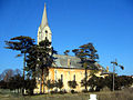
Romanian) Ruins of the reformed church Vama Buzăului in the Josephinische Landesaufnahme cadastral maps, 1769–72 Wikimedia Commons has media related to...
4 KB (325 words) - 16:23, 22 August 2024

Bărăteaz (Barathias) and Satchinez (Knees) on the Josephinische Landesaufnahme of 1769–1772...
17 KB (1,684 words) - 21:45, 2 April 2024

Giera (Gyr) and Toager (Thodier) in the Josephinische Landesaufnahme of 1769–1772...
7 KB (413 words) - 09:56, 3 June 2024
Mănăștiur (Monostur) in the Josephinische Landesaufnahme of 1769–1772...
9 KB (663 words) - 18:10, 2 October 2023