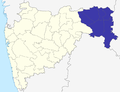
Katol taluka is a taluka in Katol subdivision of Nagpur district in Maharashtra state, India. It covers an area of 9,017 hectares, and as of 2001 had...
6 KB (276 words) - 16:47, 1 July 2023

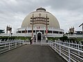
Katol is a city and a municipal council in Nagpur district of Maharashtra state, India. It is the administrative headquarters of Katol taluka, one of...
22 KB (2,510 words) - 16:21, 28 July 2024

Kalmeshwar taluka South East, Katol taluka towards South, Karanja taluka South west. Narkhed, Pandhurna, Shendurjana, Warud, Katol, Saoner are the nearby Cities...
15 KB (1,061 words) - 02:17, 20 November 2023
Narkhed and Katol talukas and part of Nagpur (Rural) taluka. Number of electorates was 245,811 in 2009 (male 128,076, female 117,735). Katol is part of...
7 KB (237 words) - 18:15, 1 August 2024
The table below lists all the talukas (tahsils/tehsils) of all the thirty-six districts in the Indian state of Maharashtra, along with district-subdivision...
23 KB (66 words) - 05:31, 7 June 2024
Railways. The station is situated beside State Highway 248 at Yerla, Katol taluka in Nagpur district in the Indian state of Maharashtra. The Bhopal–Itarsi...
4 KB (172 words) - 01:27, 29 July 2024
of Indian Railways. The station is situated beside State Highway 248, Katol taluka at Metpanjra in Nagpur district in the Indian state of Maharashtra. The...
4 KB (173 words) - 06:08, 30 July 2024
of Indian Railways. The station is situated beside State Highway 248, Katol taluka at Sonkhamb in Nagpur district in the Indian state of Maharashtra. The...
4 KB (173 words) - 03:09, 29 July 2024
Karanja Ghadge Taluka to the South, Warud Taluka to the west, Katol Taluka to the east, and Pandhurna Taluka of Madhya Pradesh to the north. The primary...
3 KB (112 words) - 17:10, 29 February 2024
situated 78 km from Nagpur, and the nearest railway stations are Mowad, Warud, Katol, Narkhed. The town is a tourist attraction as it has the Someshwar Fort...
4 KB (283 words) - 09:38, 18 August 2024

the Chorkhairi West Reserved Forest in the north-east corner of the Katol taluka at an elevation of approximately 600 meters, 21°28′01″N 78°39′52″E /...
3 KB (318 words) - 08:38, 1 June 2023
Maharashtra state. Nagpur district is divided into 14 talukas: Ramtek, Umred, Kalameshwar, Katol, Kamptee, Kuhi, Narkhed, Nagpur, Nagpur Rural, Parseoni...
20 KB (858 words) - 15:05, 23 August 2024
SH 245 at Bharsinghi Village and Jalalkheda Village in Narkhed taluka MH SH 247 at Katol MH SH 244 at Warud Many villages, cities and towns in various...
2 KB (154 words) - 21:27, 14 February 2023
Narkhed (category Talukas in Maharashtra)
Narkhed is the taluka headquarters and Panchayat Samiti. 138 villages come under Narkhed taluka with 70 Gram Panchayats. Narkhed is under Katol Vidhan Sabha...
10 KB (690 words) - 00:15, 24 February 2024

Kalameshwar (category Talukas in Maharashtra)
transport(MSRTC). All the buses on the way to Katol and Warud stops here. Regular buses are running between Nagpur, Katol, Savner, Dapewada, Mohapa, Gondkhari...
12 KB (876 words) - 02:30, 17 August 2024
Nagpur Rural (category Talukas in Maharashtra)
Nagpur Rural is a taluka in Nagpur subdivision of Nagpur district of Maharashtra in India. Nagpur Rural Area consists of 1 Lok Sabha Constituency, (Ramtek...
3 KB (78 words) - 06:47, 19 August 2024
districts. Following table shows the districts of Nagpur Division and their talukas: Make In Maharashtra Central Provinces, Administration Nagpur Province...
12 KB (362 words) - 06:58, 17 September 2023
Chikhaldara (category Talukas in Maharashtra)
road. The nearest airport is Nagpur: 229 km via Paratwada-Chandur Bazar-Katol route and 231 km via Paratwada-Amravati-Kondhali route. MSRTC plies buses...
13 KB (848 words) - 03:57, 4 August 2024
between Talegaon and Nagpur on NH-6. It is 61 km from Nagpur, 17 km from Katol. As per 2011 census population of Kondhali is 11,418 of which 5,814 were...
5 KB (329 words) - 02:11, 17 August 2024
one of the important road for Narkhed taluka, touching three important place and providing connectivity with Katol, Nagpur, Warud and the rest of India...
2 KB (121 words) - 21:55, 29 February 2024

Station, Buldana Agri. College Campus, Nagpur Regional Fruit Research Station Katol Dist Nagpur Agri. Research Station, Tharsa Dist. Nagpur Agri. Research Station...
13 KB (1,624 words) - 12:26, 17 July 2024

Sawargaon – Narkhed – Mowad Nagpur MH SH 247 Katol – Sonegaon Nagpur, Wardha MH SH 248 Nagpur – Kalmeshwar Katol – Warud Nagpur, Amravati MH SH 249 Saoner...
32 KB (85 words) - 17:26, 14 April 2024
Hingoli Jalgaon Jalna Kalyan Karad Kolhapur Latur Nagpur, Besa Nagpur, Katol Nagpur, Koradi Nanded Nandurbar Nashik Nerul, Palm Beach Road, Navi Wardha...
14 KB (594 words) - 07:37, 16 December 2023
tier system, with the Zilla Parishad at the district level, Taluka panchayat at the Taluka or sub-district level and Grampanchayat (Village Council) at...
17 KB (1,082 words) - 14:03, 23 August 2024
of Dharwad, Bijapur, North Kannada and Belgaum (excluding the Chandgad taluka) were transferred to Mysore state, while Abu Road taluk of the Banaskantha...
52 KB (213 words) - 11:05, 13 March 2024

Sahitya Sammelan, Kolhapur - [1979] 2nd Vidarbha Jana Sahitya Sammelan, Katol, Dist. Nagpur - [1984] National Integration and Social Justic Conference...
17 KB (1,209 words) - 14:11, 30 October 2023