
Kentucky Route 455 (KY 455) is a 7.111-mile-long (11.444 km) state highway in the U.S. state of Kentucky. The highway connects Glencoe and Warsaw, within...
3 KB (204 words) - 17:56, 16 February 2024

help) Template:Attached KML/Kentucky Route 102 KML is not from Wikidata Kentucky Route 102 is a 17.060-mile-long (27.455 km) rural secondary highway in...
107 KB (11,131 words) - 17:26, 1 May 2024

highway that runs from Kentucky Route 32 just east of Elliottville to Kentucky Route 7 at Green via Ault and Gimlet. Kentucky Route 505 (KY 505) is a 18...
113 KB (5,096 words) - 23:22, 14 May 2024

have portions within the State Primary and State Secondary systems. Kentucky Route 400 is a 1.377-mile-long (2.216 km) supplemental road in the city of...
131 KB (12,134 words) - 17:05, 29 April 2024

Kentucky Route 80 (KY 80) is a 483.55-mile-long (778.20 km) state highway in the southern part of the U.S. state of Kentucky. The route originates on...
64 KB (1,742 words) - 04:20, 25 July 2024

Kentucky Route 15 begins at a junction of US 119/Corridor F & Business KY 15 in Whitesburg, and terminates in Winchester at US 60. It is a major route...
20 KB (556 words) - 23:56, 8 April 2023

before crossing the Kentucky state line and entering Oak Grove, KY where SR 12 ends and US 41A continues as US 41 ALT. State Route 455, the Tennessee Waltz...
10 KB (635 words) - 04:56, 29 January 2024

Kentucky Route 90 (KY 90) is a major east–west state highway in southern Kentucky. The route is 134.734 miles (216.833 km) long, and it traverses Barren...
35 KB (2,446 words) - 21:13, 14 May 2024
Kentucky are maintained by the Kentucky Transportation Cabinet, which classifies routes as either primary or secondary. Some routes, such as Kentucky...
31 KB (125 words) - 16:22, 18 May 2024

Kentucky Route 100 (KY 100) is a state highway in south-central Kentucky. It originates at a junction with U.S. Highway 79 in Russellville in Logan County...
15 KB (610 words) - 02:52, 5 February 2024

Kentucky Route 35 (KY 35) is a 12.833-mile-long state highway in Kentucky that runs from US 127 in Owen County south of Sparta and heads north and goes...
5 KB (446 words) - 14:04, 17 July 2023

U.S. Route 60 (US 60) is a major U.S. Highway in the American state of Kentucky. In the early days of the U.S. Highway System, US 60 was originally to...
75 KB (1,848 words) - 23:01, 8 March 2024

U.S. Route 68 (US 68) is a United States highway that runs for 560 miles (900 km) from northwest Ohio to Western Kentucky. The highway's western terminus...
68 KB (1,610 words) - 14:02, 27 July 2024

U.S. Route 127 (US 127) in Kentucky runs 207.7 miles (334.3 km) from the Tennessee state line in rural Clinton County to the Ohio state line in Cincinnati...
32 KB (625 words) - 23:13, 8 March 2024

Route 62 (US 62) in Kentucky runs for a total of 391.207 miles (629.587 km) across 20 counties in western, north-central, and northeastern Kentucky....
53 KB (1,263 words) - 16:20, 23 July 2024

Kentucky Route 55 (KY 55) is a 140.858-mile-long (226.689 km) state highway in the U.S. Commonwealth of Kentucky. The route originates at a junction with...
26 KB (1,411 words) - 19:03, 26 October 2023

Kentucky Route 155 (KY 155) is a 20.788-mile-long (33.455 km) state highway in the U.S. state of Kentucky. The route originates at a junction with U.S...
6 KB (392 words) - 17:48, 16 February 2024

Kentucky Route 259 (KY 259) is a 95.91-mile-long (154.35 km) state highway that traverses five counties in west-central Kentucky. KY 259's southern terminus...
18 KB (1,075 words) - 00:57, 15 February 2024

Kentucky Route 1005 (KY 1005) is an 18.763-mile (30.196 km) long state highway in the U.S. state of Kentucky. The route is located in Shelby County and...
4 KB (164 words) - 06:41, 22 June 2023
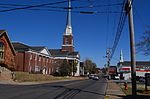
2007. p. 455. ISBN 978-1-4027-4771-7. Wikimedia Commons has media related to Glasgow, Kentucky. Wikivoyage has a travel guide for Glasgow, Kentucky. City...
21 KB (2,098 words) - 07:50, 26 July 2024

Kentucky Route 550 (KY 550) is a 43.212 miles (69.543 km) state highway in eastern Kentucky that runs from Kentucky Routes 15 and 80 in northwestern Hazard...
7 KB (282 words) - 06:48, 3 May 2023

Kentucky Route 622 (KY 622) is a rural secondary state highway in South Central Kentucky. The 20.020-mile-long (32.219 km) route traverses eastern Simpson...
5 KB (243 words) - 17:55, 16 February 2024

Kentucky Route 1136 is a north–south rural secondary state highway located entirely in Hardin County in north-central Kentucky. The route is 10.655 miles...
3 KB (182 words) - 06:42, 22 June 2023

Kentucky Route 227 (KY 227) is a 52.762-mile-long (84.912 km) state highway in Kentucky that runs from U.S. Route 460 (US 460) near Georgetown, Kentucky...
9 KB (320 words) - 17:48, 16 February 2024

Kentucky Route 695 (KY 695) is a 12.829-mile-long (20.646 km) state highway in southwestern Christian County, Kentucky, that runs from KY 164 northeast...
2 KB (103 words) - 17:55, 16 February 2024
List of highways numbered 1000–1499 (redirect from Route 1128)
listed below are all in the United States, primarily Louisiana, Texas, and Kentucky, though there are some roads in this range in Georgia and New Mexico. The...
55 KB (154 words) - 14:05, 5 April 2024

(1877). History of Kentucky. p. 455. Commonwealth of Kentucky. Office of the Secretary of State. Land Office. "Barbourville, Kentucky". Accessed 15 July...
18 KB (1,221 words) - 00:37, 21 June 2024

Pan-American Highway (redirect from Pan-American Highway (route))
Highway 43 goes left. Highway 43 goes for 455 km (283 mi) before reaching Edmonton. The unofficial route turns 2 ways, one way goes to Lloydminster,...
69 KB (8,613 words) - 19:18, 23 July 2024

the Kentucky state line, where it continues as KY 383. SR 49's route between Springfield and the Kentucky state line once formed an alternate route of...
14 KB (881 words) - 16:04, 4 December 2023

Kentucky Route 1974, also known as Tates Creek Road, stretches from New Circle Road (KY 4) at its northern terminus and proceeds southeast towards Spears...
4 KB (337 words) - 17:47, 16 February 2024