The National Geodetic Survey (NGS) is a United States federal agency based in Washington, D.C. that defines and manages a national coordinate system, providing...
7 KB (762 words) - 18:49, 12 August 2024
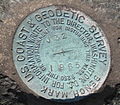
Survey markers, also called survey marks, survey monuments, or geodetic marks, are objects placed to mark key survey points on the Earth's surface. They...
10 KB (1,244 words) - 18:30, 29 November 2023
UV4136. U.S. National Geodetic Survey. Retrieved 4 May 2016. "WHITNEY". Datasheet for NGS Station GT1811. U.S. National Geodetic Survey. Retrieved 4 May...
166 KB (13,958 words) - 18:24, 25 September 2024

States Coast and Geodetic Survey (abbreviated USC&GS; known as the Survey of the Coast from 1807 to 1836, and as the United States Coast Survey from 1836 until...
103 KB (11,245 words) - 12:37, 26 September 2024
NGS Station UV4136. U.S. National Geodetic Survey. "WHITNEY". Datasheet for NGS Station GT1811. U.S. National Geodetic Survey. "BOUNDARY POINT 180". Datasheet...
114 KB (9,521 words) - 04:02, 5 August 2024

(NAVD 88). For further information, please see this United States National Geodetic Survey note. If the elevation or prominence of a summit is calculated...
46 KB (3,446 words) - 05:19, 22 September 2024
(NAVD 88). For further information, please see this United States National Geodetic Survey note. If the elevation or prominence of a summit is calculated...
54 KB (5,512 words) - 01:44, 3 September 2024
geodetic coordinates Geodetic datum Geodesics on an ellipsoid Planetary coordinate system National Geodetic Survey (U.S.).; National Geodetic Survey (U...
7 KB (893 words) - 13:52, 25 March 2024
United States Geological Survey (USGS) Geographic Names Information System @ USGS United States National Geodetic Survey (NGS) Geodetic Glossary @ NGS NGVD...
36 KB (4,449 words) - 16:38, 14 September 2024

information from Wikivoyage National Geodetic Survey Finding Survey Marks and Datasheets United States Geological Survey National Map Search Elevation Point...
48 KB (3,092 words) - 17:13, 19 September 2024

among the earliest in the federal government: United States Coast and Geodetic Survey, formed in 1807 Weather Bureau of the United States, formed in 1870...
45 KB (4,368 words) - 04:35, 4 August 2024
United States Geological Survey (USGS) Geographic Names Information System @ USGS United States National Geodetic Survey (NGS) Geodetic Glossary @ NGS NGVD...
70 KB (9,116 words) - 21:22, 20 September 2024
(NAVD 88). For further information, please see this United States National Geodetic Survey note. If the elevation or prominence of a summit is calculated...
79 KB (7,923 words) - 17:25, 13 December 2023

The National Geodetic Vertical Datum of 1929 is the official name since 1973 of the vertical datum established for vertical control surveying in the United...
4 KB (397 words) - 01:26, 19 November 2023

United States Geological Survey (USGS) Geographic Names Information System @ USGS United States National Geodetic Survey (NGS) Geodetic Glossary @ NGS NGVD...
71 KB (7,346 words) - 07:25, 21 March 2024
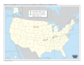
Geographic center of the United States (category Historic surveying landmarks in the United States)
regarded as such by the United States Coast and Geodetic Survey and the U.S. National Geodetic Survey (NGS) since the additions of Alaska and Hawaii to...
11 KB (1,288 words) - 22:36, 25 August 2024
A geodetic datum or geodetic system (also: geodetic reference datum, geodetic reference system, or geodetic reference frame, or terrestrial reference...
31 KB (3,346 words) - 06:28, 11 August 2024
(NAVD 88). For further information, please see this United States National Geodetic Survey note. If an elevation or prominence is calculated as a range of...
40 KB (7,379 words) - 05:07, 14 December 2023
The World Geodetic System (WGS) is a standard used in cartography, geodesy, and satellite navigation including GPS. The current version, WGS 84, defines...
24 KB (2,843 words) - 13:42, 3 August 2024
(NAVD 88). For further information, please see this United States National Geodetic Survey note. If the elevation or prominence of a summit is calculated...
24 KB (3,197 words) - 02:38, 22 July 2024
United States Geological Survey (USGS) Geographic Names Information System @ USGS United States National Geodetic Survey (NGS) Geodetic Glossary @ NGS NGVD...
34 KB (3,676 words) - 21:29, 14 October 2022

Acre (redirect from Survey acre)
definitions to be detectable. In October 2019, the US National Geodetic Survey and the National Institute of Standards and Technology announced their...
35 KB (3,534 words) - 03:15, 13 August 2024
(NAVD 88). For further information, please see this United States National Geodetic Survey note. If the elevation or prominence of a summit is calculated...
58 KB (6,673 words) - 20:46, 18 March 2024

The National Spatial Reference System (NSRS), managed by the National Geodetic Survey (NGS), is a coordinate system that includes latitude, longitude...
6 KB (555 words) - 18:29, 12 August 2024

Coast and Geodetic Survey Corps on May 22, 1917, which the service recognizes as its official date of establishment. The Coast and Geodetic Survey Corps became...
48 KB (3,597 words) - 23:58, 19 September 2024

United States Geological Survey (USGS) Geographic Names Information System @ USGS United States National Geodetic Survey (NGS) Geodetic Glossary @ NGS NGVD...
61 KB (4,671 words) - 11:45, 8 August 2024

Geodesy (redirect from Geodetic survey)
and national control networks, applying space geodesy and terrestrial geodetic techniques, and relying on datums and coordinate systems. Geodetic job...
38 KB (4,274 words) - 11:27, 24 September 2024

Foot (unit) (redirect from U.S. survey foot)
the National Spatial Reference System (NSRS) by NOAA's National Geodetic Survey (NGS). The reason for associating the deprecation of the U.S. survey foot...
50 KB (4,536 words) - 10:27, 24 September 2024
(CO-OPS) National Centers for Coastal Ocean Science (NCCOS) Office of Coast Survey (OCS) Office for Coastal Management (OCM) National Geodetic Survey (NGS)...
25 KB (2,807 words) - 13:45, 1 August 2024

Ordnance Survey Ordnance Survey of Northern Ireland United States The National Geodetic Survey (NGS; formerly United States Coast and Geodetic Survey) The...
10 KB (1,053 words) - 15:27, 3 July 2024