
Oregon Route 250 (OR 250) is an Oregon state highway running from Cape Blanco State Park to OR 101 near Sixes. OR 250 is known as the Cape Blanco Highway...
2 KB (209 words) - 09:26, 23 June 2023

No. 456 (see Oregon highways and routes); "I.O.N." stands for Idaho–Oregon–Nevada. This section of highway is a primary commercial route between Boise...
23 KB (2,408 words) - 22:29, 4 August 2024
Kentucky Route 250 Minnesota State Highway 250 Montana Secondary Highway 250 Nebraska Highway 250 New Mexico State Road 250 New York State Route 250 Oregon Route...
2 KB (151 words) - 23:25, 4 April 2024

The Oregon Trail was a 2,170-mile (3,490 km) east–west, large-wheeled wagon route and emigrant trail in the United States that connected the Missouri...
144 KB (19,226 words) - 09:26, 15 September 2024

U.S. Route 101 (US 101), is a major north–south U.S. Highway in Oregon that runs through the state along the western Oregon coastline near the Pacific...
23 KB (1,899 words) - 19:15, 15 May 2024
city in Lake County, Oregon, United States. It is along Oregon Route 31 between Summer Lake and Lake Abert. The population was 250 at the 2020 census....
18 KB (1,474 words) - 03:10, 24 November 2023

Valley, Eastern Oregon gets a significant amount of snow in the winter. Some parts of Eastern Oregon receive fewer than 10 inches (250 mm) of rain yearly...
24 KB (2,303 words) - 02:22, 4 September 2024

the U.S. state of Oregon is a major Interstate Highway that traverses the state from west to east. It is concurrent with U.S. Route 30 (US 30) for most...
71 KB (5,596 words) - 09:07, 11 September 2024

state of Oregon, there are two systems for categorizing roads in the state highway system: named state highways and numbered state routes. Named highways...
42 KB (235 words) - 04:49, 2 January 2024
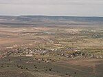
Oregon Route 251 is an Oregon state highway running from Port Orford Heads State Park to Port Orford. OR 251 is known as the Port Orford Highway No. 251...
2 KB (208 words) - 00:04, 15 July 2024
state of Oregon, there are two systems for categorizing roads in the state highway system: named state highways and numbered state routes. Named highways...
93 KB (600 words) - 15:53, 11 May 2024

U.S. Route 30 or U.S. Highway 30 (US 30) is an east–west main route of the United States Numbered Highway System, with the highway traveling across the...
40 KB (3,833 words) - 04:51, 13 August 2024

Oregon Route 245 (OR 245) is an Oregon state highway running from Salisbury to Unity. OR 245 is known as the Dooley Mountain Highway No. 415 (see Oregon...
3 KB (322 words) - 09:26, 23 June 2023

traverse the park. US 20 and US 30 break the general U.S. Route numbering rules in Oregon, since US 30 actually starts north of US 20 in Astoria, and...
44 KB (4,420 words) - 18:24, 26 August 2024

(130 km) east of Medford, 250 miles (400 km) northwest of Reno, and approximately 10 miles (16 km) north of the California–Oregon border. Logging was Klamath...
43 KB (4,061 words) - 02:05, 13 September 2024

Columbia River Gorge (redirect from Columbia River Gorge, Oregon)
Arlington, Oregon) in the east down to the eastern reaches of the Portland metropolitan area, the water gap furnishes the only navigable route through the...
17 KB (1,573 words) - 02:02, 21 October 2023
Redmond is a city in Deschutes County, Oregon, United States. The population was 33,274 at the 2020 census, and according to 2023 census estimates, the...
28 KB (2,373 words) - 02:44, 17 July 2024

city located on the Yaquina River and along U.S. Route 20 in Lincoln County, in the U.S. state of Oregon. The population was 3,465 at the 2010 census. The...
23 KB (2,157 words) - 18:08, 30 September 2024
John Day Highway (redirect from Route 19 (Oregon))
John Day Highway No. 5 is a highway in eastern Oregon. It comprises Oregon Route 19 (OR 19) and U.S. Route 26 (US 26), as well as short segments of OR 206...
6 KB (264 words) - 16:59, 10 July 2021

at 3,283 feet (1,001 m), part of the Northern Oregon Coast Range. U.S. Route 26 U.S. Route 30 U.S. Route 101 Julia Butler Hansen National Wildlife Refuge...
26 KB (2,241 words) - 18:38, 26 April 2024

Canyon City is a city in Grant County, Oregon, United States. It is the county seat of Grant County, and is about 2 miles (3 km) south of John Day on U...
15 KB (1,503 words) - 05:57, 28 September 2024

(13,040 km2) is land and 98 square miles (250 km2) (1.9%) is water. It is the fifth-largest county in Oregon by area. A portion of the Umpqua National...
27 KB (2,451 words) - 21:22, 7 September 2024

Dayville is a city along U.S. Route 26 in Grant County, in the U.S. state of Oregon. It was incorporated in 1913. The population was 149 at the 2010 census...
17 KB (1,186 words) - 05:17, 28 September 2024

Oregon Route 99, running roughly parallel to I-5, passes through downtown Ashland. Oregon Route 66 enters Ashland from the east and intersects Route 99...
82 KB (6,974 words) - 13:07, 16 August 2024

(Tolowa: yan-shuu-chit’ taa-ghii~-li~’, Takelma: tak-elam) in southwestern Oregon in the United States flows about 215 miles (346 km) in a generally westward...
95 KB (10,822 words) - 19:19, 17 August 2024

107.9 Catholic Talk Interstate 5 U.S. Route 199 Oregon Route 99 Oregon Route 238 Greyhound Lines Central Oregon and Pacific Railroad Rogue Valley International–Medford...
42 KB (3,436 words) - 04:21, 7 October 2024
The 2019 Oregon Ducks football team represented the University of Oregon during the 2019 NCAA Division I FBS football season. The team was led by second-year...
74 KB (2,423 words) - 04:58, 31 August 2024
James finished the day with over 250 rushing, moving him into 8th place all-time in Oregon's career rushing standings. Oregon quarterback Darron Thomas contributed...
52 KB (3,444 words) - 01:29, 18 July 2024

Erie County. Routes 250 through 511 all run in a general northeast–southwest pattern. No other patterns exist in Erie County. County routes in New York...
98 KB (469 words) - 00:49, 4 June 2024
with 1,027 people left the usual Oregon Trail route at Vale, Oregon, and followed Elijah Elliott through the central Oregon high desert. This became known...
27 KB (2,224 words) - 11:15, 23 September 2024