
River Road is a census-designated place (CDP) in Clallam County, Washington, United States. The population was 454 at the 2010 census. It is a primarily...
8 KB (708 words) - 02:36, 10 May 2024
Oregon, US River Road, Washington, US River Road (Queensland), a road in Dinmore, Queensland County Route 505 (New Jersey), along the Hudson River County...
2 KB (252 words) - 04:12, 29 December 2023

highways in the U.S. state of Washington used in the early 20th century. They were created as the first organized road numbering system in the state in...
22 KB (1,852 words) - 05:52, 28 March 2024

The Cedar River is a river in the U.S. state of Washington. About 45 miles (72 km) long, it originates in the Cascade Range and flows generally west and...
16 KB (1,616 words) - 09:59, 2 June 2024

The Sauk River is a tributary of the Skagit River, approximately 45 miles (72 km) long, in northwestern Washington in the United States. It drains an...
10 KB (958 words) - 17:21, 20 September 2024

Chehalis River (/ʃəˈheɪlɪs/ shə-HAY-lis) is a river in Washington in the United States. It originates in several forks in southwestern Washington, flows...
19 KB (1,757 words) - 18:48, 5 June 2024

as Mount Washington State Park. The Mount Washington Cog Railway ascends the western slope of the mountain, and the Mount Washington Auto Road climbs to...
65 KB (6,691 words) - 11:43, 21 September 2024

Built between 1811 and 1837, the 620-mile (1,000 km) road connected the Potomac and Ohio Rivers and was a main transport path to the West for thousands...
28 KB (2,928 words) - 01:17, 5 August 2024
Capital Beltway (redirect from Ring Road (Washington, D.C.))
Woodrow Wilson Bridge over the Potomac River, south of Washington. Most beltway interchanges provide access to Washington, with I-95 and I-295 from the south...
74 KB (6,129 words) - 18:35, 12 September 2024

of all 3 of the crossings Trenton Mount Holly George Washington's crossing of the Delaware River, which occurred on the night of December 25–26, 1776...
38 KB (4,466 words) - 17:53, 11 September 2024
county roads in Washington County, Florida. All county roads are maintained by the county in which they reside. General Highway Map, Washington County...
5 KB (45 words) - 14:49, 6 January 2022

Brocks Gap Road (Va 259) Hopkins Gap Road (SR 612) Little Dry River Road (SR 818) Yankeetown Road Lairs Run Road Bergton Road (SR 820) Bergton Road (SR 820)...
18 KB (1,770 words) - 05:16, 8 September 2024
List of A roads in zone 1 in Great Britain beginning north of the River Thames, east of the A1 (roads beginning with 1). "Old Stoke Bridge, Ipswich"....
99 KB (79 words) - 09:30, 3 September 2024

Birthplace State Park near the Washington County–Greene County line. Many tributary creeks join the river in Washington and Greene counties. At the county...
16 KB (1,619 words) - 19:00, 8 December 2023

the Potomac River, across from Virginia, and shares land borders with Maryland to its north and east. It was named for George Washington, the first president...
271 KB (22,720 words) - 23:49, 27 September 2024

stretch of the road on Washington Street in Roxbury, which is now served by the MBTA Silver Line. The Upper and Lower Boston Post Roads were designated...
33 KB (3,745 words) - 19:12, 16 August 2024

neighborhood in Washington, D.C., along the Potomac River, running roughly from the edge of the Georgetown University campus (at Foxhall Road) to the D.C...
10 KB (962 words) - 00:58, 25 July 2024
Potomac River in the District of Columbia and suburban Montgomery County, Maryland. A fourth section was originally proposed for Fort Washington, Maryland...
44 KB (4,393 words) - 22:19, 28 July 2024

Columbia River in Wenatchee on the Richard Odabashian Bridge. The highway continues east across the Columbia Plateau in Central Washington and crosses...
61 KB (5,040 words) - 16:22, 25 August 2024
Grays River is a tributary of the Columbia River, approximately 30 miles (48 km) long, in southwestern Washington in the United States. One of the last...
9 KB (892 words) - 21:03, 14 May 2024

Washington, D.C. Completed in 1923, it is Washington's oldest surviving road bridge across the Potomac River. Key Bridge was named for the poet Francis...
37 KB (4,021 words) - 16:53, 13 September 2024

Benning Road station is an island-platformed Washington Metro station in the Benning Ridge neighborhood of Northeast Washington, D.C., United States....
6 KB (348 words) - 10:10, 30 September 2024

state, maintained by the Washington State Department of Transportation (WSDOT). The system spans 8.5% of the state's public road mileage, but carries over...
21 KB (2,161 words) - 04:09, 15 June 2024

then Mexican Texas. Because of its location on the Brazos River and near major roads, Washington became a commercial center, drawing in new inhabitants from...
12 KB (932 words) - 16:46, 16 August 2024

two-lane road. The road is now mostly owned and maintained by the state through the Oregon Department of Transportation as the Historic Columbia River Highway...
40 KB (3,950 words) - 18:30, 10 August 2024

America. The river forms in the Rocky Mountains of British Columbia, Canada. It flows northwest and then south into the U.S. state of Washington, then turns...
196 KB (18,315 words) - 17:51, 20 September 2024

and Stadium–Armory in Washington, the first link of the Metro to Virginia. The line was extended by three stations to Addison Road on November 22, 1980...
42 KB (4,102 words) - 01:23, 22 August 2024
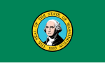
Washington, officially the State of Washington, is the northernmost state in the Pacific Northwest region of the United States. It is often referred to...
243 KB (18,570 words) - 23:48, 27 September 2024

follow the Bumping River and Naches River to a point near Naches. East of the mouth of the American River, this replaced part of State Road 1 (North Yakima...
48 KB (4,553 words) - 05:36, 26 August 2024

the Wallowa River confluence and Wildcat Creek is inaccessible by road. The Grande Ronde flows northeast, entering Asotin County, Washington at Horseshoe...
83 KB (9,227 words) - 10:02, 28 September 2024