
A satellite navigation device, satnav device or satellite navigation receiver is a user equipment that uses one or more of several global navigation satellite...
41 KB (4,388 words) - 10:33, 10 August 2024

of the BeiDou navigation system and the current Indian Regional Navigation Satellite System (IRNSS) or NavIC. Satellite navigation devices determine their...
42 KB (4,395 words) - 19:10, 30 July 2024

navigation system is part of the automobile controls or a third party add-on used to find direction in an automobile. It typically uses a satellite navigation...
21 KB (2,331 words) - 18:53, 2 June 2024

Digital video camera (DVC) Front-facing camera Pager Satellite navigation device Personal navigation assistant (PNA) Wearable computer Calculator watch...
16 KB (1,756 words) - 03:34, 18 August 2024
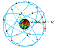
Galileo is a global navigation satellite system (GNSS) that went live in 2016, created by the European Union through the European Space Agency (ESA), operated...
108 KB (10,693 words) - 22:02, 19 August 2024
GLONASS (redirect from GLObal NAvigation Satellite System)
and is the second navigational system in operation with global coverage and of comparable precision. Satellite navigation devices supporting both GPS...
71 KB (6,159 words) - 19:00, 14 August 2024

Turn-by-turn navigation is a feature of some satellite navigation devices where directions for a selected route are continually presented to the user in...
9 KB (875 words) - 00:19, 20 April 2024

The Indian Regional Navigation Satellite System (IRNSS), with an operational name of NavIC (acronym for Navigation with Indian Constellation; also, nāvik...
55 KB (4,531 words) - 06:53, 19 August 2024
Marine electronics (category Navigational equipment manufacturers)
marine radar, satellite navigation device, fibre optic gyrocompass, satellite television, and marine fuel management. The electronics devices communicate...
6 KB (519 words) - 16:10, 10 July 2024
This is a list of notable commercial satellite navigation software (also known as GPS software) for various devices, with a specific focus on mobile phones...
16 KB (261 words) - 17:00, 3 January 2024
Automotive navigation system Marine navigation systems using sonar Satellite navigation system Global Positioning System, a group of satellites and computers...
5 KB (551 words) - 19:50, 11 March 2024
TTFF may refer to: Time to first fix, the time required for a satellite navigation device to acquire a position Trinidad and Tobago Football Federation...
357 bytes (79 words) - 16:10, 9 June 2024
GPS aircraft tracking (category Satellite navigation)
position of an aircraft fitted with a satellite navigation device. By communication with navigation satellites, detailed real-time data on flight variables...
4 KB (462 words) - 00:15, 20 April 2024
Satellite navigation software or GNSS navigation software usually falls into one of the following two categories: Navigation with route calculation and...
6 KB (689 words) - 22:36, 26 September 2023
States Uruguay Venezuela Comparison of satellite navigation software "Fun on the Autobahn: Google Maps Navigation in 11 more Countries". GoogleMobile.BlogSpot...
8 KB (828 words) - 07:57, 2 July 2024
BeiDou (redirect from Beidou satellite navigation system)
The BeiDou Navigation Satellite System (BDS; Chinese: 北斗卫星导航系统; pinyin: běidǒu wèixīng dǎoháng xìtǒng) is a satellite-based radio navigation system owned...
65 KB (5,645 words) - 12:48, 26 July 2024

The field of navigation includes four general categories: land navigation, marine navigation, aeronautic navigation, and space navigation. It is also the...
62 KB (7,333 words) - 07:47, 27 May 2024

term used in satellite navigation and geomatics engineering to specify the error propagation as a mathematical effect of navigation satellite geometry on...
16 KB (2,224 words) - 18:22, 1 July 2024
Global Positioning System (GPS), originally Navstar GPS, is a satellite-based radio navigation system owned by the United States government and operated by...
178 KB (18,553 words) - 23:33, 6 August 2024
The GPS-aided GEO augmented navigation (GAGAN) is an implementation of a regional satellite-based augmentation system (SBAS) by the Government of India...
24 KB (2,664 words) - 13:06, 17 August 2024

TomTom (category Satellite navigation)
headquartered in Amsterdam, TomTom released its first generation of satellite navigation devices to market in 2004. As of 2019 the company has over 4,500 employees...
76 KB (7,288 words) - 21:04, 10 June 2024

An inertial navigation system (INS; also inertial guidance system, inertial instrument) is a navigation device that uses motion sensors (accelerometers)...
47 KB (5,964 words) - 23:20, 29 July 2024
GPS tracking unit (redirect from GPS tracking device)
unit, satellite tracking unit, or simply tracker is a navigation device normally on a vehicle, asset, person or animal that uses satellite navigation to...
33 KB (4,180 words) - 14:28, 18 August 2024

receiver or another mobile device and then tell the story of their trip online. Proof based on non-electronic navigation is also acceptable. The geohashing...
7 KB (503 words) - 06:33, 12 March 2024

application of surveying to correct for common errors in current satellite navigation (GNSS) systems. It uses measurements of the phase of the signal's...
11 KB (1,307 words) - 01:27, 13 August 2024
Time to first fix (category Satellite navigation)
is a measure of the time required for a GPS navigation device to acquire satellite signals and navigation data, and calculate a position solution (called...
4 KB (427 words) - 14:53, 18 August 2024
of Honeywell Aerospace's TALIN 5000 INS (inertial navigation system), a satellite navigation device (GPS), and a speed calibrator. As a result, the vehicle...
71 KB (7,348 words) - 17:27, 25 July 2024

Automatic identification system (category Electronic navigation)
originates from the ship's navigational sensors, typically its global navigation satellite system (GNSS) receiver and gyrocompass. Other information, such as...
89 KB (11,143 words) - 16:35, 17 August 2024
OpenStreetMap (section Satellite/Aerial images)
Neogeography – Amateur-focused geography Turn-by-turn navigation – Feature of GPS navigation devices Volunteered geographic information – Type of user-generated...
67 KB (5,968 words) - 14:57, 14 August 2024
European Satellite Navigation Competition (ESNC) is an annual international innovation competition that recognises downstream applications of satellite navigation...
10 KB (1,113 words) - 19:58, 7 June 2024