
Sherwood Park Freeway is a 7.1-kilometre (4.4 mi) freeway that connects east Edmonton to Sherwood Park in Alberta, Canada. It begins in the Gainer Industrial...
16 KB (1,464 words) - 05:39, 27 August 2024
The Refinery Row portion of Sherwood Park is located across Anthony Henday Drive to the west, between Sherwood Park Freeway and Highway 16. Numerous developments...
32 KB (3,076 words) - 04:46, 12 September 2024

Groat Road (category Freeways in Alberta)
continuous roadway that runs through Sherwood Park, Edmonton, and St. Albert that includes Wye Road, Sherwood Park Freeway, Whyte Avenue, portions of University...
5 KB (334 words) - 23:16, 18 November 2022

Anthony Henday Drive (category Freeways in Alberta)
At its widest point east of Edmonton between Whitemud Drive and Sherwood Park Freeway, Anthony Henday Drive is eight total lanes wide which includes three...
86 KB (7,252 words) - 01:54, 25 September 2024
City, US Black Hills Airport (IATA airport code), South Dakota, US Sherwood Park Freeway, Edmonton, Alberta, Canada Springfield railway station (Scotland)...
2 KB (236 words) - 16:47, 2 November 2023

Alberta Highway 14 (category Freeways in Alberta)
was realigned to the newly constructed Sherwood Park Freeway further in the mid-1960s. Just west of Sherwood Park, at the Highway 14X junction, Highway...
13 KB (665 words) - 05:33, 27 August 2024

continuous roadway that runs through Sherwood Park, Edmonton, and St. Albert that includes Wye Road, Sherwood Park Freeway, portions of University Avenue and...
7 KB (377 words) - 06:44, 28 June 2024

Refinery Row (Edmonton) (category Industrial parks in Alberta)
Sherwood Park, Strathcona County, Alberta, just east of the city of Edmonton. The area is roughly bounded on the south by the Sherwood Park Freeway (Highway...
4 KB (303 words) - 01:10, 7 July 2024
Strathcona County runs on the west side of this right-of-way from Sherwood Park Freeway to Baseline Road. 34 Street crosses Anthony Henday Drive as 34 Street SW...
48 KB (3,577 words) - 21:17, 1 July 2024

continuous roadway that runs through Sherwood Park, Edmonton, and St. Albert that includes Sherwood Park Freeway, Whyte Avenue, portions of University...
6 KB (366 words) - 06:16, 27 August 2024

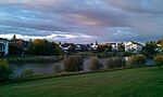
Sherwood Park is a provincial electoral district for the Legislative Assembly of Alberta, Canada. The electoral district was created in the 1986 boundary...
18 KB (604 words) - 23:39, 26 April 2024
Henday Drive (Highway 216), 50 Street between Whitemud Drive and Sherwood Park Freeway was designated as part of Highway 14. List of neighbourhoods 50...
9 KB (329 words) - 13:31, 13 April 2024
continuous roadway that runs through Sherwood Park, Edmonton, and St. Albert that includes Wye Road, Sherwood Park Freeway, portions of University Avenue and...
38 KB (2,875 words) - 06:52, 28 June 2024
continuous roadway that runs through Sherwood Park, Edmonton, and St. Albert that includes Wye Road, Sherwood Park Freeway, Whyte Avenue, portions of University...
7 KB (378 words) - 03:43, 8 September 2023

causing F2 to F3 damage. The tornado continued northward crossing the Sherwood Park Freeway and eventually hitting the Refinery Row area at F4 intensity. The...
19 KB (1,741 words) - 00:16, 31 August 2024
III back in November 1985, moving from a former location near the Sherwood Park Freeway. This location would only last about 10 years, before the store...
41 KB (3,988 words) - 21:00, 24 September 2024
97/98/101 Avenue (redirect from Baseline Road (Sherwood Park))
Baseline Road is a major arterial road in central Edmonton and north Sherwood Park, Alberta. It connects Downtown Edmonton with the mature residential...
17 KB (1,424 words) - 23:07, 20 August 2023

Strathcona County (redirect from Sherwood Place, Alberta)
lives in Sherwood Park, which is an urban service area east of Edmonton, remains an unincorporated hamlet. The balance lives beyond Sherwood Park within...
39 KB (2,476 words) - 14:09, 12 September 2024
interchange was opened at the Highway 14X/14 junction as part of the Sherwood Park Freeway construction. In the early 1970s, Highway 14X and the north-south...
7 KB (514 words) - 16:57, 16 August 2023

Wayne Gretzky Drive (redirect from Capilano Freeway)
Wayne Gretzky Drive is a freeway in Edmonton, Alberta. Originally Capilano Drive/Capilano Freeway, it was officially renamed October 1, 1999, after NHL...
17 KB (1,219 words) - 07:35, 3 September 2024
continuous roadway that runs through Sherwood Park, Edmonton, and St. Albert that includes Wye Road, Sherwood Park Freeway, Whyte Avenue, portions of Saskatchewan...
4 KB (247 words) - 14:09, 29 June 2024

expressway (Central Canada, as in the Gardiner Expressway) and freeway (Sherwood Park Freeway, Edmonton) are often used to describe various high-speed roads...
160 KB (19,097 words) - 17:30, 4 October 2024

(Yellowhead Trail) 16A 19 (105 Avenue SW) 21 28 28A 37 (259 Avenue) Sherwood Park Freeway (100) Anthony Henday Drive (216) Maskêkosihk Trail (627) Whitemud...
2 KB (58 words) - 18:41, 29 July 2024

9 Highway 14 (Sherwood Park Freeway) between Edmonton and Sherwood Park Highway 16A (Baseline Road) between Edmonton and Sherwood Park 01950-01-01c. 1950s...
59 KB (998 words) - 17:57, 4 October 2024

freeways located in or near the Sherwood area: Within Sherwood Future Interstate 57 U.S. Route 67 U.S. Route 167 Arkansas Highway 107 Near Sherwood Interstate...
31 KB (2,857 words) - 02:42, 22 September 2024

boundaries of the riding were also pushed south from 92 Avenue to the Sherwood Park Freeway at its most northern point. The district was abolished in 2017 when...
14 KB (705 words) - 20:16, 11 August 2024
the Virginia Park Historic District on the north, the Edsel Ford Freeway (I-94) on the south, John R Street on the east and the Lodge Freeway on the west...
75 KB (1,841 words) - 19:46, 21 August 2024

suburban southeast sector is generally bounded by 34 Street and Sherwood Park Freeway (Highway 100) to the northeast, Anthony Henday Drive (Strathcona...
201 KB (4,968 words) - 22:49, 31 August 2024
The west end of the Sherwood Park Freeway is located just to the south of the neighbourhood, providing access to Sherwood Park. The community is represented...
8 KB (459 words) - 01:34, 8 April 2024
order from west to east. Prince Charles Inglewood Prince Rupert Queen Mary Park Central McDougall Spruce Avenue McCauley This is a list of major intersections...
6 KB (314 words) - 06:34, 28 June 2024