State Highway 78 is a New Zealand State Highway connecting central Timaru with its port. It holds the record for New Zealand's shortest state highway...
2 KB (178 words) - 21:26, 22 July 2024
78 New Zealand State Highway 78 – New Zealand's shortest State Highway N78 highway (Philippines) Interstate 78 U.S. Route 78 Alabama State Route 78 Arizona...
6 KB (442 words) - 23:05, 4 April 2024
State Highway 15 (SH 15) is a New Zealand state highway in the Northland region of the North Island. It is 126.5 km (78.6 mi) long and provides an alternative...
9 KB (883 words) - 10:51, 10 April 2024
State Highway 67 (SH 67) is a New Zealand state highway located in the northern parts of the South Island of New Zealand. It is 51.2 km long usually on...
4 KB (396 words) - 03:42, 22 September 2023
State Highway 21 (SH 21) is a short 6.7-kilometre (4.2 mi) stretch of highway in the North Island of New Zealand. It links State Highway 1, Waikato Expressway...
9 KB (745 words) - 06:18, 12 July 2024
on New Zealand's State Highway 1 (SH 1). All exits are unnumbered. All exits are unnumbered. All exits are unnumbered. List of New Zealand state highways...
31 KB (34 words) - 10:47, 10 April 2024
State Highway 79 (SH 79) is a New Zealand state highway connecting the South Canterbury communities of Rangitata, Geraldine, and Fairlie. Starting at...
4 KB (213 words) - 21:26, 22 July 2024
State Highway 77 is a state highway in New Zealand going through the inland parts of Central and Mid Canterbury between the towns of Ashburton and Darfield...
9 KB (535 words) - 21:26, 22 July 2024

that began in the 1980s. New Zealand's transport infrastructure is "generally well developed." The New Zealand state highway network consists of 11,000 km...
135 KB (12,596 words) - 14:01, 30 July 2024

(2,418 ft) New Zealand, due to its low traffic density, has had many single lane bridges. Some of those still exist on the state highway network and...
11 KB (1,315 words) - 23:26, 15 April 2024

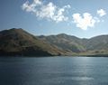
the South Island of New Zealand. It is on the banks of the Clutha River (at the confluence of the Manuherikia River), on State Highway 8, 188 kilometres...
54 KB (5,177 words) - 15:21, 30 July 2024

Coast of New Zealand's South Island. The township is beside the Haast River, 3 kilometres (2 mi) south of Haast Junction, on State Highway 6. The Haast...
21 KB (2,192 words) - 22:01, 14 July 2024
road (Namibia) Mahendra Highway Rijksweg 1 New Zealand State Highway 1 New Zealand State Highway 1B New Zealand State Highway 1C NIC-1 Route nationale...
20 KB (1,269 words) - 10:00, 30 July 2024

The climate of New Zealand is varied due to the country's diverse landscape. Most regions of New Zealand belong to the temperate zone with a maritime...
37 KB (3,530 words) - 13:35, 30 July 2024

of the South Island of New Zealand. It is about halfway between Dunedin and Gore on the Main South Line railway, State Highway 1 and the Southern Scenic...
17 KB (1,419 words) - 22:31, 5 July 2024

New Zealand Herald. Archived from the original on 29 August 2021. Retrieved 29 August 2021. "Canterbury flooding: Ashburton Bridge on State Highway 1...
74 KB (6,139 words) - 20:54, 22 July 2024

is a town and district in the Southland region of the South Island of New Zealand. It has a resident population of 8,240 as of June 2023. Gore is known...
33 KB (2,991 words) - 07:30, 27 July 2024

State Highway 74 marker State Highway 74A marker State Highway 75 marker State Highway 76 marker State Highway 77 marker State Highway 78 marker State Highway...
125 KB (10,541 words) - 06:34, 24 July 2024

Canterbury region of the South Island of New Zealand. The estimated population was 950 as of June 2023. Being on state highway 8 between Christchurch (182 km,...
27 KB (2,299 words) - 20:56, 22 July 2024

Canterbury, on the east coast of the South Island of New Zealand. It is located on State Highway 1 approximately 50 km north of Christchurch. It is the...
19 KB (2,180 words) - 20:54, 22 July 2024
Marlborough District (redirect from Marlborough, New Zealand)
served by four state highways: State Highway 1, State Highway 6, State Highway 62, and State Highway 63. State Highway 1 is the main highway in the region...
28 KB (2,310 words) - 21:09, 28 July 2024

Kawatiri) is a town in the West Coast region of the South Island of New Zealand. Established in 1861, it is the oldest European settlement on the West...
35 KB (3,275 words) - 19:20, 24 July 2024

town in the Rangitikei District of New Zealand. It is in a fertile farming area at the junction of State Highways 1 and 3, 28 km (17 mi) northwest of...
17 KB (1,500 words) - 11:45, 14 July 2024

Lindis Pass (category Use New Zealand English from April 2024)
highest point on the South Island's state highway network, and the second highest point on the New Zealand state highway network, after the Desert Road (SH 1)...
6 KB (540 words) - 21:26, 22 July 2024

Darfield is a town in the Selwyn District of the South Island of New Zealand. It is 35 kilometres west of Christchurch. Its population is 3,150 as of...
20 KB (1,688 words) - 20:55, 22 July 2024

whereas state highways are the responsibility of central government. The state highway network is the principal road infrastructure connecting New Zealand urban...
52 KB (6,016 words) - 21:33, 9 February 2024

May 2023. Retrieved 27 May 2023. "What is the highest state highway in New Zealand?". New Zealand Transport Agency. Archived from the original on 27 March...
75 KB (6,257 words) - 16:22, 30 July 2024
American author (Sweet Valley High), lymphoma. Martin Phillipps, 61, New Zealand singer-songwriter ("Pink Frost", "Kaleidoscope World") and guitarist...
195 KB (14,340 words) - 16:41, 30 July 2024
welcomed the new community members. State Highway 6 passes through the town between Queenstown and Invercargill. State Highway 96, a regional highway, connects...
16 KB (1,281 words) - 21:42, 22 July 2024

Lawrence is a small town in Otago, in New Zealand's South Island. It is located on State Highway 8, the main route from Dunedin to the inland towns of...
24 KB (2,881 words) - 15:26, 30 July 2024