
The Surrey Hills National Landscape is a 422 km2 (163 sq mi) National Landscape in Surrey, England. It comprises around one quarter of the land area of...
8 KB (374 words) - 19:59, 6 August 2024

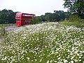
town of Dorking is the most popular viewpoint. Box Hill is part of the Surrey Hills National Landscape and forms part of the Mole Gap to Reigate Escarpment...
122 KB (12,010 words) - 10:01, 3 August 2024
Surrey Hills may refer to: Surrey Hills National Landscape, a conservation area in Surrey, England Surrey Hills (TV series), a reality TV show Surry Hills...
388 bytes (80 words) - 18:03, 4 June 2024
civil parish in central Surrey, England, around 3.5 miles (5.6 km) east of Guildford. It is in the Surrey Hills National Landscape and the Borough of Guildford...
18 KB (1,763 words) - 21:48, 8 August 2024

Borough of Waverley (redirect from Waverley, Surrey)
Abbey, near Farnham. Large parts of the borough are within the Surrey Hills National Landscape. The neighbouring districts are Guildford, Mole Valley, Horsham...
19 KB (1,048 words) - 14:07, 28 August 2024

Abinger Hammer (category Villages in Surrey)
in the Mole Valley district of Surrey, England. It lies in the Vale of Holmesdale in the Surrey Hills National Landscape and is located on the A25 about...
7 KB (788 words) - 16:31, 18 August 2024
Leith Hill in southern England is the highest summit of the Greensand Ridge, approximately 6.7 km (4 mi) southwest of Dorking, Surrey and 40.5 km (30 mi)...
16 KB (1,658 words) - 09:34, 25 August 2023

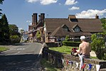
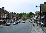
Peaslake (category Villages in Surrey)
Peaslake, Hoe, and Colman's Hill are in the centre of the Surrey Hills National Landscape and mid-west of the Greensand Ridge about 5 miles (8.0 km) ESE...
13 KB (1,448 words) - 09:28, 12 August 2024
Guildford (redirect from Guildford, Surrey)
the University of Surrey was established by Royal Charter. Guildford is surrounded on three sides by the Surrey Hills National Landscape, which severely...
167 KB (17,427 words) - 14:02, 24 July 2024

Botley Hill is a hill in Surrey and is the highest point of the North Downs, with a height of 269.6 metres (885 ft). The Prime Meridian crosses the hill. Botley...
3 KB (313 words) - 05:44, 28 December 2023
Haslemere (redirect from Haslemere, Surrey)
steep. The National Trust is a major landowner in the civil parish and its properties include Swan Barn Farm. The Surrey Hills National Landscape is to the...
145 KB (13,794 words) - 18:07, 18 August 2024

Dorking (redirect from Dorking, Surrey)
town is surrounded on three sides by the Surrey Hills National Landscape and is close to Box Hill and Leith Hill. The earliest archaeological evidence of...
194 KB (18,667 words) - 10:03, 16 August 2024

400-acre) nature reserve and filming location in the south-west of Elstead in Surrey. It is owned by the Ministry of Defence. The site is part of the Thursley...
17 KB (1,617 words) - 05:05, 10 July 2024

River Wey (redirect from River Wey, Surrey)
River Thames. Much of the upper reaches of the river are within the Surrey Hills Area of Outstanding Natural Beauty. The river passes through a variety...
22 KB (1,897 words) - 21:17, 20 July 2024

within the Surrey Hills Area of Outstanding Natural Beauty and includes the small village itself, the smaller settlement of Friday Street, Leith Hill to the...
10 KB (1,071 words) - 15:34, 22 November 2023

North Downs Way (category Footpaths in Surrey)
past Guildford, Dorking, Merstham, Otford and Rochester, along the Surrey Hills Area of Outstanding Natural Beauty (AONB) and Kent Downs AONB. Planning...
7 KB (549 words) - 13:25, 11 January 2024

Cotswolds (redirect from Cotswolds National Landscape)
just south of Bath, making it the largest National Landscape area and England's third-largest protected landscape. The Cotswold local government district...
61 KB (5,604 words) - 14:31, 22 July 2024

Devil's Punch Bowl (category National Trust properties in Surrey)
situated just to the east of the village of Hindhead in the English county of Surrey. It is part of the Wealden Heaths Phase II Special Protection Area. The...
13 KB (1,358 words) - 17:26, 20 May 2024

Silent Pool (category Lakes of Surrey)
the foot of the North Downs, about 4 miles (6 km) east of Guildford in Surrey. The outflow from Silent Pool runs into a second, adjacent, lake, Sherbourne...
8 KB (823 words) - 07:56, 15 August 2024

Weald National Landscape is in south-east England. Covering an area of 1,450 square kilometres (560 sq mi), it takes up parts of Kent, Surrey, East Sussex...
10 KB (1,309 words) - 15:00, 27 February 2024

Greensand Way (category Footpaths in Surrey)
England, from Haslemere in Surrey to Hamstreet in Kent. It follows the Greensand Ridge along the Surrey Hills and Chart Hills. The route is mostly rural...
5 KB (403 words) - 15:40, 28 May 2024

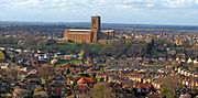
Godalming (redirect from Pepperpot, Surrey)
south over Holloway Hill. The town is almost completely surrounded by the Metropolitan Green Belt and the Surrey Hills National Landscape is to the north...
152 KB (15,441 words) - 16:09, 12 July 2024

Guildford and Merrow. The top of the hill provides a semi-panorama of Newland's Corner also in the Surrey Hills AONB. Its church is the main amenity of...
8 KB (1,068 words) - 17:18, 27 August 2024

Witley Common (category National Trust properties in Surrey)
Witley Common is an area of woodland and heath, close to Witley, Surrey, in the United Kingdom. It is part of a much larger Site of Special Scientific...
3 KB (317 words) - 18:43, 14 February 2024

North Downs (category Hills of Surrey)
of Outstanding Natural Beauty (AONBs): the Surrey Hills and the Kent Downs. The North Downs Way National Trail runs along the North Downs from Farnham...
30 KB (3,256 words) - 08:41, 9 March 2024
the sandstone Surrey Hills, while further east is the plain of the Low Weald, rising in the extreme southeast to the edge of the hills of the High Weald...
113 KB (13,178 words) - 16:50, 16 August 2024

Farnham (redirect from Farnham, Surrey)
Abbey in England, is open to the public. Farnham borders the Surrey Hills National Landscape and the North Downs Way long-distance path starts here. Alice...
88 KB (9,197 words) - 19:23, 26 August 2024

Greensand Ridge (category Hills of Surrey)
Greensand is protected as the South Downs National Park, Kent Downs Area of Outstanding Natural Beauty and Surrey Hills Area of Outstanding Natural Beauty....
15 KB (2,028 words) - 01:07, 22 September 2023
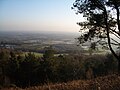
Newlands Corner (category Hills of Surrey)
agreement between the estate and Surrey County Council, but is no longer managed by them. The site reaches 567 feet (173 m) with hill-grazed grass slopes below...
5 KB (474 words) - 18:15, 20 April 2024
Gibbet Hill, at Hindhead, Surrey, is the apex of the scarp surrounding the Devil's Punch Bowl, not far from the A3 London to Portsmouth road in England...
7 KB (793 words) - 16:51, 25 April 2024