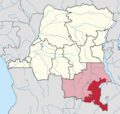
Tanganika-Moero District (French: District du Tanganika-Moero, Dutch: District Tanganika-Moero) was a district of the Belgian Congo from 1912 to 1933,...
5 KB (468 words) - 23:23, 3 November 2024
districts in the east. Tanganika District was formed from the northern part of the Tanganika-Moero District. A 1955–1957 map shows Tanganika District...
5 KB (466 words) - 23:23, 22 August 2021
map shows Luapula-Moero District bordering Tanganika District to the north, British territories to the east and south, Lualaba District to the west and...
6 KB (496 words) - 00:25, 7 April 2021
22 districts. A map of the colony after this division shows Lomami District bordering [[Maniema District to the northeast, Tanganika-Moero District to...
5 KB (396 words) - 12:33, 4 November 2024
south and east. It was bordered by Tanganika-Moero District to the north and Lulua District to the west. The district was named after the Lualaba River...
6 KB (486 words) - 00:49, 4 November 2024
the east, Ituri District to the north, Lowa and Maniema districts to the west and Tanganika-Moero District to the south. The Kivu District became part of...
4 KB (340 words) - 14:25, 4 November 2024
bordered by Sankuru District to the west, Lomami District and Tanganika-Moero District to the south, Kivu District to the east and Lowa District to the north...
5 KB (500 words) - 07:19, 1 November 2024
(including part of the old Kasai), Tanganika-Moero, Haut-Luapula and Lulua (including part of the old Kasai) The districts in 1912 were: Bas-Congo Moyen-Congo...
13 KB (1,088 words) - 07:46, 15 October 2020
Congo into 22 districts. The vice-government of Katanga now contained the districts of Lomami and Lulua in the west, and Tanganika-Moero and Haut-Luapula...
8 KB (821 words) - 08:31, 29 August 2024
Luapula-Moero District. A 1955–1957 map shows Haut-Lomami District bordered by Lulua District and Kabinda District to the north, Tanganika District to the...
6 KB (537 words) - 19:37, 22 August 2021
former Katanga province. Haut-Katanga was formed from the Haut-Katanga district and the independently administered cities of Likasi and Lubumbashi. Lubumbashi...
6 KB (227 words) - 18:14, 29 August 2024
Msiri founded the powerful but short-lived Yeke Kingdom. Msiri's home district was called Garanganza, a name which came to be used for the Yeke Kingdom...
16 KB (1,846 words) - 18:11, 23 April 2023
667°S 27.467°E / -11.667; 27.467 Haut-Katanga District (Upper Katanga District) is a former district located in the former Katanga Province of the Democratic...
4 KB (202 words) - 17:07, 16 August 2021
colony in November 1908, it was initially organised into 22 districts. Ten western districts were administered directly by the main colonial government...
23 KB (1,275 words) - 06:38, 6 November 2024
Belgian Congo. He then became a deputy of the public prosecutor in Tanganika-Moero territory. In 1914, just before the start of World War I (1914––1918)...
13 KB (1,605 words) - 13:25, 11 September 2024


