Topa is a village in Mendhar Tehsil, Poonch district in the Indian union territory of Jammu and Kashmir. During the Indo-Pakistani War of 1965, the Battle...
9 KB (1,028 words) - 05:02, 24 March 2022

Poonch district, India (redirect from Poonch district, Jammu and Kashmir)
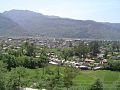
Poonch or Punch is a district of the Jammu division of Indian-administered Jammu and Kashmir in the disputed Kashmir region. With headquarters in the town...
28 KB (2,009 words) - 13:35, 18 September 2024

Bukkan, Bhand, Topa, Gajgahi... Rahi, Javaid (2012-01-01). The Gujjars Vol: 01 and 02 Edited by Dr. Javaid Rahi. Jammu and Kashmir Acacademy of Art...
9 KB (945 words) - 12:33, 18 September 2024
5th Gorkha Rifles (Frontier Force) (category Military units and formations established in 1858)
needed] Indo-Pak War of 1947–48 Indo-Pakistani War of 1965 Battle of Topa (Jammu and Kashmir) Battle of Atgram (East Pakistan) 1971 Battle of Sylhet (East Pakistan)...
18 KB (1,576 words) - 17:51, 19 September 2024
around Chirala are Narakot, Makhyala and Sahlian. Prior to 1947, Chirala had a military outpost of the Jammu and Kashmir State Forces. In October 1947, it...
8 KB (852 words) - 15:38, 26 August 2024
Mandi is a village and municipality in Poonch district of the Indian union territory of Jammu and Kashmir. The town is located 20 km (12 mi) from the district...
5 KB (194 words) - 09:53, 2 January 2024
located in Poonch, Jammu and Kashmir, India. Altitude (feet) 4019 Altitude (meters) 1224 Time zone (est) UTC+5:30 Nearby Cities and Towns West North East...
4 KB (55 words) - 08:06, 17 April 2020

Poonch (town) (redirect from Poonch, Jammu and Kashmir)
languages) is a town and the administrative headquarters of the Poonch district, of the Indian-administered union territory of Jammu and Kashmir, which is part...
14 KB (1,292 words) - 17:01, 26 September 2024
village situated in Poonch district of Jammu and Kashmir, India. It is one of the largest villages in Jammu and Kashmir. It is located approximately 5 kilometers...
4 KB (208 words) - 03:57, 14 August 2024

princely state of Jammu and Kashmir, in 1948 during the conflict in Jammu and Kashmir between the Indian Army and Pakistani and Azad Kashmir rebel forces....
12 KB (1,508 words) - 09:49, 28 September 2024
Surankote (town) (category Jammu and Kashmir geography stubs)
the Indian union territory of Jammu and Kashmir. It occupies the Surankote valley, located between the Pir Panjal and ranges within the Himalayas. It...
8 KB (669 words) - 12:22, 7 September 2024

from Murree (Kalakot Zone) of the Himalayan foot hills near Kalakot, Jammu and Kashmir state, India". Journal of the Geological Society of India. 12 (2):...
7 KB (610 words) - 10:13, 14 August 2024

in Punjab province. The second section between Murree and Muzaffarabad, Azad Jammu and Kashmir is currently under construction. The project was planned...
4 KB (219 words) - 08:45, 26 August 2024

district) in the Poonch district of the Indian union territory of Jammu and Kashmir. It is located in the foothills of Pir Panjal range within the Himalayas...
7 KB (325 words) - 22:09, 30 July 2024

Mechanised Infantry Regiment (category Military units and formations established in 1979)
Punjab and Jammu & Kashmir and Operation Vijay in Jammu & Kashmir. It also took part in UN Peacekeeping Operations in Somalia, Congo, Angola and Sierra...
16 KB (954 words) - 06:23, 19 August 2024
city of Poonch in the Indian union territory of Jammu and Kashmir. Most inhabitants are literate and are associated with agriculture. "Kallai Pin Code"...
3 KB (38 words) - 07:59, 17 April 2020
territory of Jammu and Kashmir. It is headquartered at the Poonch Town. The History of Poonch District of the princely state of Jammu and Kashmir had four...
9 KB (325 words) - 12:51, 24 July 2024

province/territory and by district. Fauji Foundation Model School Roots School System Dar-e-Arqam Schools The City School Army Public School and College Dar-e-Arqam...
5 KB (279 words) - 13:26, 23 October 2023
a tehsil of the Poonch district in the Indian union territory of Jammu and Kashmir. It is headquartered at the Surankote. The Surankote tehsil is headquartered...
8 KB (240 words) - 13:20, 9 October 2022
Balakote (category Jammu and Kashmir geography stubs)
(also known as Bala Kote) is a village and tehsil in Poonch district of the Indian union territory of Jammu and Kashmir. The village is located 63 km (39 mi)...
5 KB (193 words) - 14:39, 13 July 2021
Mandi Tehsil (category Jammu and Kashmir geography stubs)
Mandi is a town and a tehsil in the Poonch district of the Indian union territory of Jammu and Kashmir. Mandi is located in east of the Poonch district...
6 KB (278 words) - 02:53, 21 January 2024
can also take admission out of total 110 students and the remaining 100 are admitted on merit and are offered free of cost education. The project of...
3 KB (246 words) - 11:23, 8 June 2024
Bufliaz (category Jammu and Kashmir geography stubs)
and the headquarters of the eponymous community development block in Surankote tehsil of Poonch district in the Jammu division of Jammu and Kashmir,...
5 KB (262 words) - 04:45, 21 October 2022
Pakistan Air Force (category Military units and formations established in 1947)
News and several other media correspondences were not allowed to take interviews from the injured. Following the Pulwama attack in Jammu and Kashmir, India...
165 KB (14,513 words) - 20:57, 29 September 2024
Bhimber Gali (category Jammu and Kashmir geography stubs)
Bhimber Gali is a village in the Poonch district of Jammu and Kashmir, India. It is often called BG locally as an abbreviated form of Bhimber Gali. It...
4 KB (211 words) - 19:00, 14 February 2022
Mankote is a village and tehsil in Poonch district of the Indian union territory of Jammu and Kashmir. The village is located 91 kilometers from the district...
4 KB (172 words) - 18:57, 9 March 2024
Mangnar (category Jammu and Kashmir geography stubs)
village in Poonch district, India, Jammu and Kashmir, India. The name is a combination of two words 'mang' means plain and 'nar' means mountain. So this village...
3 KB (110 words) - 16:07, 14 December 2021

Seri Khawaja (category Jammu and Kashmir geography stubs)
the Indian union territory of Jammu and Kashmir. It is located 17 kilometres (11 mi) east of the city of Poonch on the Jammu-Poonch highway. Although located...
3 KB (186 words) - 14:59, 31 March 2023
Chandimarh (category Cities and towns in Poonch district, India)
district, Jammu and Kashmir, India, situated between Noori Chamb and Bufliaz Block. It is 26 km east of the district headquarters Poonch, and 22 km from...
4 KB (199 words) - 05:01, 25 June 2024
Chand Bagh School (category Official website different in Wikidata and Wikipedia)
speaker was announced as Chaudhry Abdul Majid, prime minister of Azad Jammu and Kashmir. on the twelfth Founders day, February 2014 the chief guest was Mohammad...
21 KB (1,969 words) - 04:35, 20 April 2024