
Vermont Route 3 (VT 3) is a 7.828-mile-long (12.598 km) north–south state highway in Rutland County, Vermont, United States. It runs from the town of Rutland...
3 KB (195 words) - 02:21, 19 March 2023

terminating at Route 30 in Sudbury. Vermont Route 149 is an east–west highway extending from the New York state line for only 1.3 miles to Vermont 30 in Pawlet...
30 KB (2,991 words) - 15:07, 26 April 2024

Highways, and Vermont routes. Routes in Vermont are abbreviated as "VT #" by VTrans and also abbreviated as "VT Route #" and "Route #" in common usage...
62 KB (1,082 words) - 17:43, 14 August 2024

Vermont (/vərˈmɒnt/ vər-MONT) is a state in the New England region of the Northeastern United States. It borders Massachusetts to the south, New Hampshire...
217 KB (21,654 words) - 21:07, 2 September 2024

The entire route is in Chittenden County. Vermont Route 2B (VT 2B) is an alternate route of US 2 between Danville and St. Johnsbury. The route begins across...
25 KB (1,463 words) - 01:41, 5 August 2024

U.S. Route 7 (US 7) is a north–south highway extending from southern Connecticut to the northernmost part of Vermont. In Vermont, the route extends for...
20 KB (959 words) - 01:15, 4 August 2024

S. Route 5 (US 5) is a north–south United States Numbered Highway running through the New England states of Connecticut, Massachusetts, and Vermont. Significant...
21 KB (1,923 words) - 01:15, 8 July 2024
village of Highgate Springs, Vermont, immediately south of the Canada–United States border. US 7 in Connecticut (also known as Route 7, Ethan Allen Highway...
17 KB (1,672 words) - 23:54, 3 August 2024

Vermont Route 30 (VT 30) is a 111.870-mile-long (180.037 km) north–south state highway in the U.S. state of Vermont. VT 30 runs from U.S. Route 5 (US...
11 KB (546 words) - 02:03, 26 July 2024

(275 km) from Montpelier, Vermont, beginning at US 2, to Portland, Maine, at U.S. Route 1. It passes through the states of Vermont, New Hampshire and Maine...
25 KB (1,430 words) - 22:28, 4 August 2024

New England road marking system (redirect from New England Interstate Route 3)
then U.S. Route 4, Vermont Route 30, U.S. Route 7, U.S. Route 2, and Vermont Route 225. Route 30A was superseded by Vermont Route 22A, and Route 30B was...
158 KB (6,445 words) - 17:10, 1 February 2024

Vermont Route 114 (VT 114) is a 53.094-mile-long (85.447 km) north–south state highway in northeastern Vermont in the United States. It runs northward...
11 KB (958 words) - 15:24, 10 January 2024

water. Middlebury is crossed by U.S. Route 7, Vermont Route 23, Vermont Route 30, Vermont Route 116, and Vermont Route 125. It is bordered by the towns of...
26 KB (2,439 words) - 03:10, 21 August 2024

Interstate 91 (redirect from Interstate 91 (Vermont))
miles (89 km) in Massachusetts, and 177 miles (285 km) in Vermont. I-91 parallels US Route 5 (US 5) for all of its length, and many of the exits along...
84 KB (5,162 words) - 06:43, 7 July 2024

U.S. Route 5 ("Connecticut River Byway") Vermont Route 9 ("Molly Stark Trail") Vermont Route 30 Vermont Route 119 Vermont Route 142 Vermont Route 9 runs...
60 KB (6,306 words) - 19:24, 26 August 2024
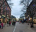
Burlington is the most populous city in the U.S. state of Vermont and the seat of Chittenden County. It is located 45 miles (72 km) south of the Canada–United...
80 KB (8,204 words) - 03:11, 28 August 2024

Vermont Route 15 (VT 15) is a 68.957-mile-long (110.976 km) east–west state highway in northern Vermont, United States. Its western terminus is at U.S...
16 KB (1,448 words) - 02:28, 19 March 2023

Route 4, Vermont Route 3, and Vermont Route 4A. The boundaries of the town center as defined by the U.S. Census Bureau are as follows: U.S. Route 4 and some...
15 KB (1,386 words) - 12:55, 23 August 2024

Interstate 93 (redirect from Interstate 93 (Vermont))
Highway in the New England states of Massachusetts, New Hampshire, and Vermont in the United States. Spanning approximately 190 miles (310 km) along a...
77 KB (5,922 words) - 21:17, 28 July 2024

U.S. Route 4 (US 4) in the U.S. state of Vermont extends for 66.059 miles (106.312 km) between the New York state line at Fair Haven and the New Hampshire...
17 KB (1,154 words) - 23:31, 26 April 2024

U.S. Route 3 (US 3) is a United States Numbered Highway running 277.90 miles (447.24 km) from Cambridge, Massachusetts, through New Hampshire, to the...
55 KB (3,184 words) - 21:33, 14 July 2024

Vermont Route 7A (VT 7A) is a 27.8-mile-long (44.7 km) north–south state highway in Bennington County, Vermont, in the United States. It is an alternate...
7 KB (464 words) - 20:17, 25 May 2024

Vermont Route 5A (VT 5A) is a 26.397-mile-long (42.482 km) state highway in extreme northeastern Vermont. It is an alternate route of U.S. Route 5 (US 5)...
6 KB (446 words) - 00:38, 16 August 2024

Interstate 89 (redirect from Interstate 89 (Vermont))
Montpelier, the state capital of Vermont; and Burlington, Vermont. I-89 is one of three main Interstate highways whose route is located entirely within New...
40 KB (3,126 words) - 13:01, 28 July 2024
1926, the former Route 2 was commissioned as US 5. At this point, the road was not paved. It was not paved until the state of Vermont started overseeing...
27 KB (1,631 words) - 14:48, 17 February 2024

Vermont Route 9 (VT 9) is a state highway in the U.S. state of Vermont. The highway runs 46.957 miles (75.570 km) from the New York state line in Bennington...
11 KB (994 words) - 01:46, 5 August 2024

Rutland. The former route of U.S. 4, which runs parallel to the freeway portion, is now signed as U.S. Route 4 Business and Vermont Route 4A. Rutland's railroad...
33 KB (2,876 words) - 07:43, 27 July 2024

trajectory, stretching from the Vermont border in the west to the Maine border in the east. NH 26 is a multi-state route with both states. At its western...
10 KB (850 words) - 23:06, 24 June 2023
traversing Vermont. In New York, US 4 is signed north–south to reflect its alignment in the state. In Vermont and New Hampshire, the route is signed east–west...
10 KB (913 words) - 04:59, 1 August 2024

Vermont Route 105 (VT 105) is a 98.135-mile-long (157.933 km) state highway located in northern Vermont in the United States. The route runs from U.S...
19 KB (1,690 words) - 17:56, 31 May 2024