
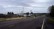
Trunk Highway 13 (often called Highway 13, STH-13 or WIS 13) is a state highway running north–south across northwest and central Wisconsin. WIS 13 serves...
21 KB (1,265 words) - 02:08, 28 June 2024

US Highway 51 Wisconsin Highway 13 Wisconsin Highway 29 Wisconsin Highway 34 Wisconsin Highway 49 Wisconsin Highway 52 Wisconsin Highway 97 Wisconsin Highway...
20 KB (1,227 words) - 22:06, 3 September 2024
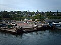
County, Wisconsin, United States. It is situated on Lake Superior at the northern end of the Bayfield Peninsula. It is along Wisconsin Highway 13 and County...
10 KB (1,036 words) - 16:38, 14 August 2024
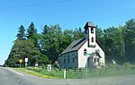
Port Wing, Bayfield County, Wisconsin, United States. The community is along Wisconsin Highway 13 and Bayfield County Highway A. It is 30 miles (48 km)...
5 KB (238 words) - 21:07, 13 July 2023

Wisconsin, on the shore of Lake Superior's Chequamegon Bay. Wisconsin Highway 13 and County Highway C are the main routes in the community. In 1659, the French...
18 KB (1,474 words) - 20:58, 6 September 2024

founded in 1874 at a branch on the Wisconsin Central Railway. Today it sits at the crossroads of Wisconsin Highway 13 (WIS 13) and WIS 98 and serves as the...
11 KB (1,034 words) - 02:11, 17 May 2024

State Trunk Highway 29 (often called Highway 29, STH-29 or WIS 29) is a state highway running east–west across central Wisconsin. It is a major east–west...
31 KB (1,767 words) - 01:49, 5 August 2024

State Trunk Highway 16 (often called Highway 16, STH-16 or WIS 16) is a Wisconsin state highway running from Pewaukee across the state to La Crosse. Much...
31 KB (1,706 words) - 13:06, 20 August 2023

KML file (edit • help) Template:Attached KML/Wisconsin Highway 182 KML is not from Wikidata Media related to Wisconsin Highway 182 at Wikimedia Commons...
7 KB (651 words) - 04:20, 2 July 2024

community of Cornucopia is located within the town. Wisconsin Highway 13 and County Highway C are the main routes in the community. According to the United...
6 KB (421 words) - 23:58, 8 May 2024

located in the town. Big Flats is located at the junction of Wisconsin Highway 13 and County Highway C 10 miles (16 km) north of Friendship. The town of Big...
15 KB (1,253 words) - 23:59, 8 May 2024
easternmost part of the Town of Eileen. The junction of US Highway 2 (US 2) and Wisconsin Highway 13 (WIS 13) is located at this city. It is the home of Northland...
56 KB (5,280 words) - 20:17, 17 September 2024

U.S. Route 53 (redirect from U.S. Highway 53 (Wisconsin))
Route 53, or U.S. Highway 53 (U.S. 53), is a north–south U.S. highway that runs for 404 miles (650 km) from La Crosse, Wisconsin to International Falls...
35 KB (2,265 words) - 05:18, 19 August 2024
residents, so it would have to be incorporated as a village instead. Wisconsin Highway 13 serves as a main route in the community. It is a former county seat...
23 KB (1,798 words) - 18:44, 31 July 2024

in north central Wisconsin, United States, that runs from Wisconsin Highway 13 (WIS 13) north of Chelsea northeast to Wisconsin Highway 86 (WIS 86) in Spirit...
4 KB (313 words) - 17:23, 16 February 2024

organized system of Wisconsin State Trunk Highways (typically abbreviated as STH or WIS), the state highway system for the U.S. state of Wisconsin, was created...
99 KB (275 words) - 17:48, 14 July 2024
cabins on the lake, most on the north shore. The nearest major road, Wisconsin Highway 13, is about 3.5 miles (5.6 km) to the north, and the nearest large...
4 KB (333 words) - 20:43, 12 October 2022

State Trunk Highway 23 (often called Highway 23, STH-23 or WIS 23) is a state highway in the U.S. state of Wisconsin. The route is signed as a north–south...
33 KB (2,160 words) - 23:12, 27 July 2024

Trunk Highway 73 (often called Highway 73, STH-73 or WIS 73) is a 265.84-mile (427.83 km) state highway in the central part of the US state of Wisconsin that...
15 KB (856 words) - 01:41, 14 September 2024

Wisconsin Highway 57 (often called Highway 57, STH-57 or WIS 57) is a 191.82-mile-long (308.70 km) state highway in Wisconsin, United States. It runs...
33 KB (2,596 words) - 18:29, 25 July 2024

counties in the U.S. state of Wisconsin. It is located at the intersection of U.S. Highway 10, Highway 13 and Highway 97. The population was 18,929 at...
36 KB (3,323 words) - 12:30, 21 August 2024

U.S. Route 8 (redirect from U.S. Highway 8 (Wisconsin))
S. Highway 8 (US 8) is a United States Numbered Highway that runs primarily east–west for 280 miles (451 km), mostly within the state of Wisconsin. It...
50 KB (5,157 words) - 15:36, 30 August 2024

State Trunk Highway 213 (often called Highway 213, STH-213 or WIS 213) is a state highway in the U.S. state of Wisconsin. It runs north–south in south...
3 KB (153 words) - 17:57, 14 July 2024

town of Jacobs in Ashland County, Wisconsin, United States. It is located on County Highway N near Wisconsin Highway 13. As of the 2010 census, its population...
8 KB (518 words) - 15:57, 7 June 2024

U.S. Route 141 (redirect from U.S. Highway 141 (Wisconsin))
US Highway 141 (US 141) is a north–south United States Numbered Highway in the states of Wisconsin and Michigan. The highway runs north-northwesterly...
43 KB (5,396 words) - 14:50, 11 September 2024

Highway 26 (often called Highway 26, STH-26, or WIS 26) is a state highway in the U.S. state of Wisconsin. The route is partially a divided highway with...
16 KB (1,075 words) - 05:09, 9 August 2024

State Trunk Highway 64 (WIS 64) is a 275.65-mile-long (443.62 km) highway in Wisconsin, which runs from the St. Croix Crossing bridge as a continuation...
17 KB (1,287 words) - 03:01, 17 March 2023

Trunk Highway 66 (often called Highway 66, STH-66 or WIS 66) is a state highway in the U.S. state of Wisconsin. It runs east–west in central Wisconsin from...
5 KB (551 words) - 04:48, 19 February 2024
is located just east of and adjacent to the town. Wisconsin Highway 13 and County Highway C are the main routes in the community. According to the United...
6 KB (517 words) - 00:34, 11 May 2024

Highway 110 (often called Highway 110, STH-110 or WIS 110) is a state highway in the US state of Wisconsin. It runs north–south in central Wisconsin from...
8 KB (565 words) - 03:29, 4 February 2024