
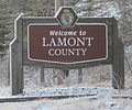
Wostok (‹See Tfd›Russian: Восток) is a hamlet in Alberta, Canada within Lamont County. It is located on Range Road 173, approximately 5 kilometres (3.1 mi)...
5 KB (159 words) - 03:49, 10 September 2023

2020. "Wostok Dossier / Wostok". Wostok. Archived from the original on 27 April 2022. Retrieved 27 August 2020. "Tannenwald / Wostok". Wostok. Archived...
10 KB (899 words) - 15:53, 4 April 2024

Vostok Island (redirect from Wostok Island)
Island, Bostock Island, Leavitts Island, Reaper Island, Wostock Island or Wostok Island. The island was first sighted in 1820 by the Russian explorer Fabian...
10 KB (1,007 words) - 05:44, 13 August 2024

working for photography agency Wostok in September 2002 where he initially began photographing demonstrations. After leaving Wostok in 2005, Ochlik founded the...
22 KB (2,043 words) - 23:39, 26 July 2024

original on 2014-07-24. Retrieved 2014-07-25. "Separatystycznym batalionem Wostok dowodził były dowódca ukraińskiego specnazu" (in Polish). Wiadomosci.gazeta...
21 KB (1,397 words) - 08:20, 8 February 2024

Alberta - after Stryi, Stryi Raion, Lviv Oblast. Ukalta, Alberta, north of Wostok off Secondary Highway 855 near the North Saskatchewan River - possibly a...
65 KB (6,516 words) - 18:40, 22 August 2024
No. 516 was incorporated, uniting the three smaller districts of Pines, Wostok, and Leslie. The office was at the town of Lamont and the first council...
12 KB (616 words) - 19:45, 28 July 2024
nearby Michel Calihoo Reserve established in 1878 on 25,600 acres under Treaty 6. In the 2021 Census of Population conducted by Statistics Canada, Calahoo...
10 KB (739 words) - 03:17, 27 September 2024

population of 64 living in 14 of its 15 total private dwellings, a change of 6.7% from its 2016 population of 60. With a land area of 0.25 km2 (0.097 sq mi)...
17 KB (1,205 words) - 03:31, 10 September 2023

area of 485.66 km2 (187.51 sq mi), it had a population density of 0.2/km2 (0.6/sq mi) in 2016. Waterton Park has a humid continental climate (Köppen Dfb)...
9 KB (410 words) - 17:56, 22 September 2024

1944, the M.D. of Pines No. 516 was united with the municipal districts of Wostok and Leslie to form the M.D. of Lamont No. 516.[citation needed] It was later...
9 KB (517 words) - 20:55, 22 July 2024

List of municipal districts in Alberta (redirect from Wostok No. 546, Alberta)
Municipal Affairs. September 20, 2013. Retrieved October 1, 2013. "Table 6: Population by census subdivisions, 1926-1946 and Table 6a: Population by...
70 KB (1,217 words) - 02:52, 7 August 2024

12 km (7.5 mi) south of Airdrie. The hamlet is located in census division No. 6 and in the Alberta federal electoral district of Banff—Airdrie (formerly in...
10 KB (736 words) - 22:37, 1 July 2024

southern Alberta under the jurisdiction of Rocky View County in Division No. 6. Bragg Creek is located 30 km (19 mi) west of Calgary (via Highway 8 and Highway...
12 KB (980 words) - 03:12, 27 January 2024

(−58 °F) in January and February the averages are −18.4 °C (−1.1 °F) and −17.6 °C (0.3 °F) respectively. Summers consist of frosty mornings and crisp, cool...
13 KB (1,057 words) - 21:26, 30 September 2024

kilometres (6.8 mi) north of Turner Valley and 35 kilometres (22 mi) southwest of Calgary's city limits. The hamlet is within Census Division No. 6 and in...
7 KB (297 words) - 18:06, 9 June 2023

community bus service once a week to Grande Prairie and Hinton. As of November 6, 2020, bus service has been cancelled until further notice. Grande Cache Airport...
17 KB (1,160 words) - 03:11, 24 July 2024

population of 2,520. With a land area of 6.05 km2 (2.34 sq mi), it had a population density of 382.5/km2 (990.6/sq mi) in 2016. Lac La Biche County's 2016...
39 KB (2,285 words) - 17:47, 22 September 2024

intersection of Highway 560 (Glenmore Trail) and Highway 797, approximately 6 km (3.7 mi) south of the Trans Canada Highway and 7 km (4.3 mi) north of Highway...
19 KB (1,344 words) - 18:04, 9 June 2024
Widewater Wildwood Willingdon Wimborne Winfield Withrow Woking Woodhouse Woolford Worsley Wostok Wrentham Zama City Category Canada portal WikiProject...
8 KB (330 words) - 03:02, 10 September 2023
of 13.5% from its 2016 population of 3,396. With a land area of 17.61 km2 (6.80 sq mi), it had a population density of 219.0/km2 (567.1/sq mi) in 2021...
15 KB (982 words) - 19:32, 18 May 2024
Widewater Wildwood Willingdon Wimborne Winfield Withrow Woking Woodhouse Woolford Worsley Wostok Wrentham Zama City Category Canada portal WikiProject...
15 KB (1,529 words) - 20:57, 28 September 2024
Public is part of the public school system and offers education from grade 6 to grade 12. Approximately 150 students attend this school. St. Mary's Elementary...
27 KB (2,623 words) - 21:25, 28 September 2024

Widewater Wildwood Willingdon Wimborne Winfield Withrow Woking Woodhouse Woolford Worsley Wostok Wrentham Zama City Category Canada portal WikiProject...
7 KB (365 words) - 03:42, 10 September 2023
Furrows. p. 35. Archived from the original on 24 September 2015. Retrieved 6 August 2013. Shaw, Keith (1978). Chief mountain country : a history of Cardston...
26 KB (626 words) - 02:44, 3 May 2024
of 377 living in 128 of its 162 total private dwellings, a change of 201.6% from its 2016 population of 125. With a land area of 1.23 km2 (0.47 sq mi)...
15 KB (1,078 words) - 06:25, 9 August 2024

population of 353. With a land area of 29.6 km2 (11.4 sq mi), it had a population density of 10.6/km2 (27.6/sq mi) in 2021. As a designated place in the...
8 KB (306 words) - 05:52, 5 August 2024

in the federal riding of Fort McMurray—Cold Lake. The community is located 6 km (3.7 mi) north of Highway 63 via Fort McKay Road, and is served by air...
15 KB (902 words) - 22:22, 5 March 2024

2009. Archived from the original (PDF) on July 20, 2011. Retrieved March 6, 2013. "Population and dwelling counts: Canada, provinces and territories...
109 KB (2,638 words) - 05:37, 14 September 2024

dwellings, a change of 0.6% from its 2011 population of 847. With a land area of 10.7 km2 (4.1 sq mi), it had a population density of 79.6/km2 (206.2/sq mi)...
23 KB (2,114 words) - 21:24, 28 September 2024