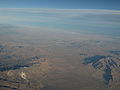
State Route 138 (SR 138) is an east–west state highway in the U.S. state of California that generally follows the northern foothills of the San Gabriel...
17 KB (1,580 words) - 03:10, 10 July 2024

US 66 and US 99, US 138 is an orphan route. US 38 was commissioned in 1926, but US 6 was extended over it to Long Beach, California (it was subsequently...
7 KB (384 words) - 14:17, 18 February 2024

State Route 18 (SR 18) is a state highway in the U.S. state of California. It serves as a primary route into the San Bernardino Mountains, both from the...
16 KB (1,472 words) - 06:03, 7 February 2024

State Route 2 (SR 2) is a state highway in the U.S. state of California. It connects the Los Angeles Basin with the San Gabriel Mountains and the Victor...
35 KB (3,398 words) - 05:21, 26 February 2024
following state highways in the U.S. state of California are entirely or partially unconstructed; in other words, their routings have been defined by state law...
47 KB (5,449 words) - 03:19, 29 December 2023

State Route 173 (SR 173) is a state highway in the U.S. state of California that runs entirely in San Bernardino County, mostly in the San Bernardino...
8 KB (966 words) - 18:48, 9 February 2024

State Route 60 (SR 60) is an east–west state highway in the U.S. state of California. It serves the cities and communities on the eastern side of the Los...
34 KB (2,612 words) - 18:15, 27 March 2024

State Route 14 (SR 14) is a north–south state highway in the U.S. state of California that connects Los Angeles to the northern Mojave Desert. The southern...
37 KB (3,395 words) - 01:12, 21 November 2023
National Route 138 Fukuoka Prefectural Route 138 Nara Prefectural Route 138 Malaysia Federal Route 138 U.S. Route 138 Alabama State Route 138 Arkansas...
4 KB (272 words) - 13:37, 23 June 2024

Interstate Highway in the U.S. state of California, connecting San Bernardino, Riverside, and San Diego Counties. The route consists of the southernmost...
59 KB (4,223 words) - 19:23, 24 June 2024

State Route 33 (SR 33) is a north–south state highway in the U.S. state of California. It runs north from U.S. Route 101 in Ventura through the Transverse...
20 KB (1,254 words) - 05:44, 26 February 2024

State Route 99 (SR 99) is a north–south state highway in the U.S. state of California, stretching almost the entire length of the Central Valley. From...
76 KB (3,793 words) - 13:03, 6 July 2024

The California portion of US 395 is a 557-mile (896 km) route which traverses from Interstate 15 (I-15) in Hesperia, north to the Oregon state line in...
53 KB (4,632 words) - 05:46, 6 May 2024
Sierra Pelona and Tehachapi Mountains. It would be built along California State Route 138 east of Interstate 5 and northeast of Quail Lake. The community...
13 KB (1,354 words) - 23:29, 4 May 2023
Cajon Pass (redirect from Cajon, California)
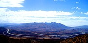
Cajon Pass is at the head of Horsethief Canyon, traversed by California State Route 138 (SR 138) and railroad tracks owned by BNSF Railway and Union Pacific...
25 KB (2,876 words) - 04:21, 9 July 2024
Highway": California State Route 138 (Pearblossom Highway) east of Palmdale and west of Interstate 15. California Deathway: California State Route 138. The...
7 KB (758 words) - 19:47, 16 February 2024

Lancaster, serving Littlerock. By road, the community is served by California State Route 138. Public transit service is provided by the Antelope Valley Transit...
15 KB (1,345 words) - 02:44, 22 April 2024
Rim of the World Scenic Byway (category State Scenic Highway System (California))
S. state of California. It consists of the following routes: California State Route 138 from near the Cajon Pass to near Crestline California State Route...
1 KB (146 words) - 19:15, 23 August 2023

to California during the Gold Rush as well as the Pony Express. In 1895, part of the present-day route was designated as California's first state highway...
63 KB (6,126 words) - 14:39, 11 July 2024
California, an unincorporated town in Los Angeles County, California, U.S. The flowers of a pear tree Pearblossom Highway, California State Route 138...
565 bytes (95 words) - 13:06, 31 January 2017

County Route N2 (CR N2) is a county highway in Los Angeles County, California, United States. It runs from State Route 138 at Quail Lake to State Route 14...
22 KB (1,206 words) - 15:53, 22 October 2023
There are 45 routes assigned to the "J" zone of the California Route Marker Program, which designates county routes in California. The "J" zone includes...
117 KB (4,843 words) - 16:47, 19 December 2023

state highways in the U.S. state of California that have existed since the 1964 renumbering. It includes routes that were defined by the California State...
106 KB (856 words) - 02:21, 22 May 2024

State Route 52 (SR 52) is a state highway in San Diego County, California, that extends from La Jolla Parkway at Interstate 5 (I-5) in La Jolla, San Diego...
53 KB (6,530 words) - 14:38, 11 July 2024

Pacific Coast, the other being U.S. Route 101 (US 101), which is primarily coastal. I-5 links the major California cities of San Diego, Santa Ana, Los...
130 KB (6,866 words) - 23:46, 29 June 2024
in California is an artificial lake in Los Angeles County, California. Situated in the San Andreas Rift Zone along the north side of State Route 138, it...
3 KB (124 words) - 08:40, 7 January 2024
State Route 41 (SR 41) is a state highway in the U.S. State of California, connecting the Central Coast with the San Joaquin Valley and the Sierra Nevada...
23 KB (2,292 words) - 21:12, 6 May 2024

U.S. Route 50 (US 50) is a transcontinental highway which stretches from Ocean City, Maryland to West Sacramento, California. In the U.S. state of Virginia...
23 KB (1,415 words) - 01:01, 1 May 2024
Victor Valley (redirect from Victor Valley (California))
Victor Valley. U.S. Route 395 Historic U.S. Route 66 California State Route 18—Rim of the World Highway California State Route 138—Pearblossom Highway...
6 KB (605 words) - 23:37, 14 October 2023

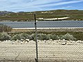
the old Ridge Route alignment to reach SR 138 near Quail Lake. The Ridge Route crosses the West Branch California Aqueduct with SR 138, splitting to the...
34 KB (4,021 words) - 16:51, 5 April 2024