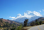
The Casma River, which upstream is called Río Grande, is a river that crosses northern Casma province in the Ancash Region of Peru. It originates in the...
5 KB (440 words) - 17:19, 21 January 2022
concentration of pre-historic ruins in the valleys of the Casma River and its tributary the Sechin River and along the nearby coast of the Pacific Ocean. The...
15 KB (2,018 words) - 23:42, 4 October 2024
Casma is a city in the coastal desert of Peru, located 330 kilometers (210 mi) northwest of Lima. It is the capital of Casma Province and the third most...
7 KB (517 words) - 10:17, 27 February 2023
of the Casma/Sechin culture in the Casma and Sechin River valleys. The others are Cerro Sechin, Sechin Alto, and Sechin Bajo. The Sechin River is a tributary...
4 KB (495 words) - 04:35, 1 August 2022
Province Casma River, river that crosses Casma Province in the Ancash Region of Peru Casma Valley, coastal valley north of Lima, Peru CASMA, Computerized...
417 bytes (92 words) - 06:54, 18 March 2013
and about 20 kilometres (12 mi) south of the Casma river valley, noted for the extensive ruins of the Casma–Sechin culture. For most of its history Las...
9 KB (1,091 words) - 05:18, 12 October 2023
Andean preceramic (section Casma and Sechin rivers)
archaeological sites are located in the valleys of the Casma River and its tributary the Sechin River. The largest among them is Sechin Alto; the other big...
19 KB (2,270 words) - 05:16, 30 August 2024
known as Loco River. It rises at an altitude of 4,385 m (14,386 ft) in the Cordillera Negra and it ends by flowing into the Casma River about 10 km (6...
3 KB (420 words) - 04:41, 29 January 2024
Huarmey, Culebras, Casma, Sechín, Nepeña, Lacramarca and Santa. Of these rivers, the only one with water year-round is the Santa River. Its sources are...
40 KB (3,840 words) - 15:17, 25 October 2024
located in close proximity to each other in the valleys of the Casma and Sechin Rivers. In 2008, a German and Peruvian archaeological team, headed by...
10 KB (1,341 words) - 15:07, 11 August 2024
Chao River Santa River Lacramarca River Nepeña River Casma River Sechín River Grande River Culebras River Huarmey River Fortaleza River Pativilca River Supe...
9 KB (818 words) - 19:29, 8 December 2023
period (2000-1500 BC). It is located in the Casma Province, the Ancash Region, on the left bank of the Sechín River, east of the town of the same name. Other...
6 KB (919 words) - 21:54, 11 October 2024
settlement of Las Haldas, at Huarmey, as well as at some other sites in the Casma River region, and in Lima area. Chavín potters (900–200 BC) on the Peruvian...
54 KB (5,985 words) - 15:32, 7 September 2024
range is bordered by the Patiwillka River at 10° 30'. In the central part of the range near Huaráz, Casma River breaks through the ridge of the range...
7 KB (927 words) - 16:54, 27 September 2023
Pampas Grande (section Pira River)
of the Casma river basin, being located in the upper part of the Quebrada Victoria sub-basin; very close to the watershed with the Culebras river basin...
44 KB (5,505 words) - 04:46, 30 October 2024
alto río Sechin Casma [Study of the Complex Societies of the Archaeological Site of Cahuacucho in the Upper Valley of the Sechin Casma River Basin] (Thesis)...
16 KB (1,589 words) - 13:16, 19 October 2024
Casma was an auxiliary ship of the Chilean Navy. Casma was bought in Buenos Aires by the Chilean Government of Jose Manuel Balmaceda during the 1891 Chilean...
8 KB (602 words) - 19:44, 7 May 2024
(Rio Caplina) Caravelí River, 16°03′40″S 73°16′25″W / 16.061208°S 73.273474°W / -16.061208; -73.273474 (Rio Caravelí) Casma River, 9°26′58″S 78°22′57″W...
80 KB (7,671 words) - 23:45, 31 December 2023
and La Libertad. The epicenter was located 35 km (22 mi) off the coast of Casma and Chimbote in the Pacific Ocean, where the Nazca plate is being subducted...
10 KB (862 words) - 20:59, 26 October 2024
Ecuadorian–Peruvian War (redirect from Battle of Yaupi River)
attacked and ignited. On July 28, Peruvian submarines BAP Islay (R-1) and BAP Casma (R-2) carried out a reconnaissance mission at the mouth of the Jambelí Strait...
48 KB (5,568 words) - 01:40, 8 November 2024
the Marginal Highway that follows the river to the north and arrives at Tarapoto. A main road that comes from Casma port, on the coast of Ancash department...
9 KB (552 words) - 08:27, 17 June 2024
President of Peru. On January 12, 1839, both fleets met in a naval battle at Casma, where the French corsairs fighting on the Confederate side were defeated...
39 KB (4,188 words) - 00:11, 1 November 2024
north of Lima, roughly bounded by the Lurín Valley on the south and the Casma Valley on the north. It comprises four coastal valleys: the Huaura, Supe...
48 KB (5,770 words) - 19:50, 24 October 2024
civilization and Casma–Sechin culture from the northern coast of Peru. These civilizations built cities, pyramids, and plazas in the coastal river valleys of...
27 KB (2,741 words) - 16:19, 7 October 2024
the backs of porters when going overland; if the trade route followed a river or the coast, then goods were transported in canoes. A substantial Maya...
186 KB (22,866 words) - 00:59, 11 November 2024
Caracoles (Río Frío) glaciation Río Llico (Colegual) glaciation Santa María (Casma) glaciation Valdivia interglacial (MIS 5e) Llanquihue glaciation (at least...
31 KB (2,104 words) - 19:29, 28 August 2024
which were important both for food and for medicines. In the Mississippi River valley, Europeans noted that Native Americans managed groves of nut and...
245 KB (24,779 words) - 17:46, 14 November 2024
found etched onto the stone walls at a site called Cerro Sechín, in the Casma Valley 240 kilometres (150 mi) to the north. What this figure represents...
19 KB (2,194 words) - 03:47, 25 October 2024
artistic production resembles many of those found at the Moxeke complex in the Casma Valley. Around 1873, the Italian explorer Antonio Raimondi described the...
2 KB (352 words) - 18:38, 17 June 2023


