
Route 118 is a state highway in northwestern Connecticut, running from the borough of Litchfield via the village of East Litchfield to the town center...
5 KB (451 words) - 01:11, 10 May 2024

Route 4 is an east–west primary state highway connecting rural Litchfield County to the Greater Hartford area of the U.S. state of Connecticut. It runs...
12 KB (1,011 words) - 00:09, 30 June 2024

Route 8 is a 67.36-mile (108.41 km) state highway in Connecticut that runs north–south from Bridgeport, through Waterbury, all the way to the Massachusetts...
21 KB (1,372 words) - 01:33, 7 July 2024

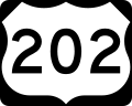
In Connecticut, U.S. Route 202 (US 202) is usually signed as an east–west route. It enters from the New York state line in Danbury overlapped with U.S...
13 KB (728 words) - 03:52, 29 June 2024

follows Connecticut Route 118 (Litchfield Road) west of Route 222 (Hill Road), and Delay Road, Swimming Hole Road, and Shingle Mill Road east of Route 222...
9 KB (712 words) - 16:03, 14 May 2024
Alabama State Route 118 Arkansas Highway 118 California State Route 118 Connecticut Route 118 Georgia State Route 118 Illinois Route 118 (former) Indiana...
4 KB (289 words) - 23:34, 4 April 2024
S. Route 44 Route 13: east-west from Kent to Sterling, roughly modern Route 341, U.S. Route 202, Route 118, Route 4, U.S. Route 6, Route 14 Route 14:...
84 KB (1,553 words) - 04:13, 1 January 2024

State Highway Route 138 is the portion of the 118-mile-long (190 km) multi-state Route 138 within the state of Connecticut. It is one of several New England...
6 KB (457 words) - 03:30, 24 June 2024

route, serving as a cutoff for US 1, along with Rhode Island–Connecticut Route 84. In fact, in 1947, Connecticut proposed moving US 1 to this route,...
12 KB (956 words) - 01:03, 6 March 2023

New England road marking system (redirect from Route 116 (Connecticut 1920s))
by Connecticut Route 9, U.S. Route 44, Connecticut Route 189, Connecticut Route 10, Massachusetts Route 10, New Hampshire Route 10, and U.S. Route 302...
158 KB (6,445 words) - 17:10, 1 February 2024

Route 222 is a state highway in west central Connecticut, running in a meandering pattern from Thomaston to Harwinton. Route 222 begins as East Main Street...
4 KB (276 words) - 18:57, 22 May 2024

Route 254 is a state highway in northwestern Connecticut running from Thomaston to Litchfield. Route 254 begins as a continuation of State Road 848 (Waterbury...
4 KB (309 words) - 18:58, 22 May 2024

Naugatuck River (category Connecticut placenames of Native American origin)
roadways and is now followed by Connecticut Route 8. The river enters a forested, hilly area between Connecticut Route 118 and Thomaston. The largely industrialized...
15 KB (1,309 words) - 08:33, 18 July 2023

crosses the Connecticut state line just past a car dealership on the south. KML file (edit • help) Template:Attached KML/U.S. Route 44 in Connecticut KML is...
56 KB (4,047 words) - 21:19, 30 July 2024

western terminus of Route 25 is at the Vermont state line on the Connecticut River in Piermont, where the road continues west as Vermont Route 25. The eastern...
22 KB (1,714 words) - 13:19, 28 December 2023

fourth lake is the source of the Connecticut River. The first three lakes can be viewed and accessed from U.S. Route 3, while the only access to the fourth...
19 KB (1,221 words) - 23:57, 9 April 2024

Route 120 is a state highway in Connecticut, running entirely in the town of Southington. It serves as a more direct connection between the town center...
3 KB (240 words) - 16:45, 16 February 2024

extremity of Route 6, and now known as Route 6A. Farther west, in Connecticut, US 6 ran via the South Coventry Historic District, while Route 3 had served...
61 KB (6,470 words) - 14:38, 12 August 2024
below the poverty line. Connecticut Route 4 connects the town to Torrington in the northwest and to Hartford in the east. Route 118 connects the town westward...
13 KB (896 words) - 02:28, 13 August 2024
U.S. Route 202 is the main east-west road connecting Bantam and Litchfield center to the city of Torrington and New Milford, Connecticut. Route 63 runs...
28 KB (2,192 words) - 13:31, 16 May 2024

Interstate 84 (I-84) is an east–west Interstate Highway across the state of Connecticut through Danbury, Waterbury, Hartford, and Union. I-84 enters Danbury...
43 KB (2,708 words) - 18:27, 6 August 2024

Stamford (/ˈstæmfərd/) is a city in Fairfield County, Connecticut, United States, 34 miles (55 kilometers) outside of New York City. It is the sixth-most...
106 KB (8,171 words) - 15:51, 19 July 2024

Connecticut Route 63 runs north from the Litchfield Green 6 miles (10 km) to Goshen and south 10 miles (16 km) to Watertown, and Connecticut Route 118...
11 KB (811 words) - 05:18, 15 May 2024

Route 63 is a secondary state highway in the U.S. state of Connecticut, from New Haven up to Canaan, running for 52.57 miles (84.60 km). It connects the...
10 KB (699 words) - 15:35, 20 May 2024

Route 117 is a state highway in southeastern Connecticut, running from Groton to Preston. Route 117 is designated the Colonel Ledyard Highway from its...
4 KB (330 words) - 15:38, 26 June 2024

(Washington, D.C.) and then south-southwest onto Connecticut Avenue at Dupont Circle. It reached U.S. Route 50 at K Street and by 1968 extended to the area...
18 KB (1,368 words) - 21:25, 4 February 2024
traveling through the states of Pennsylvania, New Jersey, New York, Connecticut, Massachusetts, and New Hampshire. The highway has borne the number 202...
57 KB (3,188 words) - 17:02, 10 August 2024
formerly known as New Cheshire Parish, is a town in New Haven County, Connecticut, United States. At the time of the 2020 census, the population of Cheshire...
37 KB (2,679 words) - 21:40, 12 July 2024
the Bear Mountain Bridge over US 9W and east to Connecticut by way of overlaps with US 6, NY 116, NY 118, and NY 22. The overlap with NY 116 was eliminated...
31 KB (2,772 words) - 22:27, 4 August 2024

Route 9 is a 135.310-mile-long (217.760 km) major east–west state highway in Massachusetts, United States. Along with U.S. Route 20 (US 20), Route 2, and...
23 KB (1,179 words) - 16:10, 12 August 2024