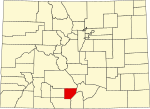
Costilla County (Spanish for "rib") is a county located in the U.S. state of Colorado. As of the 2020 census, the population was 3,499. The county seat...
15 KB (1,265 words) - 15:32, 12 July 2024
Colorado counties have highest mean elevation of any county in the United States, exceeding even the Denali Borough of Alaska. 1. Costilla County was the...
63 KB (2,326 words) - 02:36, 15 October 2024
Look up costilla in Wiktionary, the free dictionary. Costilla may refer to: Costilla County, Colorado Costilla, New Mexico, a census-designated place in...
488 bytes (73 words) - 21:32, 26 April 2018
is water. Saguache County, Colorado - north Huerfano County, Colorado - east Costilla County, Colorado - southeast Conejos County, Colorado - southwest...
14 KB (922 words) - 15:36, 12 July 2024
Sangre de Cristo Mountains (redirect from Big Costilla Peak)
at La Veta Pass in Colorado, and its southern limit at Costilla Creek, just south of Big Costilla Peak in New Mexico. Its highest point is Culebra Peak...
21 KB (1,599 words) - 19:35, 3 November 2024
San Luis, Colorado (category Towns in Costilla County, Colorado)
San Luis is a statutory town that is the county seat and the most populous town of Costilla County, Colorado, United States. Formerly known as San Luis...
14 KB (743 words) - 18:05, 28 April 2024
Fort Garland, Colorado (category Census-designated places in Costilla County, Colorado)
office, and a census-designated place (CDP) located in and governed by Costilla County, Colorado, United States. The Fort Garland post office has the ZIP...
12 KB (582 words) - 20:28, 25 October 2024
pass in the Sangre de Cristo Mountains. Sangre de Cristo Creek, in Costilla County, Colorado Sangre de Cristo Range, the northernmost portion of the Sangre...
1 KB (184 words) - 21:30, 26 April 2018
This is a list of high schools in the state of Colorado by its county. There are 648 total. Bennett High School, Bennett Prairie View High School, Henderson...
39 KB (2,315 words) - 20:01, 8 June 2024
Costilla Creek is a tributary of the Rio Grande in Colorado and New Mexico. The creek rises in the Sangre de Cristo Mountains in far southern Colorado...
9 KB (581 words) - 19:07, 4 September 2024
Taos County contains 17 of New Mexico's highest 25 peaks. Rio Arriba County - west Mora County - southeast Colfax County - east Costilla County, Colorado...
18 KB (1,351 words) - 21:27, 5 November 2024
Blanca, Colorado (category Towns in Costilla County, Colorado)
Blanca is a Statutory Town located in Costilla County, Colorado, United States. The town population was 322 at the 2020 census. Blanca is located in the...
11 KB (750 words) - 17:55, 8 August 2024
Blanca Peak (category Mountains of Costilla County, Colorado)
Forest and Alamosa County from the Sangre de Cristo Land Grant and Costilla County. The summit is the highest point of both counties and the entire drainage...
14 KB (1,213 words) - 14:58, 2 November 2024
Costilla is a census-designated place in Taos County, New Mexico, United States. Its population was 205 as of the 2010 census. Costilla has a post office...
7 KB (386 words) - 21:48, 16 August 2024
lowest-income counties in the United States, based on measures of per capita personal income and median household income. This article lists counties by per...
16 KB (184 words) - 00:09, 19 August 2024
Louis Bacon (category People from Costilla County, Colorado)
together. In November 2007, Bacon purchased the Trinchera Ranch in Costilla County, Colorado from the Forbes family. The 171,400-acre (694 km2) property...
24 KB (2,221 words) - 21:28, 10 August 2024
Chama, Colorado, unincorporated town in the Costilla County, Colorado, United States Chama, Huerfano County, Colorado, an unincorporated town in the United...
1 KB (193 words) - 17:36, 25 October 2024
several other government officials. Among them were Stephen Lee, acting county sheriff; Cornelio Vigil, prefect and probate judge; and J.W. Leal, circuit...
12 KB (1,337 words) - 00:09, 2 June 2024
Reagan a plurality). Reagan did best in Rio Blanco County, and Mondale did the best in Costilla County, along the Southern Rockies. As of the 2020 presidential...
39 KB (765 words) - 22:57, 17 June 2024
San Luis Valley (category Landforms of Costilla County, Colorado)
generally considered to comprise six Colorado counties: Saguache, Alamosa, Rio Grande, Conejos, Costilla and Mineral. The principal towns are: Alamosa...
44 KB (5,269 words) - 14:37, 26 August 2024
Vermejo Park Ranch (category Geography of Costilla County, Colorado)
southeastern Costilla County in Colorado. Elevations of Vermejo range from 5,850 feet (1,780 m) on the Canadian River near Maxwell, New Mexico to Big Costilla Peak...
19 KB (2,051 words) - 18:28, 26 August 2024
Ignacio Hidalgo y Costilla Gallaga Mandarte y Villaseñor (8 May 1753 – 30 July 1811), commonly known as Miguel Hidalgo y Costilla or Miguel Hidalgo (Spanish...
47 KB (5,177 words) - 19:52, 28 September 2024
Saguache County was formed December 29, 1866, in the Territory of Colorado when it was extracted from the northern half of Costilla County. A partition...
15 KB (1,095 words) - 13:47, 27 October 2024
San Isabel National Forest (category Protected areas of Costilla County, Colorado)
Lake, Huerfano, Fremont, Pueblo, Saguache, Las Animas, Park, Costilla, and Summit counties. San Isabel National Forest is co-managed by the Forest Service...
4 KB (335 words) - 01:11, 8 October 2024
which they carried Suffolk County, Massachusetts; Ramsey County, Minnesota; Costilla County, Colorado; Deer Lodge County, Montana; or the City of St...
82 KB (3,394 words) - 08:48, 8 November 2024
present Costilla County (November 1, 1861 to present) San Miguel/Costilla – November 1, 1861 to 1863 San Luis – 1863 to present Crowley County (May 29...
89 KB (5,972 words) - 21:07, 7 November 2024
Union County, New Mexico - south Colfax County, New Mexico - southwest Costilla County- west Huerfano County - northwest Interstate 25 I-25 BL I-25 BS...
14 KB (948 words) - 17:29, 23 April 2024
Fort Garland (category Museums in Costilla County, Colorado)
southwest of the fort. National Register of Historic Places listings in Costilla County, Colorado "National Register Information System". National Register...
6 KB (465 words) - 11:10, 7 October 2024
populous county in Colorado, while Hinsdale County with a 2023 population of 765 is now the least populous county. Five of the 64 Colorado counties have more...
29 KB (373 words) - 21:14, 9 July 2024
La Veta Pass (category Landforms of Costilla County, Colorado)
Colorado in the United States, both on the boundary between Costilla and Huerfano counties. Old La Veta Pass (officially La Veta Pass), elevation 9,380 ft...
4 KB (381 words) - 06:20, 28 September 2024


