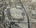
Crowchild Trail is a major expressway in western Calgary, Alberta. The segment from the 12 Mile Coulee Road at the edge of the city to 16 Avenue NW (Trans-Canada...
22 KB (2,241 words) - 01:21, 30 December 2023

River near Canada Olympic Park to Crowchild Trail, winding through the hills of northwest Calgary to Deerfoot Trail and the southern end of the Queen...
51 KB (4,769 words) - 05:09, 1 July 2024
37 Street, Glenmore Trail reduces to six lanes but traffic levels continue to increase as it continues east to an interchange with Crowchild Trail. Traffic levels...
26 KB (2,374 words) - 05:15, 1 July 2024

and the Motel Village district, and north-east of the junction of Crowchild Trail and the Trans-Canada Highway. As part of Calgary Transit's plan to...
3 KB (256 words) - 00:59, 7 May 2024

Alberta Highway 1A (redirect from Bow Valley Trail)
reaching the Calgary city limits at 12 Mile Coulee Road, it continues as Crowchild Trail, a major north-south expressway, (although it travels in a southeasterly...
26 KB (2,043 words) - 17:17, 26 September 2023
on Crowchild Trail). On September 3, 1990, a 1 km extension of the northwest line to Brentwood station (south of Brisebois Drive on Crowchild Trail) was...
47 KB (4,825 words) - 21:49, 1 July 2024
from the future ring road (now Stoney Trail) past several Interchanges to a three-level interchange at Crowchild Trail. From there on it would continue through...
13 KB (1,256 words) - 11:24, 20 December 2023

between the Bow River and Bowness Road, and also between Crowchild Trail and Deerfoot Trail. Due to Calgary's quadrant system, it is known as 16 Avenue NW...
21 KB (1,449 words) - 03:04, 12 December 2023

north of 16 Avenue NW between Crowchild Trail and University Drive. It is within walking distance of the Banff Trail C-Train station. It is the home...
17 KB (1,853 words) - 04:31, 31 May 2024

of Sarcee Trail. The remainder of the road exists today, as Old Banff Coach Road. East of 33 Street SW and west of Crowchild Trail, Bow Trail conformed...
8 KB (654 words) - 06:52, 2 July 2024

station until August 30, 1990. The station is located in the median of Crowchild Trail, just north of 24 Avenue NW and east of the University of Calgary grounds...
3 KB (220 words) - 01:00, 7 May 2024
Avenue South and 17th Avenue South. The community is bisected by the Crowchild Trail freeway. The community consists of Scarboro proper, located on Scarboro...
7 KB (417 words) - 13:48, 24 January 2023

present-day Northwest and South lines) between the original Banff Trail station (at Crowchild Trail and Northland Drive, between the present-day Brentwood and...
92 KB (9,289 words) - 05:42, 28 June 2024

Dalhousie Station northbound. The station is located in the middle of Crowchild Trail, wedged between the communities of Brentwood to the north, and Varsity...
9 KB (738 words) - 20:22, 2 June 2024
Lincoln Park, Rutland Park, CFB Currie and that part of Richmond west of Crowchild Trail and south of Richmond Road and all of its territory in Shaganappi and...
286 KB (27,264 words) - 09:25, 4 July 2024
the Currie PMQs (or private married quarters) and located east of Crowchild Trail, were redeveloped under the aegis of the Canada Lands Company as the...
13 KB (1,327 words) - 15:35, 3 March 2023
section with some small interchanges at Shaganappi Trail, West Campus Way, University Drive and Crowchild Trail (as well as a signalized interchange at 29th...
39 KB (2,758 words) - 04:42, 23 May 2024

Calgary Transit's MAX network, it largely travels north-south along Crowchild Trail SW, 14 Street SW, and 24 Street SW. It connects CTrain stations in...
4 KB (154 words) - 04:12, 12 November 2023
Banff Trail is a residential neighbourhood in the northwest quadrant of Calgary, Alberta. It is located northeast of the intersection of Crowchild Trail and...
7 KB (387 words) - 15:31, 24 September 2023

Fall 2011. However, budget issues as well as a delay with the Crowchild Trail/Stoney Trail Interchange delayed the start of construction three years to...
6 KB (542 words) - 01:04, 7 May 2024
western edge of the city, and is bounded to the north by Crowchild Trail, to the east by Stoney Trail, Nose Hill Drive and the Two Toed Pond to the south and...
6 KB (354 words) - 21:08, 29 April 2024
quadrant of Calgary, Alberta, Canada. Nestled between Glenmore Trail Sw and Crowchild Trail SW to 37th Street SW, the western city limits at this point....
7 KB (415 words) - 23:16, 25 January 2021
Sarcee Trail travels between the communities of Silver Springs in the south and Nolan Hill in the north. It starts at the intersection of Crowchild Trail and...
7 KB (475 words) - 15:59, 21 October 2022

line until June 14, 2009. The station is located in the median of Crowchild Trail, just east of 53 Street Northwest and is 9 km (5.6 mi) northwest of...
3 KB (229 words) - 01:03, 7 May 2024
Laurie Boulevard, to the east by Shaganappi Trail, to the south by Crowchild Trail and to the west by Sarcee Trail. Dalhousie was established in 1967 and was...
7 KB (374 words) - 13:46, 24 January 2023
southwest quadrant of Calgary, Alberta located north of Glenmore Trail and west of Crowchild Trail. Notable landmarks in the neighbourhood include Mount Royal...
6 KB (328 words) - 13:49, 24 January 2023

Alberta. It is bounded to the north by Crowchild Trail, to the east by Nose Hill Drive, to the west by Stoney Trail and to the south by Nose Hill Drive....
7 KB (549 words) - 18:24, 27 June 2024

suburban) were developed along its course. Macleod Trail (along with Crowchild Trail and Deerfoot Trail) constitutes one of the three major north-south corridors...
17 KB (735 words) - 18:33, 26 July 2023
Hills Boulevard, to the east by Rocky Ridge Road, to the south by Crowchild Trail and to the west by Twelve Mile Coulee Road. The land was annexed to...
6 KB (334 words) - 17:30, 30 January 2021
Calgary and Edmonton Trail), (Fort) Macleod Trail, and Banff Trail (which combined with 24th Street W was later renamed Crowchild Trail). More recently developed...
23 KB (2,957 words) - 17:51, 21 June 2024