
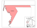
Dakhlet Nouadhibou Region (Arabic: ولاية داخلة نواذيبو, romanized: Wilayat Dakhlet Nouadhibou, lit. 'Interior Nouadhibou Region') is an administrative...
13 KB (1,188 words) - 15:07, 20 April 2024
Dakhlet Nouadhibou is a bay on the Atlantic shore of Mauritania. The Dakhlet Nouadhibou Region, one of the primary administrative divisions of Mauritania...
4 KB (341 words) - 15:42, 26 November 2023

de Nouadhibou, Agence Mauritanienne d'Information, 15 October 2018 "MyCeni - Résultats 2023". res-myceni.org. Retrieved 2023-12-05. Wilaya de Dakhlet Nouadhibou...
14 KB (986 words) - 20:42, 20 June 2024

Africa where the sun sets. The headland forms the western limit of Dakhlet Nouadhibou Bay.[citation needed] This thin stretch of land is divided between...
10 KB (1,029 words) - 00:38, 29 February 2024
Nouadhibou Airport (IATA: NDB, ICAO: GQPP) is an airport serving Nouadhibou (formerly Port-Étienne), a city in the Dakhlet Nouadhibou region of Mauritania...
4 KB (287 words) - 05:03, 11 November 2023

Bay of Arguin (category Dakhlet Nouadhibou Region)
does not include the Dakhlet Nouadhibou, or the westernmost areas. Smaller bays within the Bay of Arguin include Dakhlet Nouadhibou in the north and Baie...
4 KB (376 words) - 02:20, 10 December 2023

Cansado (category Dakhlet Nouadhibou Region)
north-western Mauritania on the Ras Nouadhibou peninsula. It is located in the Nouadhibou Department in the Dakhlet Nouadhibou region. It was built from scratch...
3 KB (182 words) - 14:31, 21 June 2024
Iouik (category Dakhlet Nouadhibou Region)
Mauritania. Located in the Banc d'Arguin National Park within the Dakhlet Nouadhibou region, it sits on a small peninsula. Nearby towns and villages include...
3 KB (119 words) - 10:13, 7 April 2018

Coordinates: 20°36′00″N 16°27′00″W / 20.6000°N 16.4500°W / 20.6000; -16.4500 Country Mauritania Region Dakhlet Nouadhibou Region Elevation 0 m (0 ft)...
7 KB (501 words) - 14:43, 2 May 2024

Mzimba District, Northern Region, Malawi Eastern Dakhlet Nouadhibou Region, Mauritania Boumdeid Department, Assaba Region, Mauritania Southeastern Tete...
24 KB (1,681 words) - 11:55, 15 June 2024

Department Bogué Department M'Bagne Department Magtar Lahjar Department Nouadhibou Department Kaedi Department M'Bout Department Maghama Department Monguel...
4 KB (152 words) - 13:10, 23 June 2024
La Batterie (category Dakhlet Nouadhibou Region)
Mauritania on the Ras Nouadhibou peninsular. It is located in the Nouadhibou Department in the Dakhlet Nouadhibou region south of Nouadhibou close to Cansado...
2 KB (42 words) - 08:53, 7 April 2024
Tanoudert (category Dakhlet Nouadhibou Region)
Tanoudert is a coastal town in Mauritania. It is located in the Dakhlet Nouadhibou region and forms a part of the Banc d'Arguin National Park. It is situated...
2 KB (75 words) - 00:33, 21 October 2017

Guidimaka Region Westernmost point – unnamed location on the border with Western Sahara on the Ras Nouadhibou, peninsula, Dakhlet Nouadhibou Region "Climate...
36 KB (2,694 words) - 23:30, 18 June 2024
Kijji (category Dakhlet Nouadhibou Region)
Kiji is a small island off the coast of The Banc d'Arguin National Park, Mauritania. The island is uninhabited. Its area is 13,5 km2; its length is 7.8...
608 bytes (62 words) - 23:28, 12 April 2024
Banc d'Arguin National Park (category Dakhlet Nouadhibou Region)
the Mauritanian port and railhead of Nouadhibou located on the eastern shore (see fig. 11). Dakhlet Nouadhibou, one of the largest natural harbors on...
19 KB (2,055 words) - 14:30, 16 October 2023
Nair (Mauritania) (category Dakhlet Nouadhibou Region)
Nair is a small offshore island off the Banc d'Arguin National Park, Mauritania. It is an important breeding ground for spoonbills and slender-billed gulls...
1 KB (132 words) - 02:53, 18 April 2021
ASC Snim (category Sport in Nouadhibou)
Mauritanean football club playing in the city of Nouadhibou the capital of Dakhlet Nouadhibou Region. Its main sponsor and owner of club is SNIM (Société...
5 KB (367 words) - 10:46, 6 June 2024

Tidra (category Dakhlet Nouadhibou Region)
Tidra (Arabic: تيدرة) is an offshore island 29 kilometres (18 miles) long and 8 km (5 mi) wide. It is the largest island off the shore of Banc d' Arguin...
2 KB (182 words) - 18:03, 1 July 2024
Kiaone (category Dakhlet Nouadhibou Region)
Kiaone are two offshore sandy islets in the Bay of Arguin, Mauritania, the islet is very small. The large islet is 1.2 km to 300 meters long and 12 to...
1 KB (189 words) - 20:36, 3 June 2018
Nouadhibou is a department in Dakhlet Nouadhibou Region in Mauritania. The Nouadhibou department is made up of following communes: Boulenouar Inal Nouadhibou...
5 KB (56 words) - 20:39, 16 February 2024
Nouadhibou Regional Hospital (French: Hôpital Regional de Nouadhibou) is a regional hospital in Nouadhibou, Mauritania. Construction started in 2012 and...
3 KB (186 words) - 12:52, 22 November 2023

Daddah. Her family belongs to the El-Gor warrior tribe from the Dakhlet Nouadhibou Region. She attended the Superior Institute of Management in Paris, graduating...
5 KB (277 words) - 11:50, 21 February 2024
9°18′W 48 Senegal Dakar city, Dakar Region 17°27′W 49 Mauritania Ras Nouadhibou peninsula, Dakhlet Nouadhibou Region 17°03′W 50 Western Sahara La Güera...
28 KB (153 words) - 11:36, 24 June 2024

a region in western Mauritania. Its capital and only city is Akjoujt. It borders the regions of Adrar to the east, Trarza to the south, and Dakhlet Nouadhibou...
7 KB (581 words) - 15:03, 20 April 2024
(or Nouâmghâr) is a coastal village and rural commune in the Dakhlet Nouadhibou region of western Mauritania. The village is 150 kilometers north north-east...
5 KB (171 words) - 13:53, 10 March 2024

Cap Blanc Lighthouse (redirect from Ras Nouadhibou lighthouse)
Blanc Lighthouse (also known as the Ras Nouadhibou Lighthouse) is an active lighthouse located on Ras Nouadhibou (French: Cap Blanc) in Mauritania. Constructed...
2 KB (176 words) - 01:16, 31 May 2024

Criteria Year Description Banc d'Arguin National Park Dakhlet Nouadhibou Region, Inchiri Region 20°14′00″N 16°06′00″W / 20.233333°N 16.1°W / 20.233333;...
6 KB (199 words) - 22:17, 11 March 2024
Brakna Communications in Mauritania Constituencies of Mauritania Dakhlet Nouadhibou Departments of Mauritania Thiam Diombar Economy of Mauritania Elections...
3 KB (208 words) - 19:31, 8 June 2024
Rift Valley fever were reported in the extreme southern part of Trarza Region around Rosso. Contagious and infectious diseases were rampant in the kébés...
11 KB (701 words) - 23:46, 17 April 2024