Duckmaloi Road (and at its western end through Oberon as Oberon Street) is a 25.7-kilometre (16.0 mi) rural road in Australia linking Oberon to Jenolan...
8 KB (557 words) - 06:40, 13 August 2024
to north-east where it is joined by the Duckmaloi River and forms the north-eastern boundary. Duckmaloi Road provides access to the locality from Oberon...
3 KB (160 words) - 11:53, 26 August 2024

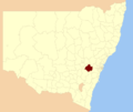
Oberon, New South Wales (section Road access)
O'Connell Road. From Great Western Highway near Hartley it is around 50 km (31 mi) south-west, along the sealed Jenolan Caves and Duckmaloi Roads. From Goulburn...
11 KB (979 words) - 00:35, 31 August 2024

southwest and ascends Mount Blaxland, then continues to Hampton and to the Duckmaloi Road intersection. Next it winds south to the 5-Mile section which descends...
8 KB (687 words) - 19:58, 6 October 2024
'snow chasers' during the winter months. From the town of Oberon, the Duckmaloi Road heads east for 26 kilometres (16 mi) until it meets the Hampton-Jenolan...
4 KB (333 words) - 13:47, 20 July 2024
Arkstone, Duckmaloi, Essington, Isabella and Porters Retreat. The Oberon Council has a number of heritage-listed sites, including: Jenolan Caves Road: Jenolan...
7 KB (587 words) - 08:26, 9 September 2024

(txt). Retrieved 26 August 2006 – via Project Gutenberg. New bridges Main Roads September 1979 pages 3-5 Bascule and Swing Span Bridges – Movable Span Bridge...
47 KB (2,921 words) - 02:12, 27 June 2024
Roads & Maritime Services. 15 August 2005. Retrieved 11 January 2013. "Boonanga Bridge over Barwon River". Heritage and conservation register. Roads &...
11 KB (867 words) - 08:15, 12 August 2024

gallery". ABC News. Western Plains, Australia. Retrieved 20 February 2011. "Road closures and diversions alert" (Press release). Dubbo City Council. 6 December...
37 KB (3,266 words) - 22:06, 18 August 2024

surface round But just a little hollowed. The dry Paroo River, near Wilcannia Road sign by the Paroo River bridge, near Wilcannia Queensland portal New South...
8 KB (524 words) - 11:01, 9 April 2024

metres (1,329 ft) over its 191-kilometre (119 mi) course. The Great Alpine Road follows much of the course of the river in its upper reaches. The river flows...
8 KB (486 words) - 05:15, 27 June 2023

unreliable levels made it impossible for boats to compete with the rail and later road transport. However, the river still carries pleasure boats along its entire...
50 KB (4,746 words) - 05:06, 28 June 2024

Lagoona Road, Borung-Hurstwood Road, Ellerslie Road, Majors Line Road, Boort-Pyramid Road, Boort-Yando Road, Canary Island-Leaghur Road, Appin South Road, Hewitt...
16 KB (1,407 words) - 05:53, 24 August 2023
approximately 400–500 metres north west. It is across the Stringybark Creek Road. A group of three policemen from Mansfield set out to search for the Kelly...
7 KB (787 words) - 21:30, 2 October 2024
its 25-kilometre (16 mi) course. The river is traversed by Great Alpine Road near Cobungra. The Victoria River Track, a walking trail, follows much of...
4 KB (137 words) - 13:37, 2 February 2023
approximately 30 kilometres (19 mi) north of Omeo on the Corryong–Benambra Road. Picnic tables and wood-fired barbecues are available at the camp site. An...
7 KB (409 words) - 03:27, 3 February 2023

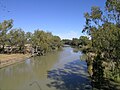
Campbells Castlereagh Cobrabald Cockburn Coolaburragundy Crudine Cudgegong Duckmaloi Fish Gwydir Horton Little Weir Little (Dubbo) Macdonald Macquarie Manilla...
5 KB (190 words) - 13:13, 31 January 2023
kilometres (12 mi) east of Marysville on the Eildon–Jamieson Road or the Big River State Forest Road. There is no booking system for the camp site. Australia...
6 KB (329 words) - 13:39, 2 February 2023
Ovens River west of the town of Myrtleford and adjacent to the Great Alpine Road. The river descends 228 metres (748 ft) over its 65-kilometre (40 mi) course...
6 KB (321 words) - 09:18, 31 October 2023

the river to Pental Island, at Swan Hill in the west, and on Fish Point Road at Fish Point in the east. Australia portal Water portal List of rivers of...
5 KB (203 words) - 12:10, 1 February 2023