
A Gemarkung (also Markung, in Switzerland also Gemarchen) is the entirety of all land plots of a specific municipality, or a specific large part of a...
5 KB (407 words) - 06:47, 24 May 2024

Hambach Forest (redirect from Gemarkung Kerpen, Flur 7, Flurstück 50)
Hambach Forest (German: Hambacher Wald, Hambacher Forst (German pronunciation: [ˈhambaxɐ ˈfɔʁst] ), Bürgewald, Die Bürge) is an ancient forest located...
30 KB (2,537 words) - 21:46, 20 August 2024
(in Gemarkung Eltersdorf) Paprika-Siedlung (in Gemarkung Frauenaurach) Schallershof (in Gemarkung Frauenaurach) Siedlung Sonnenblick (in Gemarkung Büchenbach)...
140 KB (16,295 words) - 21:01, 31 August 2024
kilometres south of Büdesheim and is the highest point in the parish (Gemarkung). The region is part of the Rhenish Massif; the basement of the Apert...
3 KB (163 words) - 14:13, 4 September 2023

population figure: Gemarkung Oberndorf: Oberndorf 89 Weiher (with Ziegelhütte) 102 Gemarkung Pommersfelden: Limbach 273 Pommersfelden 656 Gemarkung Steppach: Steppach...
5 KB (548 words) - 00:09, 30 January 2024

around 230 metres northwest of the mouth of the Leiblach opposite the Gemarkung of Reutin of the town of Lindau. On the island is the red mole beacon...
4 KB (326 words) - 13:45, 25 May 2024

Langwarden, which was incorporated in 1974 into Butjadingen (today the Gemarkung of Langwarden) ³ east of the outer Jade, after the boundary revision by...
11 KB (811 words) - 00:31, 4 September 2024

Neusörnewitz, part of Coswig, Saxony, Germany. Platform 1 is located in Coswig (Gemarkung Neusörnewitz), platform 2 in Weinböhla, though. The station lies on the...
3 KB (69 words) - 17:43, 12 August 2024
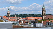
subdistrict is called a Gemarkung, and is mostly a smaller rural area (with similar concepts in Austria and Switzerland). A Gemarkung is usually associated...
55 KB (6,112 words) - 22:15, 18 May 2024

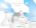
Böhl-Iggelheim station is in the town of Böhl-Iggelheim in the German state of Rhineland-Palatinate. Deutsche Bahn classifies it as a category 5 station...
13 KB (1,532 words) - 23:01, 13 August 2024
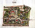
the location of these field strips continually changed. The district (Gemarkung) was divided into the village core (Dorfkern), field system (Ackerflur)...
1 KB (141 words) - 22:57, 22 April 2024
German as Gemarkungen: Hallstadt and Dörfleins (it is traditional for a Gemarkung to be named after a town or village lying nearby) Archaeological digs...
8 KB (1,027 words) - 03:13, 13 February 2024

terrace to the actual rhine valley. On the southern part of Bietigheim's Gemarkung is the southern end of the forest Hardtwald. The closest cities to Bietigheim...
4 KB (453 words) - 07:33, 13 June 2024
of the Seerhein north of Tägermoos (part of Switzerland but within the Gemarkung of Konstanz) and Gottlieben. The border then runs through the Rheinsee...
16 KB (1,689 words) - 20:18, 27 August 2024

Nagold. The village has an elevation of 310 (Monbachtal) to 687 Metern (Gemarkung Maisenbach-Zainen) and is part of the Nature Park Schwarzwald Mitte/Nord...
6 KB (654 words) - 14:22, 20 August 2024
particular, land survey is the responsibility of Constance, making Tägermoos a Gemarkung of the city of Constance. The City of Constance legally owns about two-thirds...
19 KB (2,625 words) - 13:40, 25 May 2024

Wald, Maßstab 1 : 50.000 "Bayerische Landesbibliothek Online (BLO)". "Gemarkungs- und Gemeindeverzeichnis". Landesamt für Digitalisierung, Breitband und...
18 KB (2,136 words) - 23:51, 26 August 2024

cropfields, meadows and woodland around the village. The town has only the Gemarkung (traditional rural cadastral area) of Rieneck. In 790, Rieneck had its...
9 KB (1,030 words) - 15:34, 20 August 2024

Germany. This part of the commune is situated in the southeast of the Gemarkung. To the north lies the Mahlow district. This is followed clockwise by...
2 KB (229 words) - 02:48, 26 October 2020

the two city halls in Vockenhausen and Eppstein. On the Vockenhäuser "Gemarkung" are the Freiherr-vom-Stein-Schule (comprehensive school) and the Burg-Schule...
14 KB (1,759 words) - 22:48, 6 January 2024

names with the town's constituent communities as it is traditional for a Gemarkung to be named after a town or village lying nearby. From 1972 to 1978, Schlüsselfeld...
6 KB (708 words) - 13:57, 15 August 2024
there was winegrowing until the late 19th century, as witnessed by the Gemarkung (traditional rural cadastral area) of Wingertsberg. Winegrowing was brought...
35 KB (3,546 words) - 15:21, 20 August 2024

two are wooded areas without any inhabitant. It is traditional for a Gemarkung to be named after a town or village lying nearby. The first sources of...
12 KB (1,119 words) - 14:59, 9 September 2022
forest." The woods in a Markwald do not therefore belong to the territory (Gemarkung) of the individual villages, but were part of a joint territory, run by...
2 KB (280 words) - 17:13, 17 February 2022

Castle are on the top of the mountain. This mountain is located on the Gemarkung of Duchtlingen (Hilzingen) between the villages of Duchtlingen, Schlatt...
2 KB (160 words) - 13:44, 2 June 2024

Rapperswil to Ziegelbrücke line. It is one of two railway stations in the Gemarkung of Schänis, the other being the much larger Ziegelbrücke railway station...
4 KB (184 words) - 14:22, 11 August 2024

database of the Bavarian State Library Online. Bavarian State Library „Gemarkungs- und Gemeindeverzeichnis“: Bayerisches Gemarkungsverzeichnis (ZIP archive...
10 KB (875 words) - 15:32, 20 August 2024

in 1992. The earliest evidence of human habitation in the Aubing Gemarkung was discovered in 1995/1996, situated to the south of Bodenseestraße (Bundesstraße...
101 KB (13,752 words) - 04:21, 14 August 2024

lies in the Bavarian Lower Main (Bayerischer Untermain). It has only one Gemarkung (traditional rural cadastral area), also called Krombach. The hegemony...
5 KB (444 words) - 13:25, 11 March 2022

well-to-do in Germany) by the Frankfurt salesman Jakob Latscha in the wooded Gemarkung (a cadastral unit) of Mitteldick. The first mayor was Rudolf Bindung....
22 KB (2,350 words) - 15:18, 20 August 2024