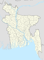
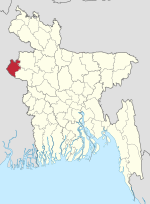
Kalai (Bengali: কালাই) is an upazila of Joypurhat District in the Division of Rajshahi, Bangladesh. Kalai is located at 25°03′30″N 89°11′00″E / 25.0583°N...
6 KB (424 words) - 12:55, 23 October 2024
An upazila (Bengali: উপজেলা, romanized: upajēlā, lit. 'sub-district' pronounced: ['upɘdʒeːlaː]), formerly called thana, is an administrative division...
31 KB (746 words) - 10:10, 4 November 2024
উদ্দীন মডেল সরকারি উচ্চ বিদ্যালয়) is a secondary school located in Kalai Upazila under Joypurhat District of Bangladesh. It is a Bangla medium government...
3 KB (491 words) - 20:05, 5 November 2024
village in Gilan Province, Iran Kalai, Cambodia, commune in Ou Chum District in northeast Cambodia Kalai Upazila, Upazila of Joypurhat District in the Division...
1 KB (195 words) - 14:40, 16 November 2021
Joypurhat Sadar Upazila and Panchbibi Upazila. Tulshiganga River passes through Joypurhat Sadar Upazila, Khetlal Upazila and Akkelpur Upazila. Chiri River...
23 KB (1,605 words) - 11:00, 29 October 2024
Upazila in Gaibandha District and Kalai Upazila in Joypurhat District on the east, Joypurhat Sadar Upazila on the south and Joypurhat Sadar Upazila and...
8 KB (583 words) - 12:55, 23 October 2024
The upazila is bounded by Joypurhat Sadar Upazila on the north, Akkelpur and Dhupchanchia upazilas on the south, Kalai and Shibganj (Bogura) upazilas on...
7 KB (498 words) - 12:55, 23 October 2024
Begungram (Bengali: বেগুনগ্রাম) is a village in Kalai Upazila of Joypurhat District in north-western Bangladesh. It is the site of the largest annual...
2 KB (135 words) - 15:06, 5 November 2024
Constituency Name Upazilas Joypurhat District 34 Joypurhat-1 Joypurhat Sadar Upazila and Panchbibi Upazila 35 Joypurhat-2 Akkelpur Upazila, Kalai Upazila and Khetlal...
28 KB (246 words) - 13:18, 15 September 2024
of Elahiganj and Dhupchanchia. It is one of the important rivers of Kalai Upazila in Joypurhat district. The Nagar is navigable by boat only during the...
2 KB (212 words) - 07:24, 22 October 2024
Kahaloo Upazila (Bengali: কাহালু উপজেলা) is an upazila of Bogra District in the Division of Rajshahi, Bangladesh. Kahaloo Thana was established in 1928...
8 KB (513 words) - 12:52, 23 October 2024
Sherpur Upazila (Bengali: শেরপুর উপজেলা) is an upazila of Bogra District in the Division of Rajshahi, Bangladesh. Sherpur Thana was established in 1962...
17 KB (1,554 words) - 12:51, 23 October 2024
on the east, Ajmiriganj, Mithamain and Austagram upazilas on the west. Main rivers are Kushiyara, Kalai and Barak. Notable beels: Charagaon, Bata, Sonamua...
11 KB (1,063 words) - 14:29, 23 October 2024
Joypurhat Sadar Upazila is bounded by Panchbibi Upazila and Balurghat CD Block in Dakshin Dinajpur district, West Bengal, India, on the north, Kalai and Khetlal...
10 KB (812 words) - 12:55, 23 October 2024
Gabtali (Bengali: গাবতলী, romanized: Gabtoli) is an upazila of the Bogra District, located in Bangladesh's Rajshahi Division. It is named after its administrative...
13 KB (1,131 words) - 12:52, 23 October 2024
Savar (Bengali: সাভার) is an upazila of Dhaka District in the division of Dhaka, Bangladesh and is located at a distance of about 24 kilometers (15 mi)...
20 KB (1,938 words) - 15:48, 23 October 2024
Shahjadpur (Bengali: শাহজাদপুর) is an upazila, or sub-district of Sirajganj District, located in Rajshahi Division, Bangladesh. In c. 1250, a Yemenite...
20 KB (1,624 words) - 13:21, 23 October 2024
Shibganj Upazila (Bengali: শিবগঞ্জ উপজেলা) is an upazila of Bogra District in the Division of Rajshahi, Bangladesh. The upazila was created in 1983. It...
10 KB (672 words) - 12:53, 23 October 2024
Chatmohar (Bengali: চাটমোহর) is an upazila of Pabna District in the Division of Rajshahi, Bangladesh. Chatmohar is located at 24°13′30″N 89°17′30″E /...
9 KB (624 words) - 13:16, 23 October 2024
Ish-shordi) is an upazila of Pabna District in Rajshahi Division. It is the westernmost upazila of Pabna district. This upazila is a dynamic administrative...
30 KB (2,328 words) - 13:16, 23 October 2024
Shibganj (Bengali: শিবগঞ্জ) is an upazila of Nawabganj District in the Division of Rajshahi, Bangladesh. Shibganj has a few well-known places with Hindu...
14 KB (1,286 words) - 13:08, 23 October 2024
Sapahar (Bengali: সাপাহার) is an upazila of Naogaon District in the Division of Rajshahi, Bangladesh. Sapahar is located at 25.1250°N 88.5819°E. It has...
8 KB (576 words) - 13:14, 23 October 2024
Nachole Upazila is bounded by Gomostapur Upazila on the north-west, Niamatpur Upazila in Naogaon District, on the north-east, Tanore Upazila in Rajshahi...
7 KB (492 words) - 13:07, 23 October 2024
Nawabganj Sadar (Bengali: নবাবগঞ্জ সদর) is an upazila of Nawabganj District in the Division of Rajshahi, Bangladesh. Chapai Nawabganj Sadar is located...
8 KB (491 words) - 13:07, 23 October 2024
Sullah (Bengali: শাল্লা, romanized: Shalla, also spelt Sulla, is an upazila (sub-district) of the Sunamganj District, located in Bangladesh's Sylhet Division...
9 KB (696 words) - 14:20, 23 October 2024
Chapai Nawabganj District (redirect from Nababganj Upazila)
district comprises five Upazilas: Bholahat Upazila Gomastapur Upazila Nachole Upazila Chapainawabganj Sadar Upazila and Shibganj Upazila. There are four municipalities...
28 KB (2,866 words) - 01:55, 5 November 2024
Baraigram (Bengali: বড়াইগ্রাম) is an upazila of Natore District, located in the Rajshahi Division of Bangladesh. The Aryan migrations to Lalpur and Baraigram...
8 KB (586 words) - 13:09, 23 October 2024
surrounded on 3 sides by this Upazila. The Mahananda River, Bil Vatia and Mango garden divide this Upazila from India. Bholahat Upazila is bounded by Old Malda...
6 KB (400 words) - 13:06, 23 October 2024
Puthia (Bengali: পুঠিয়া) is an Upazila of Rajshahi District in the Division of Rajshahi, Bangladesh. Puthia is located at 24°22′30″N 88°51′00″E / 24...
7 KB (474 words) - 13:03, 23 October 2024
Tanore Upazila of Rajshahi District and Manda Upazila of Naogaon District to the north, Bagmara Upazila to the east, Paba Upazila and Durgapur Upazila to...
7 KB (538 words) - 13:02, 23 October 2024


