
Route 24 is a 40.91-mile-long (65.84 km) freeway south of Interstate 93 (I-93) in southeastern Massachusetts, linking Fall River with the Boston metropolitan...
15 KB (1,050 words) - 16:08, 25 July 2024

Route 24 is a freeway in the U.S. state of Rhode Island. It runs approximately 8 miles (13 km) from Route 114 in Portsmouth to Massachusetts Route 24...
6 KB (278 words) - 04:58, 8 May 2024

Route 128, known as the Yankee Division Highway, is an expressway in the U.S. state of Massachusetts maintained by the Highway Division of the Massachusetts...
57 KB (5,435 words) - 23:23, 11 August 2024

which provides access to the Route 146 expressway. The I-395 designation for the highway ends as it meets I-90 (Massachusetts Turnpike) at exits 11A and...
21 KB (1,342 words) - 08:44, 9 September 2024

Route 1A is a north–south state highway in Massachusetts, United States. It is an alternate route to U.S. 1 with three signed sections and two unsigned...
17 KB (1,092 words) - 22:55, 30 September 2024

Route 2 is a 142.29-mile-long (228.99 km) major east–west state highway in Massachusetts, United States. Along with Route 9 and U.S. Route 20 to the south...
34 KB (2,020 words) - 16:25, 24 August 2024

terminus at Route 1A by Logan International Airport, is reduced to four lanes. The turnpike is the longest Interstate Highway in Massachusetts, while I-90...
129 KB (10,845 words) - 00:40, 14 September 2024
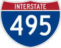
Interstate 495 (I-495) is an auxiliary route of I-95 in the US state of Massachusetts, maintained by the Massachusetts Department of Transportation (MassDOT)...
28 KB (1,601 words) - 00:12, 17 September 2024

Canal as Massachusetts Route 28 south. Prior to 1982, the Route 25 designation was given to that segment of what is now I-495 from Route 24 in Raynham...
24 KB (2,648 words) - 15:46, 9 May 2024

Route 3 is a state-numbered route in the U.S. state of Massachusetts, maintained by the Massachusetts Department of Transportation (MassDOT). Spanning...
19 KB (1,488 words) - 13:19, 5 June 2024

Route 79 is a 18.47-mile-long (29.72 km) state highway in southeastern Massachusetts. The route had formerly began as a highway in Fall River, also known...
15 KB (1,276 words) - 14:10, 6 September 2024

Route 28 is a 151.93-mile-long (244.51 km) nominally south–north state highway in the U.S. state of Massachusetts, running from the town of Eastham via...
36 KB (3,088 words) - 17:32, 18 August 2024

U.S. Route 20 (US 20) runs its easternmost 153 miles (246 km) in the U.S. state of Massachusetts. The highway crosses the state border from New Lebanon...
29 KB (1,897 words) - 04:22, 12 July 2024

and Massachusetts Route 24, a four-lane divided highway, is located at the town's border with Bridgewater. Additionally, U.S. Route 44, Massachusetts Route...
18 KB (2,167 words) - 20:27, 21 May 2024
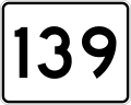
Route 139 is a 32.24-mile-long (51.89 km) west–east state highway in southeastern Massachusetts. Its western terminus is at Route 27 and Route 138 in Stoughton...
7 KB (230 words) - 00:58, 19 March 2023

Massachusetts Route 6A is the state road for two sections formerly known as U.S. Route 6 (US 6) on Cape Cod. Most of Route 6A is also known as the Old...
11 KB (975 words) - 13:58, 23 August 2024

Suggested western boundaries included the Rhode Island state line, or Massachusetts Route 24. Some individuals placed Foxborough and Stoughton in the region...
24 KB (844 words) - 17:07, 30 July 2024

Island and Massachusetts. It travels from a junction with I-95 in Providence, Rhode Island, east to a junction with I-495 and Massachusetts Route 25 in Wareham...
36 KB (2,542 words) - 17:15, 25 July 2024

caused Rhode Island and Massachusetts to briefly consider putting Interstate 895 along Rhode Island Route 24 and Massachusetts Route 24, though nothing ever...
12 KB (1,152 words) - 20:22, 14 September 2024

New England road marking system (redirect from Route 8 (Massachusetts 1920s))
blue for north–south and yellow for intermediate or diagonal routes). The Massachusetts Highway Commission convinced the rest of southern New England...
158 KB (6,445 words) - 17:10, 1 February 2024
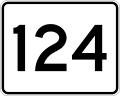
Route 124 is a 6.8-mile-long (10.9 km) north–south state highway located in the towns of Harwich and Brewster in the U.S. state of Massachusetts. Its southern...
4 KB (284 words) - 17:35, 25 July 2024

Routes 128 and 24, Randolph's location has been an important factor in its economic and social history. Randolph is located in eastern Massachusetts,...
26 KB (2,652 words) - 14:37, 2 September 2024

Route 3A is a 97-mile-long (156 km) state highway in eastern Massachusetts, which parallels Route 3 and U.S. Route 3 from Cedarville in southern Plymouth...
14 KB (718 words) - 22:07, 16 September 2024

March 9, 2017. Retrieved January 24, 2024. "Route 60 Plaza" (Map). Google Maps. Retrieved February 8, 2019. Massachusetts Department of Transportation (2015)...
39 KB (2,814 words) - 19:31, 25 August 2024

Route 140 is a 107.76-mile-long (173.42 km) north—south state highway which passes through Bristol, Norfolk and Worcester counties in Massachusetts. The...
25 KB (1,679 words) - 06:02, 19 June 2024
Highway 24 British Columbia Highway 24 Manitoba Highway 24 Ontario Highway 24 Prince Edward Island Route 24 Saskatchewan Highway 24 part of I/24 Highway;...
8 KB (568 words) - 09:50, 27 August 2024

northeastern corner of town. Massachusetts Route 24 passes through the western half of town, with an exit at Route 106. Route 106 passes from east to west...
15 KB (1,875 words) - 20:55, 7 May 2024

U.S. Route 6 (US 6) in Massachusetts is a 117.952-mile-long (189.825 km) portion of the cross-country route connecting Providence, Rhode Island, to Fall...
31 KB (2,583 words) - 18:15, 7 September 2024

Agawam, Massachusetts. The route ends at the junction of Route 147 and Route 75 in Agawam center just south of the West Springfield city line. The route was...
9 KB (579 words) - 01:36, 6 July 2024

Route 67 is a 24.81-mile-long (39.93 km) north–south (though geographically more northeast-southwest) highway in western and central Massachusetts. Its...
5 KB (289 words) - 01:01, 15 March 2023