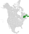
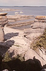
The Matamec River (French: Rivière Matamec) is a salmon river in the Côte-Nord region of Quebec, Canada. It empties into the Gulf of Saint Lawrence. The...
12 KB (1,271 words) - 16:36, 24 October 2024
with the Moisie River Aquatic Reserve. The Moisie River basin lies between the basins of the Rapides River to the west and the Matamec River to the east....
9 KB (810 words) - 13:10, 18 June 2024
River McDonald River Petite rivière à la Truite (Moisie River tributary) Matamec River Loups Marins River Pigou River Pigou-Est River Bouleau River Petite...
104 KB (9,399 words) - 19:26, 22 October 2024
bridge over the Moisie River, Sept-Iles (City), Matamec Hamlet, towards Moisie Fill of Highway No. 138, Sept-Îles (City), Hamlet Matamec Roadside restaurant...
43 KB (1,633 words) - 12:51, 16 September 2024
watershed of the Moisie River is between that of St. Margaret River (west side) and Matamec River (east side). The waters of the Moisie River descend to 410 km...
8 KB (944 words) - 19:10, 9 June 2023
kilometres (72 sq mi). It lies between the basins of the Matamec River to the west and the Pigou River to the east. The basin is partly in the unorganized...
7 KB (590 words) - 17:34, 24 October 2024
fragmented. Mining has also damaged habitats in certain areas such as Matamec. Protected areas include Bay du Nord Wilderness Reserve, Avalon Wilderness...
5 KB (448 words) - 13:40, 28 August 2024
Petite rivière au Bouleau (category Rivers of Côte-Nord)
Bouleau descends towards the south-east, between the Matamec River (located on the west side) and the rivers Chiskal and Bouleau (located on the east side)...
7 KB (802 words) - 03:47, 14 December 2021
Rivière à Dupuis (category Rivers of Côte-Nord)
62 mi) west of the course of the Bouleau river; 16.6 km (10.3 mi) north-east of the course of the Matamec River; 66.6 km (41.4 mi) west of the center of...
5 KB (526 words) - 07:18, 16 December 2021
American Beaver. Lontra canadensis. – Loutre du Canada. -North American river otter Ondatra zibethicus L. – Rat musqué. -Muskrat Vulpes vulpes L. -Renard...
26 KB (2,586 words) - 21:51, 30 October 2024
Falls (French: Chute Montmorency) is a large waterfall on the Montmorency River in Quebec, Canada. The falls are located on the boundary between the borough...
9 KB (809 words) - 15:26, 24 October 2024
Sept-Rivières (French for "Seven-Rivers") is a regional county municipality of Quebec, Canada, in the Côte-Nord region. Its county seat is Sept-Îles. The...
11 KB (600 words) - 15:44, 6 June 2024
Bouleau holds glaciofluvial sediments. The Matamec weather station, 32 kilometres (20 mi) west of the river, records an annual average temperature of 1...
16 KB (1,645 words) - 04:35, 1 November 2024
Sept-Îles, Quebec (category Quebec populated places on the Saint Lawrence River)
La Boule, Lac Labrie, Matamec, Plages, Pointe-Noire and Val-Marguerite. Located on the north shore of the Saint Lawrence River, between the Sainte-Marguerite...
28 KB (2,832 words) - 01:08, 17 October 2024
Port-Cartier (category Quebec populated places on the Saint Lawrence River)
It is located on the north shore of the St. Lawrence River at the mouth of the Aux-Rochers River, 63 kilometres (39 mi) southwest of Sept-Îles, Quebec...
14 KB (1,081 words) - 15:25, 22 August 2024
area is dedicated to conserving the ecosystems of the Sainte-Marguerite River valley. The latter is located in a glacial valley separating the Saguenay...
27 KB (2,664 words) - 21:38, 27 November 2023
steep-sided gorge, carved by the Sainte-Anne-du-Nord River, 6 km east of Beaupré, Quebec, Canada. The river drops over a 74 m (243 ft) waterfall within the...
6 KB (825 words) - 23:24, 4 September 2024
within the park, as do Richmond Gulf and the watershed of the Nastapoka River. The river hosts a population of landlocked freshwater harbour seals and salmon...
3 KB (225 words) - 21:50, 13 September 2024
Bas-Saint-Laurent, the park is situated along the eastern end of the Saguenay River and adjoins the Saguenay–St. Lawrence Marine Park for over 100 km (60 mi...
11 KB (1,174 words) - 20:39, 30 October 2024
Regional County Municipality. The eponymous Nipissis River is a left tributary of the Moisie River, with its source north of Lake Siamois. Nipissis, first...
5 KB (191 words) - 15:40, 12 June 2024
falls on the course of the Noire River. These falls are distributed over a distance of 17.7 km from the course of the river; however, only the last fall is...
5 KB (536 words) - 21:28, 16 December 2021
vicinity of Havre-Saint-Pierre include the Romaine River to the north west, Manitou Falls on the Manitou River to the west, Île du Havre to the south, less...
38 KB (3,292 words) - 22:43, 13 October 2024
travel between Quebec City and Lac Saint-Jean without using the St. Lawrence River. Starting in the mid-19th century, the area was a major producer of lumber...
8 KB (788 words) - 20:18, 30 October 2024
linked to the name of Poisson-Blanc Lake. This name of the lake and the river derives from the fact that white fish are caught there. The toponym "Poisson-Blanc...
7 KB (750 words) - 09:07, 24 September 2022
The park is named after the nearby Saint-Maurice River to the east of the park. The Matawin River flows along the west and north borders of the park...
22 KB (2,137 words) - 21:50, 30 October 2024
of the Jacques-Cartier River to Jacques-Cartier Lake, the Pikauba River, the rivière aux Écorces and the Métabetchouane River. The first more or less...
11 KB (1,104 words) - 17:59, 28 September 2024
cross-country skiing, snowshoeing, short and long hiking hut, canoe lake and river kayaking, mountain biking, backcountry camping and swimming in lakes, such...
14 KB (1,551 words) - 20:29, 30 October 2024
The park is crossed by the rivière de la Boule (Boule River), a tributary of the L'Assomption River. The park covers an area in the shape of a rectangle...
5 KB (538 words) - 18:20, 11 September 2024
dominating over the entire Torngat Mountain range. The 166 km (103 mi) Koroc River runs through the national park to Ungava Bay. Kuururjuaq National Park contains...
4 KB (296 words) - 20:19, 30 October 2024
Natashquan stretches along the coast, on both sides of the Little Natashquan River, about 120 km east of Havre-Saint-Pierre, near Aguanish and the Natashkuan...
37 KB (2,789 words) - 04:20, 1 November 2024


