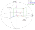
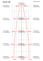
The North American Datum (NAD) is the horizontal datum now used to define the geodetic network in North America. A datum is a formal description of the...
13 KB (1,613 words) - 18:25, 12 August 2024
States of America based upon the General Adjustment of the North American Datum of 1988. It superseded the National Geodetic Vertical Datum of 1929 (NGVD...
7 KB (732 words) - 16:18, 31 January 2024
A geodetic datum or geodetic system (also: geodetic reference datum, geodetic reference system, or geodetic reference frame, or terrestrial reference frame)...
31 KB (3,346 words) - 06:28, 11 August 2024
Vertical Datum of 1929 is the official name since 1973 of the vertical datum established for vertical control surveying in the United States of America by the...
4 KB (397 words) - 01:26, 19 November 2023
the large geodetic systems, such as European Datum (ED50), North American Datum (NAD), and Tokyo Datum (TD), to provide a worldwide geo-data basis Need...
24 KB (2,843 words) - 13:42, 3 August 2024
professionals include the National Geodetic Vertical Datum of 1929 and the North American Vertical Datum of 1988. In common usage, elevations are often cited...
10 KB (1,459 words) - 03:47, 10 July 2024
The South American Datum (SAD) is a regional historical geodetic datum for South America. The most common version was established in 1969 (SAD69), as adopted...
2 KB (255 words) - 20:02, 13 August 2023
geodetic datum. In 1913, the datum was adopted across all of North America, and the system revised and formalized as the North American Datum of 1927 (NAD27)...
15 KB (1,486 words) - 22:19, 16 November 2023
European Terrestrial Reference System 1989 (redirect from ETRS89 datum)
geodetic datum to be used for mapping and surveying purposes in Europe. It plays the same role for Europe as NAD-83 for North America. (NAD-83 is a datum in...
6 KB (611 words) - 09:24, 3 July 2024
Geographic coordinate conversion (redirect from Datum transformation)
referenced to the same geodetic datum. A geographic coordinate transformation is a translation among different geodetic datums. Both geographic coordinate...
34 KB (5,200 words) - 08:18, 10 August 2024
Spatial reference system (section North America)
Examples include the World Geodetic System and the 1927 and 1983 North American Datum. A datum generally consists of an estimate of the shape of the Earth...
15 KB (1,546 words) - 06:12, 22 May 2024
ED50 (redirect from European Datum 1950)
ED50 ("European Datum 1950", EPSG:4230) is a geodetic datum which was defined after World War II for the international connection of geodetic networks...
8 KB (927 words) - 23:56, 8 June 2024
Geographic coordinate system (category Use American English from June 2024)
for positions in space. Local datums chosen by a national cartographical organization include the North American Datum, the European ED50, and the British...
22 KB (2,491 words) - 18:21, 12 August 2024
from the geographical 49th parallel for the currently adopted datum, the North American Datum of 1983 (NAD 83). The Digital Chart of the World (DCW), which...
23 KB (1,640 words) - 03:22, 14 July 2024
National Spatial Reference System (redirect from Datum of 2022)
Reference System (NSRS). It will replace the North American Datum of 1983 (NAD 83) and the North American Vertical Datum of 1988 (NAVD 88) with a new geometric...
6 KB (555 words) - 18:29, 12 August 2024
Earth-centered, Earth-fixed coordinate system (category Use American English from March 2021)
2010. ECEF datum transformation Archived March 22, 2007, at the Wayback Machine Notes on converting ECEF coordinates to WGS-84 datum Datum Transformations...
9 KB (904 words) - 13:39, 7 January 2024
– Mathematical Association of America". www.maa.org. Donald Engels (1985). The Length of Eratosthenes' Stade. American Journal of Philology 106 (3): 298–311...
21 KB (2,446 words) - 18:46, 17 August 2024
data in latitude/longitude if the datum is the 'North American Datum of 1983' is denoted by 'GCS North American 1983'. While no digital model can be...
101 KB (13,112 words) - 06:30, 12 August 2024
Geodesy (section Geodetic datums)
(vertical). These regional geodetic datums, such as ED 50 (European Datum 1950) or NAD 27 (North American Datum 1927), have ellipsoids associated with...
38 KB (4,268 words) - 03:16, 13 August 2024
Nad, County Cork, a village in Ireland North American Datum, a series of geographic coordinate systems North Atlantic Drift, an Atlantic Ocean current...
2 KB (215 words) - 19:03, 27 October 2022
is used for WGS84 and some other modern geodetic datums, the letter for the first row – just north of the equator – is A in odd-numbered zones, and F...
15 KB (2,133 words) - 06:55, 13 February 2024
means current UTM northing at a given point can differ up to 200 meters from the old. For different geographic regions, other datum systems can be used...
17 KB (2,833 words) - 22:21, 29 June 2024
Level Datum 1929 OSGB36 Ordnance Survey Great Britain 1936 SK-42 Systema Koordinat 1942 goda ED50 European Datum 1950 SAD69 South American Datum 1969 GRS...
14 KB (1,850 words) - 08:23, 8 December 2023
Parameter Dataset (also EPSG registry) is a public registry of geodetic datums, spatial reference systems, Earth ellipsoids, coordinate transformations...
5 KB (450 words) - 10:37, 21 July 2024
Projected coordinate system (redirect from Grid north)
choice of map projection (with specific parameters), a choice of geodetic datum to bind the coordinate system to real locations on the earth, an origin...
21 KB (2,803 words) - 22:28, 19 June 2024
needed] Datum: OSGB36 Map projection: Transverse Mercator projection using Redfearn series True origin: 49°N, 2°W False origin: 400 km west, 100 km north of...
20 KB (2,197 words) - 07:51, 11 August 2024
1927 North American Datum (NAD27); conversion or a change in settings is necessary when using a GPS which by default employ the WGS84 geodetic datum. Beginning...
4 KB (361 words) - 01:11, 20 August 2023
Washington meridians (redirect from American Meridian)
local vertical used by astronomic observations relative to NAD 27 (North American Datum 1927), an ellipsoid of revolution that is at mean sea level beneath...
21 KB (2,523 words) - 09:53, 16 July 2024
State Plane Coordinate System (category Use American English from November 2023)
on the North American Datum of 1927 (NAD27). Later, the more accurate North American Datum of 1983 (NAD83) became the standard (a geodetic datum is the...
7 KB (965 words) - 15:06, 26 February 2024
Examples include the North American Datum 1983 (NAD83), the European Terrestrial Reference Frame 1989 (ETRF89), and the Geocentric Datum of Australia 1994...
13 KB (777 words) - 21:52, 21 July 2024


