
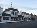
State Route 360 (SR 360) is a short east–west route in Buckeye Lake, Ohio. SR 360 starts and ends at SR 79, paralleled to the shore of Buckeye Lake. The...
4 KB (425 words) - 03:22, 2 May 2023

State Routes in Ohio are owned by the state, and maintained by the state except in cities. They are signed with a white silhouette of Ohio against a black...
191 KB (38 words) - 02:16, 1 July 2024
Japan National Route 360 U.S. Route 360 Arizona State Route 360 (former) Arkansas Highway 360 Georgia State Route 360 Hawaii Route 360 K-360 (Kansas highway)...
1 KB (146 words) - 15:55, 16 August 2024
state of Ohio. At about 336 miles (541 km) in length, it is the longest state route in Ohio. Its southern terminus is an interchange with U.S. Route 52...
50 KB (2,481 words) - 03:03, 9 August 2024

State Route 608 (SR 608) is a north–south state highway in the northeastern portion of the U.S. state of Ohio. Its southern terminus is at State Route...
4 KB (366 words) - 03:53, 19 May 2024

Virginia and Ohio, the route is signed east–west. In West Virginia, the route is signed north–south. In Ohio, U.S. 250 is an important cross-state corridor...
14 KB (1,373 words) - 03:35, 2 February 2024

also coming across several State Highway termini: New Mexico State Road 360 (NM 360), NM 176, NM 243, NM 529, NM 483, NM 360, and NM 8 along the 70-mile...
36 KB (3,677 words) - 00:53, 3 August 2024
is a list of former state routes in Ohio since 1923 with route numbers from 354 through 568 inclusive. SR 354 was a state route through central Columbiana...
48 KB (3,726 words) - 16:33, 11 March 2022

State Route 79 (SR 79) is a north–south highway that traverses Central Ohio, extending from Buckeye Lake at SR 37 to Nellie at US 36. SR 79 serves Newark...
9 KB (491 words) - 22:41, 16 May 2024

State Route 361 (SR 361, OH 361) is a 4.67-mile-long (7.52 km) long state highway entirely located within Pickaway Township, Pickaway County, Ohio. The...
4 KB (354 words) - 03:22, 2 May 2023

U.S. Route 68 (US 68) is a United States highway that runs for 560 miles (900 km) from northwest Ohio to Western Kentucky. The highway's western terminus...
68 KB (1,610 words) - 14:02, 27 July 2024

Beach U.S. Roads portal U.S. Route 160 U.S. Route 260 U.S. Route 360 U.S. Route 460 Special routes of U.S. Route 60 "U.S. Route Number Database" (December...
50 KB (5,489 words) - 01:43, 5 August 2024

Interstate 80 (I-80) in the US state of Ohio runs across the northern part of the state. Most of the route is part of the Ohio Turnpike; only an 18.78-mile...
22 KB (722 words) - 01:01, 16 August 2024
state routes in Ohio since 1923 with route numbers from 1 through 49 inclusive. SR 1, formerly known as Inter-county Highway 1 until 1921 and State Highway...
31 KB (2,381 words) - 13:57, 20 December 2023

Dublin is a city in the U.S. state of Ohio. A suburb of Columbus, it falls within the jurisdictions of Franklin, Delaware, and Union counties. The population...
37 KB (3,493 words) - 10:21, 17 August 2024

Columbia-class submarine (redirect from Ohio Replacement Program)
as prime contractor for Ohio Replacement Programme". IHS Jane's 360, Janes.com. Retrieved 20 August 2016. "SSBN / SSGN Ohio Class Submarine". Naval Technology...
38 KB (3,267 words) - 06:35, 24 June 2024
Interstate 270, United States Route 23, Ohio State Route 161, and Ohio State Route 315. Interstate 71 and Ohio State Route 710 pass just to the east of...
23 KB (2,571 words) - 13:52, 25 May 2024

The Ohio Statehouse is the state capitol building and seat of government for the U.S. state of Ohio. The Greek Revival building is located on Capitol...
32 KB (3,678 words) - 21:13, 7 August 2024

(/kəˈlʌmbəs/, kə-LUM-bəs) is the capital and most populous city of the U.S. state of Ohio. With a 2020 census population of 905,748, it is the 14th-most populous...
181 KB (16,669 words) - 00:39, 15 August 2024
List of highways numbered 1 (redirect from State Route 1)
New York State Route 1A (former) New York State Route 1B (former) New York State Route 1X (former) North Dakota Highway 1 Ohio State Route 1 (former)...
20 KB (1,281 words) - 22:26, 13 August 2024

neighboring city of Heath, Ohio. This complex has been designated as a National Historic Landmark and is operated as a state park by the Ohio History Connection...
27 KB (2,302 words) - 13:18, 13 August 2024

St. Paris or Saint Paris is a village in Champaign County, Ohio, United States. The population was 1,882 at the 2020 census. The area where St. Paris now...
13 KB (1,217 words) - 23:28, 15 May 2024

state of Ohio. As of the 2020 census, the population was 242,337. Its county seat is Lebanon and largest city is Mason. The county is one of Ohio's most...
45 KB (4,434 words) - 06:05, 20 July 2024
widened in 1954. The highway was likely removed from the state highway system by 1960. Maryland Route 360 was the designation for Sackertown Road from MD 358...
104 KB (12,452 words) - 18:24, 21 August 2023

Interstate 780 (redirect from California State Route 780)
city-maintained Curtola Parkway continues west from I-80 to State Route 29 (SR 29) in Vallejo. The I-780 state-maintained freeway begins at Lemon Street and Curtola...
14 KB (1,593 words) - 06:44, 22 August 2023

Interstate 90 (redirect from Interstate Route 90)
15 auxiliary routes, primarily in major cities such as Chicago, Cleveland, Buffalo, and Rochester. I-90 begins at Washington State Route 519 in Seattle...
126 KB (10,989 words) - 22:43, 16 August 2024

the route leaves Levisa Fork near its headwaters. US 460 ascends to Shortt Gap, where the highway crosses Sandy Ridge. There, US 460 leaves the Ohio River...
82 KB (6,756 words) - 21:28, 15 April 2024

List of Kentucky supplemental roads and rural secondary highways (500–599) (redirect from Kentucky State Route 509)
The entire route is in Ohio County. Kentucky Route 506 (KY 506) is a 10.245-mile-long (16.488 km) state highway that runs from Kentucky Route 902 northeast...
113 KB (5,096 words) - 23:22, 14 May 2024

List of Kentucky supplemental roads and rural secondary highways (300–399) (redirect from Kentucky Route 362)
help) Template:Attached KML/Kentucky Route 306 KML is not from Wikidata Kentucky Route 306 is a 2.088-mile-long (3.360 km) rural secondary highway in southern...
95 KB (9,567 words) - 02:37, 9 July 2024

United States Numbered Highway System (redirect from U.S. Route)
and have always been maintained by state or local governments since their initial designation in 1926. The route numbers and locations are coordinated...
46 KB (5,110 words) - 01:38, 5 August 2024