
State Route 558 (SR 558) is a 15.74-mile (25.33 km) state route that runs between Salem and East Palestine in the US state of Ohio. Most of the route...
11 KB (963 words) - 01:25, 5 August 2024

State Routes in Ohio are owned by the state, and maintained by the state except in cities. They are signed with a white silhouette of Ohio against a black...
191 KB (38 words) - 02:16, 1 July 2024

State Route 45 (SR 45) is a north–south state highway in the northeastern portion of the U.S. state of Ohio. Its southern terminus is at the State Route...
9 KB (341 words) - 19:58, 15 May 2024
state of Ohio. At about 336 miles (541 km) in length, it is the longest state route in Ohio. Its southern terminus is an interchange with U.S. Route 52...
50 KB (2,457 words) - 03:03, 9 August 2024

the eastern terminus of State Route 558), and its northern terminus is at State Route 11 several miles south of State Route 531 in Plymouth Township...
10 KB (384 words) - 20:06, 15 May 2024

of State Route 7 and State Route 558, State Route 517 has not experienced any major changes in alignment since its designation. The entire route is in...
4 KB (264 words) - 22:18, 4 August 2024

State Route 15 (SR 15) is a north–south and east–west route in northwestern Ohio. Its southern (eastern) terminus is at its interchange with U.S. Route...
10 KB (329 words) - 01:23, 8 April 2023

State Route 170 (SR 170) is a north–south running state route located in Mahoning and Columbiana counties in northeast Ohio. It runs within a few miles...
6 KB (261 words) - 19:32, 18 May 2024

List of Kentucky supplemental roads and rural secondary highways (500–599) (redirect from Kentucky Route 558)
from Kentucky Route 556 to Kentucky Routes 7 and 32 north of Sandy Hook. Kentucky Route 558 (KY 558) is a 11.656-mile-long (18.759 km) state highway that...
113 KB (5,096 words) - 23:22, 14 May 2024

State Route 557 (SR 557, OH 557) is a two-lane north–south state highway in the central portion of Ohio, a U.S. state. The highway's southern terminus...
8 KB (671 words) - 22:19, 4 August 2024

U.S. Route 68 (US 68) is a United States highway that runs for 560 miles (900 km) from northwest Ohio to Western Kentucky. The highway's western terminus...
71 KB (1,848 words) - 21:59, 31 August 2024

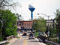
following highways pass through East Palestine: State Route 46 State Route 165 State Route 170 State Route 558 According to the United States Census Bureau...
23 KB (1,931 words) - 23:26, 19 September 2024

State Route 154 (SR 154) is a 16.27-mile-long (26.18 km) Ohio State Route that runs between Lisbon and the Pennsylvania state line in the US state of Ohio...
13 KB (1,052 words) - 22:16, 4 August 2024

State Route 344 (SR 344) is an east-west state highway lying entirely in Columbiana County, Ohio. Its western terminus is at State Route 14 and State...
3 KB (290 words) - 03:06, 2 May 2023

State Route 559 (SR 559) is a north–south state highway in the central portion of the U.S. state of Ohio. The southern terminus of the highway is at the...
4 KB (238 words) - 01:25, 5 August 2024

State Route 164 (SR 164) is a state highway passing through four counties in east-central Ohio. The route runs in a general southwest to northeast fashion...
7 KB (467 words) - 19:27, 18 May 2024

of Lawrence County, Ohio, United States. The population was 10,571 at the 2020 census. Located in southernmost Ohio along the Ohio River, it is 20 miles...
23 KB (2,369 words) - 17:23, 16 September 2024

Township. U.S. Route 27 forms the eastern edge of the CDP, leading south to Cincinnati and north to Oxford. State Routes 126 and Ohio State Route 128 run through...
9 KB (759 words) - 11:36, 23 March 2024
Interstate 290 (Massachusetts) (redirect from Massachusetts State Route 290)
(32 km), it is signed as an east–west spur route of I-90 (Massachusetts Turnpike) in Central Massachusetts. The route begins in Auburn at I-90 as a northward...
15 KB (923 words) - 11:35, 12 May 2024

Schools, Churches, Industries, Etc. Warner, Beers & Company. 1885. p. 558. "Ohio County". Jim Forte Postal History. Retrieved January 10, 2016. "Gomer...
3 KB (266 words) - 17:50, 1 May 2024

County, Ohio, United States. The population was 634 at the 2020 census. Millville sits between Oxford, Ohio and Cincinnati, Ohio along U.S. Route 27. Millville...
10 KB (964 words) - 23:28, 15 May 2024

a state highway network which includes Interstate Highways, U.S. Highways, and state routes. U.S. and Interstate highways are classified as state routes...
347 KB (2,796 words) - 03:13, 15 September 2024
List of highways numbered 1 (redirect from State Route 1)
New York State Route 1A (former) New York State Route 1B (former) New York State Route 1X (former) North Dakota Highway 1 Ohio State Route 1 (former)...
20 KB (1,282 words) - 08:59, 27 August 2024

S. Route 23 (US 23) is a 157.765-mile-long (253.898 km) United States Numbered Highway in the state of Kentucky. It travels from the Virginia state line...
20 KB (380 words) - 23:06, 8 March 2024

Wayne Township, Champaign County, Ohio, United States. It has the ZIP code 43047. It is located along State Route 245. Mingo was originally known as...
2 KB (121 words) - 21:03, 20 March 2024
Elmore is a village in Ottawa and Sandusky counties in the U.S. state of Ohio. The population was 1,370 at the 2020 census. The Ottawa County portion...
13 KB (1,347 words) - 15:17, 23 June 2024

Woodville is a village in Sandusky County, Ohio, United States. The population was 2,006 at the 2020 census. The National Arbor Day Foundation has designated...
14 KB (1,497 words) - 00:20, 16 May 2024
unincorporated community in Franklin Township, Tuscarawas County, Ohio, United States. It is on State Route 516 between Dover and Dundee. Winfield was originally...
1 KB (114 words) - 00:52, 10 March 2024

Cleveland Hopkins International Airport (redirect from Cleveland-Hopkins International Airport, Ohio)
Cleveland, Ohio, United States, and is the primary airport serving Greater Cleveland and Northeast Ohio. It is the largest and busiest airport in the state, as...
53 KB (4,549 words) - 17:30, 26 September 2024

Interstate 680 (California) (redirect from California State Route 21)
557, 558, 560..." 1965 Session of the Legislature. Statutes of California. State of California. Ch. 1372 p. 3273.: "Route 17 is from: (a) Route 1 near...
40 KB (3,734 words) - 08:18, 11 September 2024