Pithoragarh (Kumaoni: Pithor'garh) is a Himalayan town with a Municipal corporation in Pithoragarh district in the Indian state of Uttarakhand. It is the...
26 KB (2,399 words) - 02:02, 8 September 2024

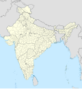
Pithoragarh district is the easternmost district in the state of Uttarakhand. It is located in the Himalayas and has an area of 7,110 km2 (2,750 sq mi)...
25 KB (1,933 words) - 07:10, 14 September 2024

Pithoragarh Airport (IATA: NNS, ICAO: VIPG), also known as Naini–Saini Airport, is a domestic airport serving Pithoragarh and Kumaon division in Uttarakhand...
9 KB (687 words) - 08:01, 7 June 2024
Pithoragarh Fort (Hindi: पिथौरागढ़ किला) is a fort in Pithoragarh in the Indian state of Uttarakhand. It was built during Chand period by regional ruler...
2 KB (111 words) - 19:54, 29 November 2021
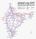
east-west direction. It starts at Malout in Punjab and ends at Pithoragarh in Pithoragarh district in Uttarakhand. It passes through the states of Punjab...
7 KB (267 words) - 03:21, 9 August 2024

six districts of the state: Almora, Bageshwar, Champawat, Nainital, Pithoragarh and Udham Singh Nagar. Historically known as Manaskhand and then Kurmanchal...
55 KB (4,787 words) - 13:12, 11 September 2024

40 10 Almora Almora Almora Municipal Corporation 39,600 1864 2024 40 11 Pithoragarh Pithoragarh Pithoragarh Municipal Corporation 62,500 1963 2024 40...
5 KB (83 words) - 05:39, 21 August 2024
both side of the river in India and Nepal. Pithoragarh-Jhulaghat road connects the Jhulaghat to Pithoragarh which is 38 KM at distance from Jhulaghat....
4 KB (354 words) - 19:39, 12 March 2023

Airport in Dehradun, Pantnagar Airport in Pantnagar, and Pithoragarh Airport in Pithoragarh are operated by the Airports Authority of India. Three airstrips...
3 KB (156 words) - 20:57, 27 January 2023

Lapthal is located in the Pithoragarh district and Chamoli district of Uttarakahand, India. Lapthal is historically part of India territory and currently...
7 KB (619 words) - 17:54, 20 July 2024

following new districts: Chakrata, from Dehradun district. Dharchula, from Pithoragarh district. Gangotri and Purola, from Uttarkashi district. Haldwani, from...
9 KB (514 words) - 12:08, 14 June 2024
Kumaoni Hindu family at Tundi village of Pithoragarh district. His ancestral village is Harkhola, Pithoragarh district in the state of Uttarakhand. His...
11 KB (689 words) - 23:07, 15 September 2024

River. The river forms the South-eastern border between the districts of Pithoragarh and Almora. Temperate and sub-Tropical forests cover the entire Catchment...
11 KB (1,003 words) - 05:13, 16 August 2024

Om Parvat is a mountain located in Pithoragarh district, Uttarakhand, India. Om Parvat's peak elevation is 5,590 m (18,340 ft) above sea level. Om Parvat...
6 KB (626 words) - 05:48, 8 June 2024
Lipulekh Pass (category Geography of Pithoragarh district)
also used by pilgrims to Kailas and Manasarovar. It is reached by the Pithoragarh-Lipulekh Pass Highway (PLPH), and a spur from Nabhidhang (Nabidhang)...
9 KB (370 words) - 13:34, 22 June 2024
Sardotsav (section 2014 in Pithoragarh)
portmanteau of Sarad (winter) and Utsav (festival). Sardotsav festivals of Pithoragarh and Nainital are most prominent. In 2014 Sardotsav took place on the...
1 KB (147 words) - 15:47, 23 October 2022

Pithoragarh Legislative Assembly constituency is one of the 70 Legislative Assembly constituencies of Uttarakhand state in India. It is part of Pithoragarh...
17 KB (232 words) - 07:53, 14 August 2024

the Champawat district of Uttarakhand, which was carved out from the Pithoragarh district by the Government of Uttar Pradesh in 1997. Total No of Tehsil...
28 KB (1,514 words) - 13:50, 22 July 2024
128 3,853 225 8 PG Pauri Garhwal Pauri 686,527 5,438 129 9 PI Pithoragarh Pithoragarh 485,993 7,110 69 10 RP Rudraprayag Rudraprayag 236,857 1,896 119...
131 KB (1,567 words) - 09:29, 16 September 2024

Mathura 1584 Najibabad 954 Naushera 1089 Nyoma 1485 Padam 1584 Pauri 1602 Pithoragarh 1602 Rampur 891 Rohtak FM 103.5 MHz Shimla 774 Budgam 1116 Budgam A 1224...
32 KB (2,861 words) - 08:47, 4 September 2024

Munsiari (category Cities and towns in Pithoragarh district)
refers to the entire region as Munsiyari Tehsil and Sub Division in the Pithoragarh District in the hill-state of Uttarakhand, India. It is a hill station...
11 KB (858 words) - 07:01, 4 August 2024

pursue a career in the Hindi film industry. Bisht was born in Gangolihat, Pithoragarh district, Uttarakhand. His grandfather died in the Indo-Pakistani War...
29 KB (1,831 words) - 10:45, 3 September 2024
referred as 'Mahar Patti'. The majority of the population is found in Pithoragarh city. 'Hilljatra' and 'Chaitol' are the key festivals of Mahar community...
3 KB (249 words) - 19:33, 31 March 2024
Haridwar Fiyajuddin Nainital SG Pipers Nainital Dr. Rohan Gupta Pithoragarh Hurricane Pithoragarh Parkash Singh & Krishna Shetty Udham Singh Nagar Indians Udham...
7 KB (325 words) - 13:40, 16 September 2024

Assam (1947) Assam (1950) Anjar (1956) Koynanagar (1967) Kinnaur (1975) Pithoragarh (1980) Cachar (1984) India (1988) Bihar (1988) Uttarkashi (1991) Latur...
177 KB (18,859 words) - 04:33, 15 September 2024
in the university campuses at Dehradun, Tehri, Tanakpur, Gopeshwar, Pithoragarh, and Uttarkashi spread all over the state. Architecture Business Management...
6 KB (513 words) - 01:56, 11 April 2024
Milam, India (redirect from Milam, Pithoragarh)
Milam is the last village situated in Johar valley of Pithoragarh district in the state of Uttarakhand, India. The river Gori Ganga originates from Milam...
6 KB (477 words) - 14:30, 13 August 2024

incorporated into Pithoragarh district in 1982 and became a part of the Champawat district, when it was carved out of Pithoragarh district in 1997. Lohaghat...
24 KB (1,046 words) - 15:45, 29 August 2024

Almora. It is 1,638 meters above sea level. The neighbouring regions are Pithoragarh district to the east, Chamoli district to the west, Bageshwar district...
21 KB (1,673 words) - 17:35, 21 August 2024

It comprises four districts namely Almora, Bageshwar, Champawat and Pithoragarh. Since 2009, this constituency is reserved for the Scheduled Caste candidates...
15 KB (222 words) - 12:25, 15 September 2024