
The Rothaarsteig is a 154.80 km long hiking trail along the crest of the Rothaargebirge mountain range in Germany in the border region between the states...
14 KB (1,682 words) - 09:08, 15 September 2023

of Orange-Nassau, as well as on the German Timber-Frame Road and the Rothaarsteig hiking trail. Dillenburg lies on the eastern edge of the Westerwald range...
17 KB (1,875 words) - 18:09, 31 March 2024

an area landmark and is one of the points along the Orange Route and Rothaarsteig. This article incorporates text from a publication now in the public...
2 KB (264 words) - 22:14, 6 March 2019

females, and 2 calves) was released into nature in April 2013 at the Rothaarsteig natural reserve near Bad Berleburg (North Rhine-Westphalia) after 850...
110 KB (11,340 words) - 23:50, 13 August 2024

association takes care of numerous footpathes and trails, for instance the Rothaarsteig, the Sauerland-Höhenflug (in German) and the Ruhrhöhenweg (in German)...
3 KB (275 words) - 18:36, 4 April 2020

direction and to Würgendorf-Wasserscheide along the same route as the Rothaarsteig. From its northernmost point at Welschen Ennest to Dornbruch/Dollenbruch...
17 KB (1,137 words) - 02:28, 16 January 2024

long newly opened ramblers' trail across the Rothaar Mountains, the Rothaarsteig. Brillion, Wisconsin is named after Brilon. Wahlergebnisse in NRW Kommunalwahlen...
17 KB (1,437 words) - 14:37, 20 August 2024

leading through forests, across mountains and through valleys. The Rothaarsteig, a hiking trail along the Rothaar Mountains from Brilon to Dillenburg...
20 KB (2,242 words) - 11:06, 23 April 2023

ridgeway in Central Germany Rheinsteig, 320-km-long trail along the Rhine Rothaarsteig, 154-km-long ridgeway along the Rothaar Mountains Klettersteig Mountain...
3 KB (368 words) - 19:04, 11 November 2023

Trödelstein Path (Trödelsteinpfad), a 10.2-kilometre-long branch of the Rothaarsteig. The E1 European long distance path runs over the mountain, crossing...
4 KB (404 words) - 17:48, 30 June 2023
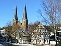
Wilgersdorf is located in a rich forestregion in the Rothaargebirge (see Rothaarsteig for the nearby hiking trail). Highest elevations of the area are the...
4 KB (506 words) - 09:08, 15 September 2023

"Wisent-welt". Retrieved 11 December 2017. Wikimedia Commons has media related to Rothaargebirge. Rothaar Mountain Region Rothaarsteig Waldskulpturenweg...
7 KB (607 words) - 15:30, 20 August 2024

Trödelstein Path (Trödelsteinpfad), a 10.2-kilometre-long branch of the Rothaarsteig. The Heller Ridgeway (Hellerhöhenweg, waymark "H") and the Siegerland...
4 KB (385 words) - 22:01, 10 July 2024
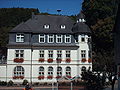
also had something to do with revitalizing the hiking trails along the Rothaarsteig, 7 km of which run through Hainchen. Hainchen also has a castle, the...
22 KB (2,922 words) - 19:55, 21 August 2024

source area is situated along the Eisenstraße scenic highway and the Rothaarsteig hiking trail. The river arises in the southeastern Rothaargebirge in...
35 KB (3,791 words) - 22:22, 4 June 2024

Burbecker Platz. A section of the long-distance footpath known as the Rothaarsteig runs by the summit to the west in a north–south direction, passing a...
5 KB (543 words) - 20:13, 20 August 2024

surrounding area is ideal for walking and hiking. Altastenberg lies on the Rothaarsteig long-distance hiking trail which runs over the Kahler Asten. There is...
4 KB (638 words) - 07:23, 13 November 2022

under the Ginsburg through the Schloßberg tunnel directly next to the Rothaarsteig is particularly picturesque. The high point of the line is directly in...
19 KB (2,261 words) - 11:58, 10 October 2023
Houplines") has been founded. Kirchhundem offers, with its location on the Rothaarsteig trail, which runs from Brilon to Dillenburg, recreational activity that...
36 KB (4,236 words) - 11:53, 20 September 2024