County routes in Ontario County, New York, provide main arterial connections that are not otherwise provided by state highways. County routes never enter...
15 KB (190 words) - 16:54, 11 March 2022
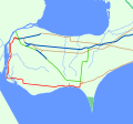
King's Highway 20, commonly referred to as Highway 20, is a provincially maintained highway in the Canadian province of Ontario. Presently, it is a short...
26 KB (1,913 words) - 13:28, 7 August 2024
This is a List of Ontario Tourist Routes throughout the province, which are designated to highlight places of cultural, environmental, or social importance...
27 KB (2,929 words) - 14:58, 29 April 2023

Ontario (/ɒnˈtɛərioʊ/ on-TAIR-ee-oh; French: [ɔ̃taʁjo]) is the southernmost province of Canada. Located in Central Canada, Ontario is the country's most...
163 KB (13,520 words) - 07:29, 1 October 2024
highway in the Canadian province of Ontario. Comprising a privately leased segment and a publicly owned segment, the route spans the entire Greater Toronto...
108 KB (8,359 words) - 20:51, 26 September 2024
Greater Toronto Area of the Canadian province of Ontario. The approximately 52-kilometre (32 mi) route is currently undergoing planning and analysis under...
69 KB (5,629 words) - 00:51, 12 September 2024

Ontario International Airport (IATA: ONT, ICAO: KONT, FAA LID: ONT) is an international airport 2 mi (3.2 km) east of downtown Ontario, in San Bernardino...
45 KB (3,609 words) - 06:06, 15 September 2024
It is also a Core Route in the National Highway System of Canada. The route is maintained by the Ministry of Transportation of Ontario (MTO) and patrolled...
232 KB (16,261 words) - 06:13, 3 September 2024
List of secondary highways in Algoma District (redirect from Ontario Route 546)
populated areas in the Algoma District of northeastern Ontario. Some of the shorter ones are also access routes for communities with moderate amounts of tourism...
35 KB (2,703 words) - 03:04, 20 June 2024
List of secondary highways in Thunder Bay District (redirect from Ontario Route 527)
in the Canadian province of Ontario, which serves to connect the small community of Hurkett to Highway 17, the main route of the Trans-Canada Highway...
30 KB (1,905 words) - 15:53, 3 September 2023
of Ontario, located entirely within Essex County. Since 1998, the majority of the former route has been known as Essex County Road 20. The route travelled...
48 KB (4,207 words) - 19:27, 24 August 2024
Highway 20 Manitoba Highway 20 New Brunswick Route 20 (former) Newfoundland and Labrador Route 20 Ontario Highway 20 Prince Edward Island Route 20 Quebec...
9 KB (588 words) - 23:41, 20 September 2024

Trans-Canada Highway (redirect from Route Transcanadienne)
continue as non-TCH routes outside the designated sections) en route. In addition, Ontario and Quebec use standard provincial highway shields to number...
69 KB (8,094 words) - 03:46, 14 September 2024
List of secondary highways in Kenora District (redirect from Ontario Route 116)
maintained secondary highway in the Canadian province of Ontario. Located in Kenora District, the route branches off Highway 17, the Trans-Canada Highway, between...
30 KB (2,153 words) - 02:37, 7 July 2023
Queen Elizabeth Way (redirect from Ontario Route QEW)
in Ontario, the QEW is directionally signed using locations along the route as opposed to cardinal directions. Driving towards Toronto, the route is signed...
101 KB (9,257 words) - 23:23, 24 August 2024

Quebec City–Windsor Corridor (category Geographic regions of Ontario)
nucleus of what later became Ontario. By contrast, many of the Ontario towns along the old fur-trading and logging route to the north, through the Ottawa...
22 KB (2,041 words) - 20:11, 20 September 2024
List of secondary highways in Cochrane District (redirect from Ontario Route 572)
connecting Iroquois Falls, Ontario to Highway 11/Trans Canada Highway, and to Highway 101. This provides a very direct route for Timmins-Iroquois Falls...
18 KB (1,354 words) - 10:20, 11 August 2022
The Ontario Provincial Highway Network consists of all the roads in Ontario maintained by the Ministry of Transportation of Ontario (MTO), including those...
119 KB (11,365 words) - 06:13, 3 September 2024
List of secondary highways in Timiskaming District (redirect from Ontario Route 558)
province of Ontario. The highway is 7.6 kilometres (4.7 mi) in length, connecting Highway 112 in Dane with the now abandoned Adams Mine site. The route was designated...
17 KB (982 words) - 16:49, 10 April 2023
as "Main Street Ontario" and was one of the first roads in what would later become Ontario. It was devised as an overland military route between York (Toronto)...
133 KB (9,551 words) - 18:45, 19 August 2024
the Canadian province of Ontario. The Ministry of Transportation of Ontario was once responsible for the length of the route, when it ran from Long Branch...
26 KB (1,820 words) - 17:53, 20 September 2024
List of secondary highways in Rainy River District (redirect from Ontario Route 600)
a secondary highway in the Canadian province of Ontario, located in Rainy River District. The route connects Highway 71 (the Trans-Canada Highway) with...
8 KB (525 words) - 15:52, 3 September 2023

eastern terminus of the highway is designated as part of the Central Ontario Route of the Trans-Canada Highway. Travelling east from Donald Cousens Parkway...
84 KB (5,116 words) - 13:48, 22 August 2024
Retrieved October 26, 2011. "Highway 416 length and route" (Map). Google Maps. Retrieved October 26, 2011. Ontario Road Map (Map). Cartography by Geomatics Office...
38 KB (3,836 words) - 17:29, 17 September 2024
route is signed at 80 km/h (50 mph). Like other provincial routes in Ontario, Highway 48 is maintained by the Ministry of Transportation of Ontario....
23 KB (1,933 words) - 15:08, 8 August 2024

in the U.S. state of Oregon. It connected US 99 in Eugene with US 30 in Ontario. It existed from 1926 to 1952. In 1937, US 28 was truncated from Florence...
5 KB (302 words) - 03:30, 23 January 2024

10. As initially announced in April 2019, the route of the Ontario Line seemed to follow much of the route of the Relief Line, beginning at Exhibition Place...
93 KB (8,564 words) - 22:57, 1 October 2024
Trans-Canada Highway (TCH), the Georgian Bay Route, and is part of the highest-capacity route from southern Ontario to the Canadian West, via a connection with...
82 KB (6,153 words) - 02:02, 1 October 2024

Several special routes of U.S. Route 20 (US 20) exist. In order from west to east, they are as follows. U.S. Route 20 Business (US 20 Bus.) in Toledo...
24 KB (2,253 words) - 02:53, 9 February 2024
McDougall Parkway. East of Algonquin Park, the route serves east–west traffic in the highlands of central Ontario. It begins at Highway 11 in Huntsville and...
18 KB (1,181 words) - 15:15, 8 August 2024