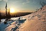
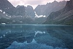
Stanovoy Highlands (Russian: Станово́е наго́рье) or Stanovoy Uplands is a mountain range in the Transbaikal region of Siberia, Russia. The Stanovoy Highlands...
5 KB (434 words) - 23:57, 17 August 2024
bound by the Olyokma River in the west (which separates it from the Stanovoy Highlands to the west) and the Uchur River in the east (which separates it from...
5 KB (404 words) - 04:26, 27 October 2024
several rural localities in Russia Stanovoy Highlands, a mountain range in the Transbaikal region of Siberia, Russia Stanovoy Range, a mountain range in the...
407 bytes (84 words) - 04:27, 4 March 2024
then northward in the Vitim Plateau. Then it flows north through the Stanovoy Highlands and the town of Bodaybo. Including river Vitimkan, its western source...
7 KB (612 words) - 02:23, 29 October 2024
Khentei-Daur Highlands Khentei Range Chikokon Range Stanovik Range Ikat Range Vitim Plateau Bolshoy Khapton Selenga Highlands Stanovoy Highlands Kalar Range...
5 KB (529 words) - 14:54, 24 October 2024
Andes, American Cordillera) Dzhugdzhur Mountains – 700 km (430 mi) Stanovoy Highlands – 700 km (430 mi) (section of the East Siberian System of mountains)...
51 KB (4,774 words) - 03:22, 15 October 2024
Olyokma-Stanovik Highlands (Олёкминский Становик), west of Mogocha. It flows through remote terrain and cuts across the Kalar Range of the Stanovoy Highlands through...
4 KB (330 words) - 12:35, 31 October 2024
Siberia - 26 Mountain Summits with Prominence of 1,500 meters or greater". Stanovoy Khrebet High Point, Russia at Peakbagger.com Kizimen V., Russia at Peakbagger...
119 KB (2,491 words) - 11:16, 16 July 2024
Kodar Mountains (category Stanovoy Highlands)
the Kalar and Udokan ranges. The Kodar Mountains are part of the Stanovoy Highlands, which range from the northern tip of Lake Baikal to the Olyokma River...
5 KB (512 words) - 23:58, 17 August 2024
Upper Angara (category Stanovoy Highlands)
lakes of the Delyun-Uran range, right by the Northern Muya Range, Stanovoy Highlands. It its upper course the river flows in a WSW direction across mountainous...
4 KB (296 words) - 05:32, 22 October 2024
Churo (category Stanovoy Highlands)
The Churo (Russian: Чуро) is a river in Buryatia, southern East Siberia, Russia. It is a tributary of the Upper Angara river of the Angara - Baikal basin...
3 KB (213 words) - 14:45, 28 March 2024
Delyun-Uran Range (category Stanovoy Highlands)
mountain range in Irkutsk Oblast and Buryatia, Russia, part of the Stanovoy Highlands. The nearest airport is Bodaybo Airport. This remote mountain area...
6 KB (484 words) - 12:11, 1 December 2023
Chara (river) (category Stanovoy Highlands)
begins as an outflow of Bolshoye Leprindo lake in the Kodar Mountains, Stanovoy Highlands in northern Zabaykalsky Krai. It flows through the Chara Basin between...
4 KB (295 words) - 09:08, 3 November 2024
Shaman (Russian: гора Шаман) is a mountain in the Southern Muya Range, Stanovoy Highlands, Russia. Administratively it is located in the Zabaykalsky Krai of...
2 KB (100 words) - 18:53, 19 July 2024
BAM Peak (category Stanovoy Highlands)
south of it. It is the highest summit of the Kodar Range and the Stanovoy Highlands, as well as of Zabaykalsky Krai. The nearest town is Novaya Chara...
2 KB (134 words) - 00:01, 3 January 2024
Leprindokan at the feet of the Kalar Range, one of the subranges of the Stanovoy Highlands. The river flows in a roughly western direction in a narrow valley...
3 KB (284 words) - 14:32, 22 October 2024
Muya (river) (category Stanovoy Highlands)
The Muya (Russian: Муя) is a left tributary of the Vitim in Buryatia, Russia. It is 365 kilometres (227 mi) long and has a drainage basin of 11,900 square...
2 KB (191 words) - 16:21, 28 March 2024
Skalisty Golets (category Stanovoy Highlands)
(Russian: Скалистый голец) is the highest peak in the Kalar Range, Stanovoy Highlands, Russia. The Skalisty Golets is a ‘’golets’’-type of mountain with...
1 KB (84 words) - 08:42, 21 October 2024
mountain range in Buryatia and Irkutsk Oblast, Russia, part of the Stanovoy Highlands. The Baikal–Amur Mainline passes at the foot of the southern side...
4 KB (297 words) - 20:10, 21 October 2024
(in Russian)". FGBU Tarhankut. Retrieved December 27, 2015. "Tokinsko-Stanovoy National Park" (in Russian). Nature Russia. Retrieved December 27, 2021...
61 KB (1,461 words) - 14:35, 11 October 2024
in the same manner as the Amga River in the west. The highlands are limited by the Stanovoy Range to the southwest, and by its Toko-Stanovik subrange...
7 KB (683 words) - 07:02, 29 July 2024
Northern Muya Range (category Stanovoy Highlands)
khrebet) is a mountain range in Buryatia, Russia, part of the Stanovoy Highlands. The Baikal Amur Mainline (BAM) railway traverses the southern end...
4 KB (335 words) - 14:04, 22 July 2024
Kodar National Park (category Stanovoy Highlands)
Kodar National Park (Russian: Национальный парк «Кодар») is located in Kodar Mountains of Russia, about 500 km northeast of Lake Baikal. The park encompasses...
6 KB (541 words) - 22:40, 29 October 2024
2,988 metres (9,803 ft) high mountain located in the Kodar Range, Stanovoy Highlands, South Siberian System. Some sources give a height of 2,932 metres...
3 KB (173 words) - 11:23, 11 July 2023
Peak Пик БАМ 3,072 metres (10,079 ft) Zabaykalsky Krai Kodar Range, Stanovoy Highlands Peak Pobeda Пик Победа 3,003 metres (9,852 ft) Yakutia Buordakh Massif...
13 KB (169 words) - 15:17, 30 June 2024
between the Lena and the Amur basins, surveying the then little-known Stanovoy Highlands. He made a significant contribution to the cartography of Eastern...
4 KB (340 words) - 15:23, 10 November 2023
Southern Muya Range (category Stanovoy Highlands)
mountain range in Buryatia and Zabaykalsky Krai, Russia, part of the Stanovoy Highlands. The highest point of the range is 3,067 m high Muisky Gigant; another...
3 KB (276 words) - 08:11, 11 July 2023
Central Siberian Plateau and to the east the Delyun-Uran Range of the Stanovoy Highlands. The average altitudes range between 1,000 meters (3,300 ft) and 1...
7 KB (725 words) - 03:20, 1 November 2024
Apsat (river) (category Stanovoy Highlands)
Location Country Russia Physical characteristics Source Kodar Range, Stanovoy Highlands Mouth Chara • coordinates 57°02′05″N 118°33′10″E / 57.0348°N 118...
1 KB (76 words) - 22:55, 10 September 2024
Lake Bolshoye Toko (category Aldan Highlands)
Aldan Highlands, on the border of Sakha Republic and Khabarovsk Krai. River Utuk flows into the lake from the Toko-Stanovik subrange of the Stanovoy Highlands...
2 KB (120 words) - 10:40, 31 October 2021


