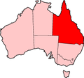
Surat Developmental Road (State Route 87) is a sealed road in the Western Downs Region, Queensland, Australia. It is a state-controlled district road...
12 KB (873 words) - 23:11, 15 August 2024
Moonie Highway (category WikiProject Australian Roads articles with a junction list using templates)
the intersection with the Surat Developmental Road. Kumbarilla is located on a ridge (Kumbarilla Ridge) which divides the Surat Basin from the Clarence-Moreton...
7 KB (549 words) - 10:30, 27 October 2024
Gregory Highway (redirect from Gregory Developmental Road)
2016 included the following project for the Gregory Developmental Road. The project to widen the road south of Charters Towers is expected to be completed...
14 KB (691 words) - 05:47, 20 January 2024
The Peninsula Developmental Road (PDR) runs 571 km (355 mi) from Lakeland to Weipa. It is the main road transport link within Cape York Peninsula and...
6 KB (500 words) - 05:35, 9 January 2024
The Burke Developmental Road is a Queensland (Australia) developmental road. It links Cloncurry and Normanton in a south–north direction, then turns to...
12 KB (573 words) - 00:31, 21 January 2024
List of highways in Queensland (category Lists of roads in Australia)
England Highway Surat Developmental Road D'Aguilar Highway – Toowoomba–Athol Road No shield Donohue Highway Bamaga Road (Telegraph Road) Birdsville Track...
5 KB (381 words) - 02:22, 30 July 2024
The Diamantina Developmental Road is a gazetted road in Queensland, Australia, that runs from Charleville in the south-central part of the state to Mount...
11 KB (502 words) - 03:05, 28 June 2024
Hervey Range Developmental Road (alternate spellings: "Herveys", "Hervey's") is a continuous 125-kilometre (78 mi) road route in the Townsville and Charters...
10 KB (836 words) - 04:16, 24 August 2024
Birdsville Developmental Road (State Route 14) is a mostly unsealed road in south-west Queensland that branches off the Diamantina Developmental Road at a point...
3 KB (241 words) - 23:26, 22 May 2022
Carnarvon Highway (category WikiProject Australian Roads articles with a junction list using templates)
and Mungindi. Moree Ashley Garah Mungindi St George Surat Roma Injune Rolleston Australian Roads portal New South Wales portal Queensland portal Highways...
20 KB (1,518 words) - 08:37, 5 January 2024
Gulf Developmental Road is an Australian highway linking the Cairns and Normanton regions in northern Queensland, Australia. It is the only sealed (asphalt)...
6 KB (460 words) - 12:01, 23 May 2024
Dawson Highway (redirect from Dawson Developmental Road)
Dawson Developmental Roads, the following state-controlled roads, from east to west, intersect with the Dawson Highway: Gladstone–Mount Larcom Road Gladstone–Benaraby...
20 KB (1,285 words) - 20:52, 28 July 2024
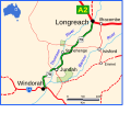
The Thomson Developmental Road is a designated sealed road in from Longreach to Windorah in Queensland, Australia. The length is 319 kilometres (198 mi)...
2 KB (118 words) - 08:22, 23 July 2023
The town is at the junction of the Leichhardt Highway and the Surat Developmental Road on the Darling Downs, 329 kilometres (204 mi) west of the state...
9 KB (860 words) - 01:55, 15 November 2024
The Bulloo Developmental Road is an outback road in Queensland, Australia. It is part of the Adventure Way, a route from Brisbane to Adelaide via the...
5 KB (183 words) - 04:11, 12 January 2024
Burnett Highway (redirect from Murgon–Barambah Road)
Kilkivan–Tansey Road Murgon–Gayndah Road Gayndah–Mount Perry Road Mundubbera–Durong Road Eidsvold–Theodore Road Wuruma Dam Road Monto–Mount Perry Road Gladstone–Monto...
15 KB (910 words) - 06:03, 27 April 2024
The Wills Developmental Road is a road in north-west Queensland running between Julia Creek and Burketown. As of 2016 it is sealed with a total length...
5 KB (186 words) - 05:20, 14 February 2024
The Fitzroy Developmental Road (The Beef Road) is a designated road in the Central Highlands Region of Queensland consisting of three separate sections...
8 KB (435 words) - 03:26, 10 June 2024
Flinders Highway, Queensland (redirect from Julia Creek–Kynuna Road)
Burke Developmental Roads, the following state-controlled roads, from east to west, intersect with the Flinders Highway: Townsville Port Road Townsville...
19 KB (1,267 words) - 00:30, 5 May 2024
Kennedy Highway (redirect from Kennedy Developmental Road)
from Smithfield, on the northern outskirts of Cairns, to the Gulf Developmental Road in the vicinity of Forty Mile Scrub and Undara Volcanic national parks...
20 KB (1,055 words) - 05:45, 20 January 2024
Brisbane Valley Highway (redirect from Forest Hill–Fernvale Road)
Gatton–Esk Road Esk–Hampton Road Esk–Kilcoy Road Forest Hill–Fernvale Road is a state-controlled district road (number 412) rated as a local road of regional...
13 KB (759 words) - 12:20, 15 July 2024
The Suttor Developmental Road is a state-controlled regional road (number 82A) part of which is rated as a local road of regional significance (LRRS)....
6 KB (361 words) - 11:17, 15 July 2024
Castlereagh Highway (redirect from A55 road (Queensland))
construction, maintenance, and financing of main roads; to provide for developmental roads; to constitute a Main Roads Board Archived 11 August 2022 at the Wayback...
21 KB (1,602 words) - 06:36, 13 August 2024
Leichhardt Highway (category WikiProject Australian Roads articles with a junction list using templates)
Queensland Government - Department of Transport and Main Roads - Maps Hema, Maps (2007). Australia Road and 4WD Atlas (Map). Eight Mile Plains Queensland: Hema...
9 KB (266 words) - 22:59, 27 May 2024
The Eyre Developmental Road is a gazetted road in south-west Queensland that runs from Bedourie to Birdsville and then to the border with South Australia...
3 KB (212 words) - 05:59, 21 October 2022
Garbutt–Upper Ross Road Herveys Range Developmental Road Shaw Road North Townsville Road Mount Spec Road Ingham–Abergowrie Road Mount Spec Road is a state-controlled...
40 KB (3,168 words) - 15:45, 4 April 2024
Crossing Road Kalbar Connection Road Boonah–Fassifern Road Lake Moogerah Road New England Highway Freestone Road Warwick–Yangan Road Warwick–Allora Road Warwick–Killarney...
22 KB (1,702 words) - 04:45, 19 October 2024
The Cooper Developmental Road is an outback road in Queensland, Australia. It is sometimes called the Cooper's Creek Developmental Road. It commences at...
2 KB (149 words) - 21:50, 20 February 2023
Bowen Developmental Road is a state-controlled district road (numbers 88A and 88B) rated as a local road of regional significance (LRRS). It is a rural...
8 KB (523 words) - 05:40, 9 January 2024
Haigslea–Amberley Road Rosewood–Marburg Road Laidley–Plainland Road Forest Hill–Fernvale Road Gatton–Esk Road Gatton–Helidon Road Toowoomba Second Range...
23 KB (1,837 words) - 00:40, 22 January 2024


