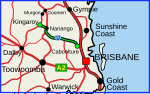
Tin Can Bay Road is a continuous 56.1 kilometres (34.9 mi) road route in the Gympie region of Queensland, Australia. Part of it is signed as State Route...
14 KB (1,179 words) - 18:19, 25 July 2024

Shelter Gympie Road: Tin Can Bay Memorial Hall 22 – 24 Gympie Road: Tin Can Bay Church Tin Can Bay Road: Wide Bay Military Reserve Tin Can Bay State School...
17 KB (1,527 words) - 09:00, 15 June 2024
Wide Bay Military Reserve is a heritage-listed military installation at Tin Can Bay Road, Tin Can Bay, Queensland, Australia. The reserve supports a diverse...
12 KB (1,435 words) - 08:47, 2 April 2024
Maryborough–Cooloola Road and Pialba–Burrum Heads Road: Tin Can Bay Road Burrum Heads Road Burrum Heads Road is a state-controlled district road (number 1603)...
16 KB (1,326 words) - 17:36, 25 July 2024
Connection Road Cooroy–Gympie Road Mary Valley Link Road Tin Can Bay Road Gympie–Woolooga Road Gympie Connection Road The following state-controlled roads intersect...
40 KB (3,348 words) - 15:45, 4 April 2024

and the western side of Tin Hau Temple Road, remain in the Eastern District. Town planning is managed by the Causeway Bay Outline Zoning Plan, which...
14 KB (1,614 words) - 00:02, 26 June 2024
Cleveland–Redland Bay Road is a continuous 15.2 kilometres (9.4 mi) road route in the Redland local government area of Queensland, Australia. The route...
15 KB (1,236 words) - 16:48, 25 July 2024

these temples can be found below. Famous Tin Hau temples in Hong Kong include: Tin Hau temple, located at 10 Tin Hau Temple Road, Causeway Bay, east of Victoria...
110 KB (1,504 words) - 22:39, 6 June 2024
Crossing Road Kalbar Connection Road Boonah–Fassifern Road Lake Moogerah Road New England Highway Freestone Road Warwick–Yangan Road Warwick–Allora Road Warwick–Killarney...
22 KB (1,802 words) - 22:38, 9 February 2024
Haigslea–Amberley Road Rosewood–Marburg Road Laidley–Plainland Road Forest Hill–Fernvale Road Gatton–Esk Road Gatton–Helidon Road Toowoomba Second Range...
23 KB (1,932 words) - 00:40, 22 January 2024
roads: Brighton–Redcliffe Road (see below for component bridges and roads) Clontarf–Anzac Avenue Road (Elizabeth Avenue, Snook Street) Deception Bay Road...
13 KB (1,137 words) - 17:59, 25 July 2024

A can opener (North American and Australian English) or tin opener (British English) is a mechanical device used to open metal tin cans. Although preservation...
27 KB (3,210 words) - 19:51, 29 June 2024
Marlborough–Sarina Road is a state-controlled district road (number 512) rated as a local road of regional significance (LRRS). It runs from the Bruce...
18 KB (1,471 words) - 05:56, 19 December 2023
Douglas–Garbutt Road Garbutt–Upper Ross Road North Townsville Road North Ward Road Ross River Road Shaw Road South Townsville Road Townsville Connection Road Townsville...
29 KB (2,361 words) - 18:21, 25 July 2024
Range Crossing, but traffic can transition between them via the Hermitage Road intersection. The following state-controlled roads intersect with section 22B:...
12 KB (1,052 words) - 01:05, 22 January 2024
D'Aguilar Highway (redirect from Caboolture Connection Road)
entire road is within the Moreton Bay local government area. Esk–Kilcoy Road is a state-controlled district road (number 405) rated as a local road of regional...
22 KB (1,114 words) - 16:52, 25 July 2024
population of 367 people. Tin Can Bay Road (State Route 15) enters the locality from the south-west. Kin Kin Road splits from Tin Can Bay Road at Canina and proceeds...
4 KB (219 words) - 03:17, 30 June 2024
Road routes in Queensland assist drivers navigating roads throughout the state, by identifying important through-routes. Queensland is in the process...
81 KB (670 words) - 20:26, 24 January 2024

Bruce Highway (category WikiProject Australian Roads articles with a junction list using templates)
from the Wide Bay Highway interchange to the Maryborough–Biggenden Road interchange at Maryborough passes through Tiaro and the Gympie Road exit to Maryborough...
103 KB (5,398 words) - 16:42, 25 July 2024

Flinders Highway, Queensland (redirect from Julia Creek–Kynuna Road)
Road Burdekin Falls Dam Road Aramac–Torrens Creek Road Hughenden–Muttaburra Road Richmond–Winton Road Julia Creek–Kynuna Road Julia Creek–Kynuna Road...
19 KB (1,272 words) - 00:30, 5 May 2024
place on the coach road from Mareeba to Herberton. A survey for a town in Carrington was done in 1884. Herberton was established as a tin mining town in 1880...
8 KB (690 words) - 16:32, 25 July 2024

Dawson Highway (redirect from Dawson Developmental Road)
Gladstone–Benaraby Road Gladstone–Monto Road Biloela–Callide Road Blackwater–Rolleston Road Orion Ten Chain Road Biloela–Callide Road is a state-controlled...
20 KB (1,305 words) - 20:52, 28 July 2024
entire road is within the Moreton Bay local government area. The following state-controlled roads intersect with Road 1: Western Arterial Road Everton...
28 KB (1,684 words) - 17:25, 5 April 2024
Castlereagh Highway (redirect from A55 road (Queensland))
October 1997, subsuming Main Road 77 (previously Trunk Road 77). The southern end of Main Road 56 (previously Trunk Road 56) was truncated to meet State...
21 KB (1,617 words) - 20:23, 18 May 2024

Causeway Bay Market are located there. Electric Road King's Road (partially) Hong Kong Central Library (Tin Hau MTR Exit B's name) Victoria Park (Tin Hau MTR...
3 KB (323 words) - 07:08, 28 August 2022
state-controlled roads: Gladstone–Benaraby Road Boyne Island Road Gladstone Port Access Road Gladstone–Mount Larcom Road Boyne Island Road is a state-controlled...
3 KB (267 words) - 00:03, 5 March 2024

Birdsville Track (category WikiProject Australian Roads articles with a junction list using templates)
distance. Other than this, the road has no major intersections. Fuel, supplies and facilities, including a hotel, can be found on the track at the Mungeranie...
10 KB (861 words) - 12:52, 22 June 2024

Administratively, it is part of the Sha Tin District. Sha Tin is one of the neighbourhoods of the Sha Tin New Town project. The new town was founded...
26 KB (2,390 words) - 05:56, 27 July 2024
Main Roads ©State of Queensland [CC BY 4.0]. 2020. Retrieved 29 May 2023. "Wide Bay Burnett district map" (PDF). Department of Transport and Main Roads ©State...
14 KB (1,151 words) - 17:43, 25 July 2024
Beenleigh–Redland Bay Road is a continuous 16.5 kilometres (10.3 mi) road route in the Logan and Redland local government areas of Queensland, Australia...
8 KB (625 words) - 16:35, 25 July 2024