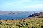
Tomales Bay State Park is a California state park in Marin County, California. It consists of approximately 2,000 acres (8 km²) divided between two areas...
4 KB (435 words) - 11:20, 1 March 2024
the east shore of the bay. Satellite picture of Tomales Bay San Francisco Bay Area portal Hog Island (Tomales Bay) Drakes Bay — adjacent to the south...
12 KB (1,165 words) - 00:53, 18 October 2024
California), a beach within Tomales Bay State Park in Marin County, California Indian Beach (Oregon), a beach within Ecola State Park in Oregon Indian Beach...
465 bytes (94 words) - 20:08, 26 October 2020
to Tomales Bay in the West Marin area of Marin County, California. While waters to its west are deep enough for small ships to enter Tomales Bay, at...
6 KB (579 words) - 00:42, 15 September 2024
Bodega Bay sits on the east side of Bodega Harbor. The bay connects on its south end to the mouth of Tomales Bay. Streams flowing into Bodega Bay include...
16 KB (1,693 words) - 17:27, 25 October 2024
County state parks, Olompali State Historic Park and Tomales Bay State Park. A revised agreement in 2013 returned operation of Olompali and Tomales Bay parks...
14 KB (1,521 words) - 21:07, 2 March 2024
California, United States. It is located on the southwest shore of Tomales Bay 3.5 miles (5.6 kilometers) northwest of Point Reyes Station and about...
13 KB (1,209 words) - 20:54, 5 June 2024
Historic Parks Parks in California California Department of Parks and Recreation "California State Park System Statistical Reports". California State Parks. Retrieved...
95 KB (1,656 words) - 20:59, 19 October 2024
Emerald Bay State Park is a state park of California in the United States, centered on Lake Tahoe's Emerald Bay, a National Natural Landmark. Park features...
4 KB (364 words) - 11:06, 21 November 2024
National Historic Landmark District on October 17, 2012. New Albion Tomales Bay Drake's Plate of Brass Camp Hydle List of National Historic Landmarks...
6 KB (487 words) - 00:54, 22 May 2024
Morro Bay State Park is a state park on the Morro Bay lagoon, in western San Luis Obispo County, on the Central Coast of California. On the lagoon's northeastern...
4 KB (333 words) - 19:43, 19 July 2024
List of beaches in California (redirect from List of state beaches in California)
Park Healdsburg Veterans Memorial Beach (1799231) Tomales Bay State Park Point Reyes National Seashore Mount Tamalpais State Park Stinson Beach Park Golden...
27 KB (1,188 words) - 21:31, 2 August 2024
Marin County, California (category Counties in the San Francisco Bay Area)
Camp State Park Mount Tamalpais State Park Olompali State Historic Park Samuel P. Taylor State Park Tomales Bay State Park Like underwater parks, these...
93 KB (5,607 words) - 10:33, 22 November 2024
California State Parks is the state park system for the U.S. state of California. The system is administered by the California Department of Parks and Recreation...
19 KB (1,722 words) - 08:54, 14 November 2024
Redwood National Park, Del Norte Coast Redwoods State Park, Jedediah Smith Redwoods State Park, and Prairie Creek Redwoods State Park. The parks' 139,000 acres...
90 KB (8,730 words) - 19:02, 19 November 2024
Coast Miwok (category History of the San Francisco Bay Area)
this article's map, lumps them into a single tribelet.) North Tomales Bay South Tomales Bay The Coast Miwok language is still spoken, but the Bodega dialect...
37 KB (4,116 words) - 00:49, 28 October 2024
Marin Conservation League (category Environmental organizations based in the San Francisco Bay Area)
State Park. In 1945, they helped obtain the land for the Marin Art and Garden Center. After World War II, the League also helped create Tomales Bay State...
4 KB (342 words) - 14:58, 27 September 2023
Angel Island (California) (redirect from Angel Island State Park)
island in San Francisco Bay. The entire island is included within Angel Island State Park, administered by California State Parks. The island, a California...
43 KB (4,642 words) - 00:21, 22 November 2024
Anza-Borrego Desert State Park (/ˈænzə bəˈreɪɡoʊ/, AN-zə bə-RAY-goh) is a California State Park located within the Colorado Desert of Southern California...
36 KB (3,853 words) - 02:10, 13 November 2024
Point Reyes (category Landforms of the San Francisco Bay Area)
in March 1836. Named Rancho Tomales y Baulines, it is believed to have included the entire Olema Valley from Tomales Bay to Bolinas Lagoon, although its...
43 KB (5,473 words) - 00:01, 18 November 2024
Handbook: Environmental Living Program, Tomales Bay State Park" (PDF). parks.ca.gov. California State Parks. Archived (PDF) from the original on 25 November...
15 KB (1,651 words) - 20:50, 15 October 2024
Park Antelope Valley Indian Museum State Historic Park Bale Grist Mill State Historic Park Benicia Capitol State Historic Park Bidwell Mansion State Historic...
3 KB (350 words) - 05:49, 2 August 2023
California (redirect from State of California, United States)
admitted as the 31st state in 1850, as a free state, following the Compromise of 1850. The Greater Los Angeles and San Francisco Bay areas are the nation's...
275 KB (23,810 words) - 23:07, 21 November 2024
"The Everything Park". Bay Nature. 24 (2): 28–33. Central Valley Vision Implementation Plan (PDF) (Report). California State Parks. 2009. Retrieved March...
8 KB (644 words) - 02:47, 29 September 2024
National Park Service Pinnacles National Park maps, U.S. National Park Service Pinnacles National Park at San Francisco Bay Area National Parks Science...
39 KB (4,247 words) - 16:58, 5 October 2024
Año Nuevo State Park is a state park of California, United States, encompassing Año Nuevo Island and Año Nuevo Point, which are known for their pinniped...
10 KB (1,137 words) - 13:01, 24 October 2024
Point Reyes National Seashore (category National Park Service areas in California)
climbed to over 440 elk at Tomales Point's 2,600 acres (1,100 ha) of coastal scrub and grasslands. In 1999, 100 elk from Tomales Point were moved to the...
41 KB (4,227 words) - 00:29, 1 November 2024
instead heads towards, and then along, the eastern shore of Tomales Bay. Leaving Tomales Bay, SR 1 heads further inland to intersect with Valley Ford Road...
137 KB (9,304 words) - 17:03, 2 November 2024
Point Arena State Marine Conservation Area) Bodega Head (see also Bodega Head State Marine Conservation Arena) Point Tomales (see Tomales Bay) Tiburon Peninsula...
6 KB (571 words) - 17:32, 2 March 2024
Mount Diablo (redirect from Mt. Diablo State Park)
Road. The peak is in Mount Diablo State Park, a state park of about 20,000 acres (8,000 hectares). The state park was the first public open space established...
60 KB (6,871 words) - 08:55, 21 October 2024


