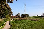
Wyre Estuary Country Park is located in Thornton-Cleveleys, Lancashire, England. Established in 1991 and covering 0.79 acres (0.32 ha), it is situated...
6 KB (430 words) - 01:37, 18 August 2024
The River Wyre, in Lancashire, England, flows into the Irish Sea at Fleetwood. It is 28 miles (45 km) long and has a sheltered estuary which penetrates...
13 KB (1,014 words) - 23:04, 11 November 2024
points are the Wyre Estuary Country Park, the Shard Riverside Inn, Garstang Tourist Information, and Stoops Bridge in Abbeystead. A Wyre Way waymark stone...
3 KB (211 words) - 12:26, 21 March 2024
Cockle Hall (category Geography of the Borough of Wyre)
England. Located in today's Wyre Estuary Country Park, it was the location of one of the earliest crossings of the River Wyre, and was used as such until...
4 KB (321 words) - 16:00, 25 July 2024
Hillylaid Pool (category Rivers of the Borough of Wyre)
pumping station on River Road, beside the entrance to Wyre Estuary Country Park. It was the subject of Wyre River Trust's Hillylaid Pool Wetland Project in...
5 KB (341 words) - 01:40, 18 August 2024
Wardleys, Hambleton (category Buildings and structures in the Borough of Wyre)
from the pub car park across the River Wyre to the ICI works at Thornton and Fleetwood Wardleys Pub viewed from Wyre Estuary Country Park in Stanah, 2007...
7 KB (377 words) - 21:03, 20 November 2024
Fleetwood (redirect from Fleetwood-on-Wyre)
Fleetwood is a coastal town in the Borough of Wyre in Lancashire, England, at the northwest corner of the Fylde. It had a population of 25,939 at the 2011...
77 KB (8,387 words) - 03:41, 19 October 2024
(26 km) to Ribbesford, a few miles south of Bewdley, Worcestershire in the Wyre Forest. The area is about 25 miles (40 km) due west of Birmingham. There...
6 KB (698 words) - 16:34, 19 December 2023
River Severn (section Severn Estuary)
River Wye and the Bristol Avon, both of which flow into the Severn Estuary. The Estuary discharges into the Bristol Channel, which opens into the Celtic...
53 KB (5,647 words) - 13:14, 8 November 2024
The Rance Tidal Power Station is a tidal power station located on the estuary of the Rance River in Brittany, France. Opened in 1966 as the world's first...
11 KB (1,139 words) - 15:44, 28 September 2024
The major rivers of the county are, from north to south, the Lune, the Wyre, and the Ribble, which all flow west into the Irish Sea. The highest point...
96 KB (8,702 words) - 19:29, 1 November 2024
feeding grounds around Southport and Over Wyre. Many pintail and other ducks feed and rest in the estuary. There are 80 hectares of sand dune habitat...
67 KB (6,724 words) - 17:22, 13 November 2024
Weald (Kent, East Sussex, West Sussex and Surrey) Wychwood (Oxfordshire) Wyre Forest (on the border of Worcestershire and Shropshire) All of these were...
16 KB (1,841 words) - 21:30, 18 May 2024
is a county in the west of Wales. It borders Gwynedd across the Dyfi estuary to the north, Powys to the east, Carmarthenshire and Pembrokeshire to the...
40 KB (3,931 words) - 09:08, 8 November 2024
miles (122 km), the boundary between Ceredigion and Pembrokeshire. Its estuary is northwest of Cardigan, known in Welsh as Aberteifi, meaning 'mouth of...
17 KB (1,641 words) - 09:32, 8 November 2024
the licences for The Wyre and The Severn from MNA Broadcasting. 7 February – UTV Media unveils plans to merge The Wolf, The Wyre and The Sever and rebrand...
169 KB (18,890 words) - 17:22, 2 November 2024
Ystwyth flows westwards before its confluence with the Afon Rheidol and the estuary at Aberystwyth to drain into Cardigan Bay. The Ystwyth valley is sparsely...
6 KB (560 words) - 17:57, 7 November 2024
bridge. Other midstream moorings exist from Cardigan downstream to the estuary and there are occasional slipways on both sides of the river. There is...
41 KB (3,992 words) - 15:04, 8 November 2024
52 metres (171 ft) a.s.l., and 38 acres (15 ha) in area. Lying in the estuary of the River Teifi, it is known for having a small colony of grey seals...
5 KB (356 words) - 03:08, 8 November 2024
Speke is Estuary Commerce Park. Further to south is Prinovis UK and B & M (previously in Blackpool) on the Liverpool International Business Park; on the...
179 KB (17,042 words) - 21:27, 5 November 2024
United Kingdom List of tunnels in the United Kingdom List of bridges by country Category:Bridges across the River Wear Crossings of the River Severn Category:Crossings...
69 KB (258 words) - 13:05, 8 October 2024
(2022). The neighbouring districts are Ribble Valley, South Ribble, Fylde and Wyre. The district is named after its largest settlement, Preston, which lies...
43 KB (2,828 words) - 17:09, 2 October 2024
Borth Welsh: Y Borth Borth with Cors Fochno, the River Dyfi estuary and Aberdyfi in the background Borth Location within Ceredigion Population 1,399 (2011)...
11 KB (1,108 words) - 08:19, 8 November 2024
Regulations 2023 251 The Air Navigation (Restriction of Flying) (St Michael's on Wyre) Regulations 2023 252 The Public Service Pensions Revaluation Order 2023...
222 KB (71 words) - 02:10, 14 September 2024
home to many rare plants and animals. The sands of the estuary beach can be driven onto and parked upon. The nature reserve has a visitor centre with toilets...
4 KB (371 words) - 14:07, 1 September 2024
an inlier at Pontrhydfendigaid, bounded to the north by a branch of the Wyre Fault running along the Ystwyth valley. The extreme east and the southeast...
12 KB (1,584 words) - 23:03, 31 December 2023
Co. Limerick; traditionally the site is below the meeting of the Marshaw Wyre and the Tarnbrook Wyre, on the north bank of the Abbeystead reservoir...
24 KB (2,841 words) - 12:34, 15 September 2024
westwards before reaching its confluence with the Afon Ystwyth and the estuary at Aberystwyth to drain into Cardigan Bay. (52°24′26″N 4°05′23″W / 52...
8 KB (874 words) - 17:26, 9 November 2024
it evolved into a small half-tide harbour for recreational craft. The estuary is also crossed by a wooden pedestrian bridge. Crafts were an important...
15 KB (1,512 words) - 23:54, 3 November 2024
Hayle Estuary SSSI Lymsworthy Meadows SSSI Marazion Marsh SSSI Meddon Moor SSSI Porth Kidney Sands SSSI Tamar Estuary complex Estuary Estuary birds IBA...
19 KB (207 words) - 23:09, 29 August 2024


