
The A428 road is a major road in central and eastern England. It runs between the cities of Coventry and Cambridge by way of the county towns of Northampton...
13 KB (1,167 words) - 15:52, 7 September 2024

dual carriageway, to be renamed A421, mostly paralleling the existing A428 road, between the A1 south of St Neots and Caxton Gibbet, with enlarged junctions...
14 KB (1,323 words) - 07:21, 1 October 2024

The A421 is an important road for east/west journeys across south central England. Together with the A428, the A43 and A34, it forms the route from Cambridge...
13 KB (1,293 words) - 20:42, 26 September 2024

north-west of Northampton and 7 miles (11 km) east of Rugby and just off the A428 road which by-passes the village. The population of civil parish was 1,718...
7 KB (673 words) - 12:16, 10 August 2024
Eaton Socon (section The Great North Road in 1794)
River Great Ouse, and is bounded on the west by the A1 road and on the south by the A428 road (St Neots by-pass). On the north side Duloe Brook delineates...
28 KB (3,950 words) - 17:20, 29 September 2024
district of South Cambridgeshire. It is a new settlement and lies on the A428 road between Cambridge, 9 miles (14 km) to the east, and St Neots and Bedford...
24 KB (2,742 words) - 21:15, 28 July 2024
eastern side of the town, east of the East Coast main line and next to the A428 road. The site of Wintringham was previously part of the Eynesbury Hardwicke...
2 KB (153 words) - 18:00, 19 September 2024

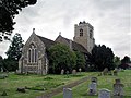
is 5 miles (8 km) east of central Coventry, on the A428 road, east of the junction with the A46 road. The small village of Brandon lies 1.5 miles (2.4 km)...
8 KB (741 words) - 18:59, 9 July 2024

medieval bridge over the River Great Ouse that, until 1986, carried the main A428 road over the river on 26 arches. The watermill is referred to in the Domesday...
5 KB (543 words) - 17:47, 19 April 2024

located around 2 miles (3.2 km) west of Bedford town centre near the A428 road. It forms part of the wider Bedford urban area. The earliest archaeological...
5 KB (377 words) - 03:33, 19 June 2024
and Bicester. Of the proposed Oxford–Cambridge Expressway, the existing A428 road is expressway standard (grade separated dual carriageway) only between...
15 KB (1,616 words) - 23:49, 16 October 2023

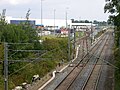
continues past Bar Hill towards Cambridge to meet the end of the M11 and the A428 at the Girton Interchange. The A14 continues easterly over northern Cambridge...
57 KB (4,746 words) - 21:17, 28 August 2024
Caxton Gibbet stands by the side of the A428 road, north of Caxton village. The roundabout at the junction of the A428 and A1198 is also known as Caxton Gibbet...
9 KB (997 words) - 03:23, 20 August 2024

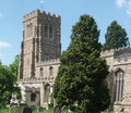
south (which is within the parish). The village sits just north of the A428 road between Rugby and Coventry. The Rugby to Coventry railway line runs through...
12 KB (1,164 words) - 22:44, 14 January 2024

county town of Northampton and is skirted on its south side by the main A428 road to Bedford. The village's name means 'rod wood/clearing', a place where...
9 KB (1,198 words) - 14:36, 19 August 2024

River Great Ouse, to the south of Hen Brook, and to the north-west of the A428 road (St Neots by-pass). It has a range of local shops for necessities and...
28 KB (3,782 words) - 09:53, 2 October 2024
Rugby, Warwickshire (section Roads)
and the A5, A14 and A45 roads. Other main roads in the town include the A426 road, the A428 road and the Rugby Western Relief Road, which links the A45 with...
88 KB (9,175 words) - 14:38, 26 August 2024

Road Eaton Socon Lock A428 Road bridge A1 Tempsford Bridges River Ivel Roxton Lock Gt Barford Lock Site of Old Lock Willington Lock A421 Road bridge...
41 KB (4,805 words) - 22:22, 4 October 2024
corner junction. Biggleswade south. Biggleswade North, Sandy A603, Blackcat A428/A4211, lastly Buckden, then there are no more roundabouts for 276 mi (444 km)...
74 KB (4,295 words) - 14:38, 17 September 2024
north–south through the parish. The parish's northern boundary is the A428 road, Cambridgeshire is to the east and Central Bedfordshire to the south....
9 KB (901 words) - 21:32, 8 September 2024

an extended A428. The route through Felixstowe at the end of the A14 is now the A154. The road starts on the A4540 Birmingham Ring Road, bypassing Small...
23 KB (1,356 words) - 00:56, 30 July 2024
facility is located at the junctions between the M1 motorway, A5 and A428 roads, 4 miles (6 km) east of Rugby and 6 miles (10 km) north of Daventry; it...
17 KB (1,515 words) - 00:49, 24 March 2024
Century. It is now grade II* listed. The main road between Coventry and Northampton (now the A428 road) runs through upper Hillmorton, and at one time...
15 KB (1,521 words) - 09:50, 3 September 2024

Black Cat Roundabout (category A1 road (Great Britain))
Black Cat Roundabout is on the junction between the A1 and A421 (formerly A428) just south of St Neots. It has been reconstructed twice since 2000 and,...
7 KB (703 words) - 17:16, 14 September 2024
at Junction 14 via the A509), and the A428, which runs between Coventry and Cambridge. Bedford lies on the A6 road, and two of the most important north-south...
8 KB (879 words) - 14:53, 6 June 2023

List of A roads in zone 5 in Great Britain starting north/east of the A5, west of the A6, south of the Solway Firth/Eden Estuary (roads beginning with...
53 KB (46 words) - 09:19, 23 August 2024
about 7 miles (11 km) west of Bedford town centre. The village is on the A428 road between Bedford and Northampton, close to the border with Buckinghamshire...
8 KB (792 words) - 20:47, 30 January 2023

List of A roads in zone 4 in Great Britain starting north of the A4 and south/west of the A5 (roads beginning with 4). Only roads that have individual...
70 KB (79 words) - 20:36, 17 September 2024

city of Cambridge, England. The village lies immediately south of the A428 road between Cambridge and St Neots. It is about 4 miles (6.4 km) east of the...
8 KB (898 words) - 10:37, 30 September 2024