21 routes assigned to the "E" zone of the California Route Marker Program, which designates county routes in California. The "E" zone includes county highways...
45 KB (2,559 words) - 01:21, 30 March 2024
34 routes assigned to the "S" zone of the California Route Marker Program, which designates county routes in California. The "S" zone includes county highways...
107 KB (6,573 words) - 21:57, 4 August 2024
County routes in the U.S. state of California are controlled and maintained by the respective counties in which they are located. However, they are generally...
50 KB (444 words) - 00:29, 25 April 2024

California. At 656 miles (1,056 km), it is the longest state route in California, and the second-longest in the US after Montana Highway 200. SR 1 has several portions...
136 KB (9,236 words) - 02:24, 29 July 2024

Southern California, United States. As of the 2020 census, the population was 3,186,989, making it the third-most-populous county in California, the sixth-most-populous...
213 KB (16,677 words) - 20:15, 6 August 2024

98°W / 33.73; -115.98 Riverside County is a county located in the southern portion of the U.S. state of California. As of the 2020 census, the population...
141 KB (6,167 words) - 16:50, 30 July 2024

both Route 7 and Route 710. The California Streets and Highways Code defines Route 710 as follows: 622. Route 710 is from Route 1 to Route 210 in Pasadena...
41 KB (3,297 words) - 05:14, 28 July 2024

Contra Costa County (/ˌkɒntrə ˈkɒstə/ ; Contra Costa, Spanish for 'Opposite Coast') is a county located in the U.S. state of California, in the East Bay...
137 KB (8,708 words) - 19:53, 31 July 2024

Alameda County (/ˌæləˈmiːdə/ AL-ə-MEE-də) is a county located in the U.S. state of California. As of the 2020 census, the population was 1,682,353, making...
91 KB (5,005 words) - 10:42, 25 July 2024

Dixie Fire (redirect from Devil's Punchbowl (Plumas County, California))
enormous wildfire in Butte, Plumas, Lassen, Shasta, and Tehama counties in Northern California. Named after a nearby Dixie Road, the fire began in the Feather...
133 KB (9,154 words) - 15:58, 17 July 2024

Santa Clara County, officially the County of Santa Clara, is the sixth-most populous county in the U.S. state of California, with a population of 1,936...
108 KB (6,313 words) - 07:56, 2 August 2024

San Mateo County (/ˌsæn məˈteɪ.oʊ/ SAN mə-TAY-oh), officially the County of San Mateo, is a county in the U.S. state of California. As of the 2020 census...
113 KB (5,953 words) - 07:57, 8 August 2024

Interstate 15 (redirect from Interstate 15 (California–Montana))
in the Western United States, running through Southern California and the Intermountain West. I-15 begins near the Mexican border in San Diego County...
28 KB (2,690 words) - 01:50, 5 August 2024
Hinkley is an unincorporated community in the Mojave Desert, in San Bernardino County, California, United States, 14 miles (23 km) northwest of Barstow...
9 KB (707 words) - 04:47, 25 April 2024

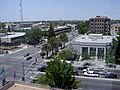
Atascadero (Spanish for "Mire") is a city in San Luis Obispo County, California, United States, located on U.S. Route 101. Atascadero is part of the San Luis...
31 KB (3,213 words) - 04:37, 2 August 2024
Kern County is a county located in the U.S. state of California. As of the 2020 census, the population was 909,235. Its county seat is Bakersfield. Kern...
120 KB (6,592 words) - 04:15, 1 August 2024
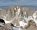
It offers climbers at least a dozen routes, from multiple scrambling routes (class 3) to a serious technical route (Grade IV, 5.10). Mount Russell sees...
5 KB (426 words) - 15:58, 8 November 2023

Ventura County (/vɛnˈtʊərə/ ) is a county located in the southern part of the U.S. state of California. As of the 2020 census, the population was 843,843...
140 KB (10,530 words) - 22:16, 18 July 2024

August Complex fire (category Wildfires in Glenn County, California)
wildfire that burned in the Coast Range of Northern California, in Glenn, Lake, Mendocino, Tehama, Trinity, and Shasta Counties. The complex originated...
67 KB (5,281 words) - 14:52, 2 August 2024

Monterey County (/ˌmɒntəˈreɪ/ MON-tə-RAY), officially the County of Monterey, is a county located on the Pacific coast in the U.S. state of California. As...
88 KB (4,430 words) - 02:56, 20 July 2024

California is a state in the Western United States, lying on the American Pacific Coast. It borders Oregon to the north, Nevada and Arizona to the east...
280 KB (24,118 words) - 19:41, 4 August 2024

Modoc County (/ˈmoʊdɒk/ ) is a county located in the far northeast corner of the U.S. state of California. Its population is 8,700 as of the 2020 census...
55 KB (3,517 words) - 21:45, 6 August 2024

County (/ˌmærɪˈpoʊzə, -sə/ ) is a county located in the U.S. state of California. As of the 2020 U.S. Census, the population was 17,131. The county seat...
47 KB (2,521 words) - 03:51, 29 June 2024

Siskiyou County (/ˈsɪskjuː/ SISK-yoo) is a county located in the northwestern part of the U.S. state of California. As of the 2020 census, the population...
55 KB (2,580 words) - 09:09, 20 June 2024
located in Eastern California. Modoc County U.S. Route 395 State Route 139 State Route 299 Lassen County U.S. Route 395 State Route 36 State Route 44 State...
24 KB (1,641 words) - 16:40, 9 May 2024
2019 Ridgecrest earthquakes (redirect from 2019 earthquake in California)
5 occurred north and northeast of the town of Ridgecrest, California located in Kern County and west of Searles Valley (approximately 200 km [122 mi]...
68 KB (6,304 words) - 21:27, 22 July 2024

San Francisco (redirect from San Francisco County, California)
Francisco, officially the City and County of San Francisco, is a commercial, financial, and cultural center in Northern California. With a population of 808,437...
264 KB (24,323 words) - 19:36, 7 August 2024

List of UTC offsets (redirect from Time Zone Map)
Island Mexico Baja California United Kingdom Pitcairn Islands United States (Pacific Time Zone) California Idaho The northern counties of Benewah, Bonner...
61 KB (4,178 words) - 20:52, 6 July 2024

Camp Fire (2018) (redirect from Destruction of Paradise, California)
destructive wildfire in California's history. The fire began on the morning of Thursday, November 8, 2018 in Butte County, California, near Camp Creek Road...
149 KB (15,086 words) - 16:56, 3 August 2024

Bishop Creek) is a city in California, United States. It is the largest populated place and only incorporated city in Inyo County. Bishop is located near...
46 KB (4,621 words) - 02:26, 9 July 2024