
Today, this causeway still exists as a major thoroughfare called Calzada Mexico-Tacuba. During the Spanish conquest of the Aztec Empire, the Aztecs succeeded...
12 KB (1,286 words) - 04:27, 14 August 2024

Mercado Tacuba, market North: Calzada México-Tacuba, Tacuba East: Calzada México-Tacuba and Golfo de Bengala, Tacuba West: Golfo de México and Golfo...
13 KB (530 words) - 10:43, 30 December 2024

computer technology. Main thoroughfares include Paseo de la Reforma, Calzada México Tacuba, the Anillo Periférico, Avenida V Palmas and Avenida Constituyentes...
40 KB (4,695 words) - 02:43, 13 August 2024

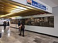
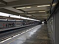
Colegio Militar metro station (redirect from Colegio Militar (Mexico City Metro))
the Mexico City Metro system. It is located in the Miguel Hidalgo borough of Mexico City, northwest of the city centre, on Calzada México-Tacuba. In 2019...
10 KB (582 words) - 08:12, 30 December 2024

Popotla metro station (redirect from Popotla (Mexico City Metro))
Hidalgo borough of Mexico City, northwest of the city center, on the Calzada México-Tacuba. In 2019 the station had an average ridership of 10,000 passengers...
11 KB (598 words) - 10:04, 30 December 2024
Normal metro station (redirect from Normal (Mexico City Metro))
memorial plaque unveiled in 2001 by Mexico City's government. The station is located on the Calzada México-Tacuba and serves the following neighborhoods:...
11 KB (669 words) - 09:47, 30 December 2024

San Cosme metro station (redirect from San Cosme (Mexico City Metro))
centre, on Avenue Ribera de San Cosme a few blocks before it becomes Calzada México-Tacuba. The southern exit leads to Colonia San Rafael while the Northern...
10 KB (575 words) - 10:22, 30 December 2024
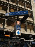
Cuitláhuac metro station (redirect from Cuitláhuac (Mexico City Metro))
San Álvaro neighborhoods. South: Calzada México-Tacuba and Avenida Cuitláhuac, Popotla North: Calzada México-Tacuba and Avenida Cuitláhuac, Colonia San...
10 KB (534 words) - 08:15, 30 December 2024
such as Tenayuca, renamed Vallejo; Tlacopan, renamed México Tacuba, and Tepeyac, now called the Calzada de los Misterios. They also kept major divisions of...
48 KB (5,547 words) - 18:01, 13 January 2025

under the following roads: Calzada San Bartolo Naucalpan in the stretch from Cuatro Caminos to Panteones, Calzada México-Tacuba from Panteones to Normal...
36 KB (1,009 words) - 21:56, 31 January 2025

Xola metro station (redirect from Xola (Mexico City Metro))
Benito Juárez borough of Mexico City, directly south of the city centre on Calzada de Tlalpan. It is a surface station. The station logo shows a coconut palm...
9 KB (464 words) - 00:05, 1 February 2025

Abril, Avenida Revolución, Puente de la Morena, Viaducto Miguel Alemán, Calzada de Tlalpan, Santa Anita, Atzayacatl, Plutarco Elías Calles and Barranca...
56 KB (6,520 words) - 19:10, 2 February 2025
Centro de transferencia modal (redirect from CETRAM Tacuba)
urbano de la Ciudad de México" (PDF). Instituto de Políticas para el Transporte y el Desarrollo (in Spanish). Cuauhtémoc, Mexico City. ISBN 978-607-8288-08-3...
36 KB (830 words) - 15:58, 12 February 2025

Ferrocarril de Tacubaya opened a second line to Popotla, near the Calzada México-Tacuba (Tacuba causeway). After these initial lines, different companies were...
9 KB (761 words) - 23:47, 31 January 2025

at Av. Paseo de la Reforma y Calzada Gandhi s/n, Col. Chapultepec Polanco. Delegación Miguel Hidalgo. C.P. 11560, México, D.F." Arnaiz y Freg, Arturo...
16 KB (1,642 words) - 18:52, 25 January 2025

of the Mexico City Metro system. It is located in the Coyoacán borough of Mexico City, directly south of the city centre in the median of Calzada de Tlalpan...
10 KB (569 words) - 15:59, 6 February 2025
Viaducto metro station (redirect from Viaducto (Mexico City Metro))
the Mexico City Metro system. It is located in the border of Benito Juárez and Iztacalco boroughs of Mexico City, south of the city centre on Calzada de...
12 KB (697 words) - 00:05, 1 February 2025

Nativitas metro station (redirect from Nativitas (Mexico City Metro))
built in the outskirts of Mexico City during the first half of the 20th century. The station opened on 1 August 1970. East: Calzada de Tlalpan between Justina...
9 KB (476 words) - 11:53, 10 February 2025

San Antonio Abad metro station (redirect from San Antonio Abad (Mexico City Metro))
borough of Mexico City, to the south of the city centre, in the median of Calzada San Antonio Abad. The station logo depicts Saint Anthony the Great, after...
9 KB (493 words) - 12:00, 10 February 2025

Portales metro station (redirect from Portales (Mexico City Metro))
East: Calzada de Tlalpan between Av. Victor Hugo and Hamburgo street, Colonia Albert West: Calzada de Tlalpan between Av. Victor Hugo and Calzada Santa...
10 KB (522 words) - 23:14, 31 January 2025

Villa de Cortés metro station (redirect from Villa de Cortés (Mexico City Metro))
2 of the Mexico City Metro system. It is located in the Benito Juárez borough of Mexico City, directly south of the city center on Calzada de Tlalpan...
10 KB (522 words) - 00:06, 1 February 2025

Paseo de la Reforma (category Cuauhtémoc, Mexico City)
near the Plaza de las Tres Culturas. There it divides into Calzada de Guadalupe and Calzada de los Misterios that continue toward La Villa. Its western...
27 KB (2,909 words) - 02:08, 30 December 2024
Tasqueña metro station (redirect from Tasqueña (Mexico City Metro))
campus of the Universidad Autónoma de la Ciudad de México (UACM). Metro Tasqueña also serves Mexico City's southern bus depot, which serves important cities...
11 KB (627 words) - 10:44, 30 December 2024

Coyoacán (redirect from Coyoacan, Mexico)
"Calzada General Anaya No. 371 Colonia del Carmen, Coyoacán México, D.F." "Contacto Archived 2015-07-03 at the Wayback Machine." Colegio Nuevo México,...
100 KB (12,841 words) - 19:10, 2 February 2025

Chabacano metro station (redirect from Chabacano (Mexico City Metro))
de México. p. 6. Archived (PDF) from the original on 13 September 2021. Retrieved 12 September 2021. "Línea 9, Ciudad de México" [Line 9, Mexico City]...
49 KB (3,541 words) - 18:26, 25 January 2025

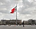
Zócalo/Tenochtitlan metro station (redirect from Zócalo (Mexico City Metro))
Spanish conquistador Pedro de Alvarado, were also renamed to Calzada México-Tenochtitlan and México-Tenochtitlan station, respectively. On 29 March 1998, a...
37 KB (2,862 words) - 07:08, 25 February 2025

Ermita metro station (redirect from Ermita (Mexico City Metro))
It is located in the Benito Juárez borough of Mexico City, directly south of the city centre on Calzada de Tlalpan. It is a surface station. The station...
15 KB (717 words) - 20:47, 31 January 2025

Colonia Santa María la Ribera (category Neighborhoods in Mexico City)
Spanish). Mexico City. p. 12. Gabriela Medina (September 7, 1995). "Las Calles de Mexico: Calzada Tlacopa" [Streets of Mexico City:Calzada Tlacopa]. Reforma...
21 KB (2,636 words) - 12:04, 14 October 2024

Los Pinos (category Official residences in Mexico)
to the public. "Los Pinos: historia de la casa del próximo Presidente de México". Animal Politico. 23 July 2012. Retrieved 17 October 2015. "La historia...
8 KB (685 words) - 02:30, 6 October 2024

Pueblo de Santa Fe • Belén de las Flores • Bellavista • Bonanza • Bosque • Calzada Jalapa • Campestre • Campo de los Tiros • Cañada 1a Secc. • Cañada 2a Secc...
34 KB (3,140 words) - 17:35, 17 July 2024