The Charles River Reservation is a 17-mile-long (27 km) urban preserve and public recreation area located along the banks of the Charles River in Boston...
13 KB (1,121 words) - 02:37, 28 November 2023
into a broad basin and is lined by the parks of the Charles River Reservation. On the Charles River Esplanade stands the Hatch Shell, where concerts are...
37 KB (3,882 words) - 08:07, 17 November 2024
The Upper Charles River Reservation is a Massachusetts state park encompassing portions of the banks of the Charles River between the Watertown Dam in...
5 KB (227 words) - 01:42, 3 August 2023
woodland river reservations: the Mystic River Reservation, Charles River Reservation, and Neponset River Reservation. The Mystic River Reservation originally...
8 KB (515 words) - 18:04, 11 October 2024
Reservation to the east. The reservation includes the northern end of the Bighorn Mountains, Wolf Mountains, and Pryor Mountains. The Bighorn River flows...
18 KB (1,615 words) - 10:20, 25 October 2024
The Charles River Reservation Parkways are parkways that run along either side of the Charles River in eastern Massachusetts. The roads are contained...
8 KB (817 words) - 02:43, 10 August 2024
Path runs on both sides of the river within the Charles River Reservation. From the Museum of Science on the Charles River Dam Bridge, they run on sidewalk...
7 KB (650 words) - 03:07, 22 October 2024
The Charles River Reservation (Speedway)-Upper Basin Headquarters (Speedway Headquarters) is located at the corner of Western Avenue and Soldiers Field...
7 KB (711 words) - 16:44, 22 June 2024
Gila River Indian Reservation was a reservation established in 1859 by the United States government in New Mexico Territory, to set aside the lands of...
2 KB (160 words) - 10:20, 22 August 2024
Blake State Reservation". Mass.gov. Department of Conservation and Recreation. Retrieved July 24, 2022. Mink, Jessica. "The Neponset River: A History"...
67 KB (248 words) - 17:55, 21 November 2024
officiate at any same sex marriage which takes place on the Gila River Indian Reservation; 4) the Office of General Counsel is directed to draft and present...
14 KB (1,333 words) - 22:11, 26 October 2024
Esplanade (redirect from River side road)
Iloilo River Esplanade in Iloilo City, Philippines Błonia, Kraków, Poland L'Enfant Plaza in Washington, D.C., United States Charles River Reservation, in...
10 KB (936 words) - 02:05, 9 August 2024
Hills Reservation Parkways Boylston Street (Back Bay sections) Breakheart Reservation Parkways Cambridge Parkway Carey Circle Charles River Reservation Parkways...
12 KB (1,134 words) - 14:40, 30 September 2024
Hemlock Gorge Reservation is a state-owned, public recreation area and urban wild comprising 23 acres (9.3 ha) on the Charles River in Newton and Needham...
6 KB (397 words) - 11:40, 1 June 2024
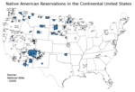
An American Indian reservation is an area of land held and governed by a U.S. federal government-recognized Native American tribal nation, whose government...
82 KB (10,223 words) - 00:02, 15 November 2024
307 acres (124 ha). Significant portions of the river's shores are within the Mystic River Reservation and are administered by the Massachusetts Department...
15 KB (914 words) - 19:01, 7 December 2023
for illegally taken reservation lands. The United States used the Missouri River to form the eastern boundary of the Reservation, but some of the land...
14 KB (1,744 words) - 01:20, 9 November 2024
Indian Reservation is the homeland of the Yankton Sioux Tribe of the Dakota tribe. The reservation occupies the easternmost 60 percent of Charles Mix County...
7 KB (643 words) - 22:47, 21 September 2024
lacrosse, field hockey, and soccer), and a small playground. Charles River Reservation maintained by the Massachusetts Department of Conservation and...
28 KB (3,251 words) - 00:11, 8 September 2024
Almost half of the reservation land is owned by non-Native Americans; the reservation includes significant portions of the Umatilla River watershed. In 2013...
17 KB (2,008 words) - 07:22, 26 August 2024
The Red Lake Indian Reservation (Ojibwe: Miskwaagamiiwi-zaaga'iganing) covers 1,260.3 sq mi (3,264 km2; 806,600 acres) in parts of nine counties in Minnesota...
50 KB (5,002 words) - 14:56, 17 November 2024
ballfields, and Community Boating. The Esplanade comprises part of the Charles River Reservation state park. The Esplanade was designated as a Boston Landmark...
9 KB (895 words) - 16:27, 3 November 2024
The 2000 census reported a population of 1,734 on the reservation. Together with the Walker River Paiute tribe (two Northern Paiute bands: Aga'idökadö...
13 KB (1,354 words) - 09:52, 9 November 2024
within Middlesex County are included on multiple area lists: Charles River Reservation Parkways (Cambridge, Newton, Waltham, Weston, and other Middlesex...
16 KB (860 words) - 01:45, 22 November 2024
part of Boston's Emerald Necklace. The Charles River Reservation runs between Storrow Drive and the Charles River at Back Bay's northern border. Commonwealth...
35 KB (3,047 words) - 15:03, 26 August 2024
Historic District Case Estates Case's Corner Historic District Charles River Reservation Parkways Edward Peirce House, Henderson House of Northeastern...
31 KB (3,566 words) - 09:02, 21 November 2024
east-northeast and southeast at the northern edge of the reservation, forming the northern boundary of the reservation and the southern boundary of Buffalo Gap National...
9 KB (505 words) - 23:32, 13 January 2024
also known as the Three Affiliated Tribes. The reservation includes lands on both sides of the Missouri River. The tribal headquarters is in New Town, the...
15 KB (1,092 words) - 16:17, 19 November 2024
Paul Dudley White Bicycle Path runs on both sides of the river within the Charles River Reservation for bicyclists and runners. Boston is also home is the...
59 KB (6,177 words) - 05:33, 17 November 2024
is the Watertown Riverfront Park and Braille Trail along the Charles River Reservation in Watertown, Massachusetts, USA, which opened in July 2016. A...
1 KB (142 words) - 18:48, 16 June 2024


