values. Data models are implemented throughout the GIS ecosystem, including the software tools for data management and spatial analysis, data stored in...
40 KB (5,298 words) - 02:55, 9 October 2024

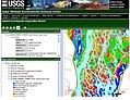
Geographic information system (redirect from GIS data mining)
system (GIS) consists of integrated computer hardware and software that store, manage, analyze, edit, output, and visualize geographic data. Much of...
101 KB (13,147 words) - 21:43, 12 February 2025
information systems (GIS) and other geospatial applications. Since the 1970s, dozens of formats have been created based on various data models for various purposes...
23 KB (2,986 words) - 22:26, 6 January 2024

A data model is an abstract model that organizes elements of data and standardizes how they relate to one another and to the properties of real-world...
40 KB (5,059 words) - 16:45, 13 October 2024
ArcMap. ArcGIS Server was renamed to ArcGIS Enterprise at the 10.5 release, wherein ArcGIS Server, Portal for ArcGIS, ArcGIS Data Store and ArcGIS Web Adaptor...
55 KB (5,477 words) - 03:29, 11 January 2025
a list of GIS data sources (including some geoportals) that provide information sets that can be used in geographic information systems (GIS) and spatial...
43 KB (514 words) - 19:06, 13 November 2024

spatial and temporal modeling, and visualizing. It can handle raster, topological vector, image processing, and graphic data. GRASS GIS contains over 350...
12 KB (1,319 words) - 14:31, 15 December 2024
(GIS). There are also many different types of geodata, including vector files, raster files, geographic databases, web files, and multi-temporal data....
3 KB (257 words) - 12:25, 18 October 2024
Geographic information system software (redirect from GIS software)
analyze, and visualize geographic data, that is, data representing phenomena for which location is important. The GIS software industry encompasses a broad...
26 KB (2,782 words) - 21:52, 16 February 2025
on. GIS data model Wade, T. and Sommer, S. eds. A to Z GIS Chrisman, Nick (2006). Charting the Unknown: How Computer Mapping at Harvard Became GIS. Esri...
6 KB (850 words) - 16:36, 21 October 2024

spatial data. While Web GIS and Internet GIS are sometimes used interchangeably, they are different concepts. Web GIS is a subset of Internet GIS, which...
27 KB (2,981 words) - 01:23, 6 October 2024
Geoscientific Analyses (SAGA GIS) is a geographic information system (GIS) computer program, used to edit spatial data. It is free and open-source software...
5 KB (445 words) - 14:49, 19 July 2024
Geodatabase (Esri) (section Logical Model)
spatial database model for storing spatial data in relational and object-relational databases. Given the dominance of Esri in the GIS industry, the term...
31 KB (3,473 words) - 18:24, 3 December 2024

geographic information systems (GIS), and are the most common basis for digitally produced relief maps. A digital terrain model (DTM) represents specifically...
31 KB (3,352 words) - 19:10, 7 January 2025

visualize, and distribute spatial data. Internet GIS is an outgrowth of traditional GIS, and represents a shift from conducting GIS on an individual computer...
21 KB (2,240 words) - 19:44, 2 May 2024
through GIS help in data collection, its storage and retrieval, its manipulation for customized circumstances and, finally, the display of the data so that...
10 KB (1,339 words) - 16:03, 26 November 2024

Vector graphics (redirect from Vector data)
Vector data, especially in GIS, information about topological relationships between objects may be represented in the data model, such as tracking the connections...
28 KB (3,089 words) - 23:22, 8 February 2025
geospatial objects used within PostGIS DE-9IM, the Dimensionally Extended nine-Intersection Model used by PostGIS "PostGIS 3.5.0". 26 September 2024. Retrieved...
10 KB (745 words) - 17:25, 29 September 2024
role in geographic information systems (GIS), geospatial content and services, GIS data processing, and data sharing. A coverage is represented by its...
10 KB (1,365 words) - 17:26, 7 January 2023
Geospatial metadata (redirect from GIS metadata)
to geographic data and information. Such objects may be stored in a geographic information system (GIS) or may simply be documents, data-sets, images or...
17 KB (1,889 words) - 02:41, 30 January 2025
Spatial database (redirect from GIS database)
geographic data (or geodata, i.e., data associated with a location on Earth), especially in geographic information systems (GIS). Almost all current relational...
22 KB (2,037 words) - 23:38, 19 December 2024
Distributed GIS permits a shared services model, including data fusion (or mashups) based on Open Geospatial Consortium (OGC) web services. Distributed GIS technology...
28 KB (3,990 words) - 18:19, 5 November 2024
use of web-based data collection. In the past, GIS was not a practical source of analysis due to the difficulty in obtaining spatial data on habitats or...
9 KB (1,012 words) - 00:58, 12 December 2023
term AM/FM/GIS mostly refers to GIS software that allows utility users to digitize, manage and analyze their utility network data. This data is stored...
5 KB (736 words) - 11:42, 7 October 2023
Open Geospatial Consortium (redirect from OpenGIS)
Things, GIS data processing and data sharing. The OGC was incorporated as a not for profit in 1994. At that time, the official name was the OpenGIS Consortium...
13 KB (1,017 words) - 14:47, 26 December 2024
systems (GIS). PGIS combines a range of geo-spatial information management tools and methods such as sketch maps, participatory 3D modelling (P3DM), aerial...
27 KB (3,317 words) - 14:14, 27 March 2024

Elevation (section Maps and GIS)
height. GIS or geographic information system is a computer system that allows for visualizing, manipulating, capturing, and storage of data with associated...
6 KB (561 words) - 15:40, 18 November 2024
environmental data and their characteristics can be graphically displayed and studies using GIS. In the field of hydrological modeling, analysis generally...
8 KB (896 words) - 09:39, 30 April 2024

GDAL (redirect from Geospatial Data Abstraction Library)
software project for its "extensive capabilities of data exchange" and also in the commercial GIS community due to its widespread use and comprehensive...
15 KB (1,169 words) - 10:52, 16 November 2022
Global Mapper (category GIS companies)
MapInfo GIS products. Global Mapper handles both vector, raster, and elevation data, and provides viewing, conversion, and other general GIS features...
3 KB (337 words) - 18:22, 20 February 2023