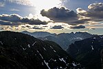
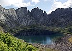
The Dusse-Alin (Russian: Дуссе-Алинь) is a mountain range in Khabarovsk Krai, Russian Far East. Although it is named after this range, the Dusse-Alin Tunnel...
6 KB (502 words) - 02:15, 7 November 2024
The Dusse-Alin Tunnel (Russian: Дуссе-Алиньский тоннель) is a two-kilometre-long railway tunnel on the Baikal–Amur Mainline (BAM) in Siberia, 88 kilometres...
3 KB (344 words) - 05:21, 7 November 2024
Tourism in Khabarovsk Krai (section Dusse-Alin)
peaks exceed the height of 2000 m), Sikhote-Alin (Highest point Tordoki-Yani) Myaochanu, Dusse-Alin and Yam-Alin. The cave "Farewell" in Imeni Lazo District...
5 KB (554 words) - 04:37, 12 July 2024
Jewish Autonomous Oblast in the southern part of the Russian Far East. The Dusse-Alin Tunnel on the Baikal Amur Mainline crosses the range to enter the Amgun...
5 KB (296 words) - 02:26, 3 November 2024
Tunnel 15,343 metres (9.534 mi) Kodar Tunnell 1,981 metres (1.231 mi) Dusse Alin Tunnel 1,852 metres (1.151 mi) Korshunovsky tunnel 950 metres (3,120 ft)...
30 KB (2,726 words) - 14:12, 23 October 2024
point 2,221 metres (7,287 ft) high, the Gora Ulun), the Yam-Alin, the Dusse-Alin, the Sikhote-Alin, the Dzhugdzhur Mountains, the Kondyor Massif, as well as...
40 KB (3,145 words) - 10:04, 14 November 2024
carp. The Baikal Amur Mainline railway enters the Amgun valley from the Dusse-Alin Tunnel and follows the river 180 kilometres (110 mi) northeast to Beryozovy...
3 KB (178 words) - 21:46, 2 November 2024
east View of terrain looking across the top of the tunnel midway along Dusse-Alin Tunnel List of longest tunnels "Investigators find train in Russian tunnel...
12 KB (1,259 words) - 04:33, 5 November 2024
to Chegdomyn 3,324 Chemchuko 3,339 Mugule 3,365 Soloni 3,384 Dusse-Alin 3,382 Dusse-Alin Tunnel (1.8 km) 3,402 Suluk 3,422 Mogdy 3,434 Orokot 3,456 Gerbi...
2 KB (66 words) - 04:59, 22 November 2024
a Russian exclave in Belarus Medvezhye Lake, a body of water in the Dusse-Alin Medvezhye (Chukotka Autonomous Okrug), a body of water in Providensky...
569 bytes (104 words) - 06:57, 7 March 2024
the first reliable map of Yam-Alin was drawn in 1851. The Yam-Alin and the Dusse-Alin to the south of it are northern prolongations of the Bureya Range...
5 KB (419 words) - 22:55, 5 November 2024
slopes of the range from the south. At the eastern end rise the Yam-Alin and Dusse-Alin ranges, which run in a north/south direction in Khabarovsk Krai....
3 KB (257 words) - 21:43, 6 November 2024
Nimelen. The Amgun flows to the west of the lake and beyond it rises the Dusse-Alin. Godbanki and Dzhalu are two large islands in the lake. Godbanki, the...
3 KB (289 words) - 23:29, 5 November 2024
to Chegdomyn 3,324 Chemchuko 3,339 Mugule 3,365 Soloni 3,384 Dusse-Alin 3,382 Dusse-Alin Tunnel (1.8 km) 3,402 Suluk 3,422 Mogdy 3,434 Orokot 3,456 Gerbi...
2 KB (98 words) - 05:08, 22 November 2024
and southern part of the Dusse-Alin. The area is surrounded by mountain ranges - the Ezop Range to the northwest, the Yam-Alin to the north and the Bureya...
7 KB (692 words) - 15:03, 6 November 2024
mountain ranges meet the Bureya Range, the Dusse-Alin from the south, the Ezop Range from the west and the Yam-Alin from the north, and flows first northwest...
3 KB (192 words) - 17:41, 2 November 2024
Verkhnebureinsky District Верхнебуреинский район District Dusse-Alin Range Flag Coat of arms Location of Verkhnebureinsky District in Khabarovsk Krai Coordinates:...
4 KB (1,054 words) - 03:31, 29 October 2024
population. The district is mountainous. In the western part rise the Yam-Alin, Dusse-Alin, Etkil-Yankansky, Mevadzha and Koltoursky ranges; in the eastern part...
5 KB (1,009 words) - 03:03, 30 October 2024


