
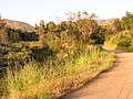
The Gabrielino Trail is a United States National Recreation Trail that runs through the Angeles National Forest. Its western trailhead is at Windsor Avenue...
5 KB (531 words) - 18:49, 28 February 2024

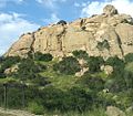
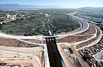
Chantry Flat (section Trails)
starting point for several historic trails of the San Gabriel Mountains, including the 28.5-mile (45.9 km) Gabrielino Trail. The US Forest Service estimates...
8 KB (1,110 words) - 17:29, 1 March 2024
Tongva (redirect from Gabrielino)
places have been recently named to honor the Indigenous peoples. The Gabrielino Trail is a 28-mile path through the Angeles National Forest, created and...
112 KB (12,662 words) - 21:00, 17 October 2024

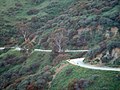
Valley. The Burton Trail descends from this road to the upper stretches of the Arroyo near Oakwilde Campground. The Gabrielino Trail, which is a popular...
39 KB (3,526 words) - 11:03, 19 October 2024

Cogswell Reservoir, where Devils Canyon Creek joins from the north. The Gabrielino Trail parallels the river from Red Box Saddle as far as the Devore campground...
107 KB (13,359 words) - 03:34, 11 September 2024

routes" and the one-way mileage: Chantry Flat to West Fork CG via Gabrielino Trail ... 9 miles (14 km) West Fork CG to Angeles Crest Hwy via Shortcut...
6 KB (652 words) - 19:07, 28 February 2024
attendance. Stoney Point was occupied by Gabrielino-Tongva (Gabrielino) Natives beginning in 6000 BC. The Gabrielino homeland offers an area rich in natural...
19 KB (2,402 words) - 22:44, 2 September 2024
still in existence in Pasadena is the old Tongva foot trail, also known as the Gabrielino Trail, that goes along the west side of the Rose Bowl and up...
23 KB (2,848 words) - 13:51, 20 July 2024
portions of the Pacific Crest Trail (where it climbs Mount Baden-Powell), the Silver Moccasin Trail, and the Gabrielino Trail. It finishes at Loma Alta Park...
5 KB (539 words) - 17:51, 26 September 2024
Black Star Canyon (section Tongva-Gabrieliño)
archaeological site as much information concerning the daily lives of the Tongva-Gabrieliño people has been uncovered through studies of artifacts found in the canyon...
15 KB (2,084 words) - 03:02, 28 February 2024
Runyon Canyon Park (section Walks and trails)
Mulholland Drive. It is reputed to have been a seasonal campsite for local Gabrielino/Tongva Indians, who hunted in the area known to them as the Nopalera....
21 KB (2,631 words) - 17:07, 29 May 2024

(1988), the top of neighboring Culver City Park was "Lookout Point for the Gabrielino Indians." The land was "once the location of an oil field, with a drinking...
9 KB (804 words) - 13:39, 11 September 2024

Los Angeles River (redirect from Los Angeles River Trail)
Retrieved January 30, 2011. William McCawley (1996). The First Angelinos: The Gabrielino Indians of Los Angeles. Ballena Press. p. 304. ISBN 978-0-9651016-0-8...
79 KB (8,016 words) - 20:46, 24 September 2024

Paiute, Tubatulabal, Panamint Shoshone, Kawaisu, Kitanemuk, Tataviam, Gabrielino, Juaneno, Luiseno, Cuipeno, Cahuilla, Serrano, Chemehuevi ABC has the...
275 KB (23,808 words) - 22:01, 16 October 2024

Playa Vista, Los Angeles (redirect from Bluff Creek trail)
planned a museum to educate people about the Ballona wetlands and the Gabrieliño-Tongva tribe. The Westchester/Playa Vista Discovery Center opened in 2020...
35 KB (2,998 words) - 03:07, 4 September 2024

closed in 1987. Today it is privately held but is used as an informal hiking trail. The village of Timigtac was located around the present-day Rockaway Beach...
14 KB (1,216 words) - 21:41, 7 April 2024

include Tongva Peak (2,656 feet), recently named in honor of the Tongva (Gabrielino) people, the original inhabitants of much of the Los Angeles Basin, Santa...
32 KB (3,780 words) - 21:53, 1 February 2024

City since at least 8000 BCE. The region was the homeland of the Tongva-Gabrieliño Native Americans. For centuries, native people lived in areas currently...
55 KB (4,103 words) - 07:14, 19 October 2024

and the tribe were renamed Gabrielino Indians by the Spaniards. The first Mount Wilson trail was carved by the Gabrielino Indians, who used it when they...
65 KB (6,493 words) - 03:30, 19 October 2024

of the Mission San Gabriel ranchos. Jarupa was probably a Serrano or Gabrielino Shoshonean name. List of Riverside County, California, placename etymologies#Jurupa...
3 KB (200 words) - 23:05, 25 July 2024
States Geological Survey, United States Department of the Interior. "Gabrielino/Tongva Nation of the Greater Los Angeles Basin". NAHC Digital Atlas. Retrieved...
9 KB (893 words) - 16:03, 9 October 2023

distinguished schools, extensive horse trails, and high-value homes. The peninsula was the homeland of the Tongva-Gabrieliño Native Americans people for thousands...
37 KB (3,502 words) - 08:36, 29 September 2024

called Gabrielino by the Spanish. The Tongva also provide the origin of many current names; Piwongna – Pomona, Cucomog-na – Cucamonga. The Gabrielinos lived...
61 KB (6,701 words) - 20:58, 17 October 2024
Along the Mojave Trail. San Bernardino, California: San Bernardino County Museum. Johnson, Bernice Eastman (1962). California's Gabrielino Indians. Los Angeles...
138 KB (16,645 words) - 15:25, 27 September 2024

is now the San Gabriel Valley. These Native Americans were dubbed the Gabrieliño Indians (after San Gabriel, the local mission) by early Spanish colonial...
30 KB (3,212 words) - 00:10, 7 September 2024
PRIME. Retrieved January 6, 2023. Tovaangar, which encompasses all of Gabrielino-Tongva territory, covers the Los Angeles Basin, half of Orange County...
160 KB (12,285 words) - 17:37, 3 October 2024

D. Earle (1992) further stated that "There is some evidence... that Gabrielino (Tongva) territory may have extended only as far south as the Tustin Plain"...
95 KB (10,270 words) - 01:04, 1 September 2024

Mission San Gabriel Arcángel (category Old Spanish Trail (trade route))
ISBN 0-89658-492-5. McCawley, William (2006). The First Angelinos: The Gabrielino Indians of Los Angeles. Malki Museum Press and Ballena Press, Banning...
34 KB (3,492 words) - 02:33, 18 October 2024

January 8, 2023. Bartolomea (her Spanish mission name), an indigenous Gabrieliño-Tongva Native American, was born around 1808 in an indigenous town called...
110 KB (10,031 words) - 16:17, 19 October 2024

Directory (1988), the top of Culver City Park was "Lookout Point for the Gabrielino Indians." Culver West Alexander Park - footpath access to Del Rey neighborhood...
3 KB (266 words) - 03:44, 19 May 2024